
| Memorials | : | 1 |
| Location | : | Trimley St Martin, Suffolk Coastal District, England |
| Coordinate | : | 51.9851680, 1.3142220 |
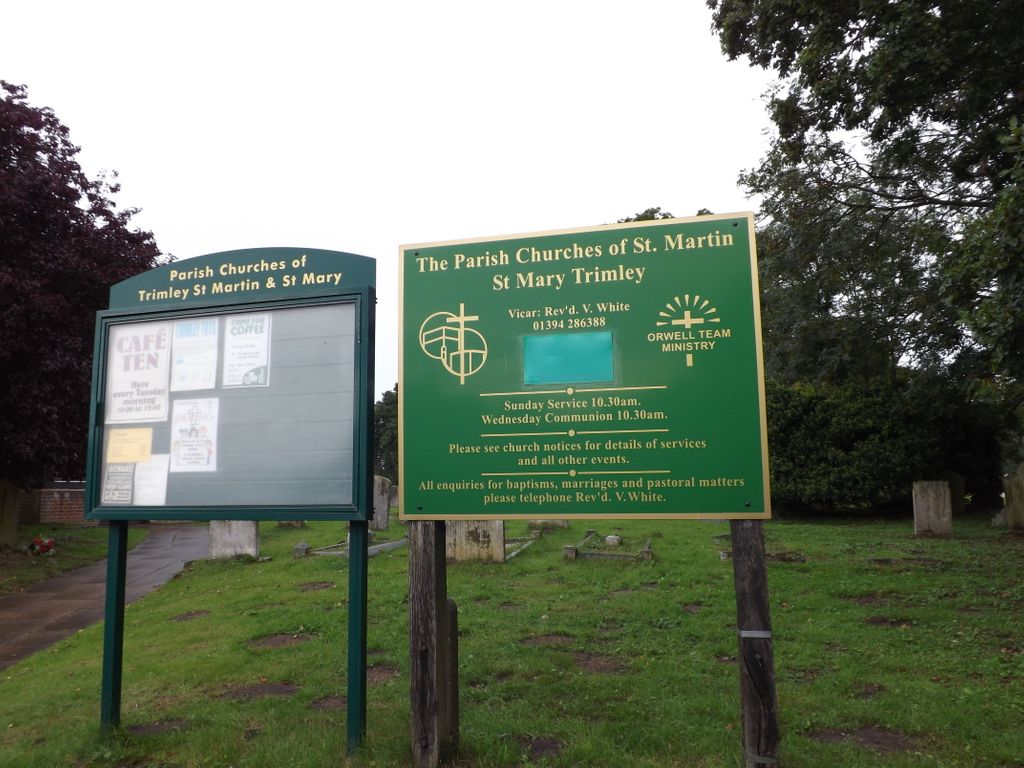
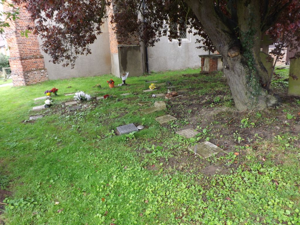
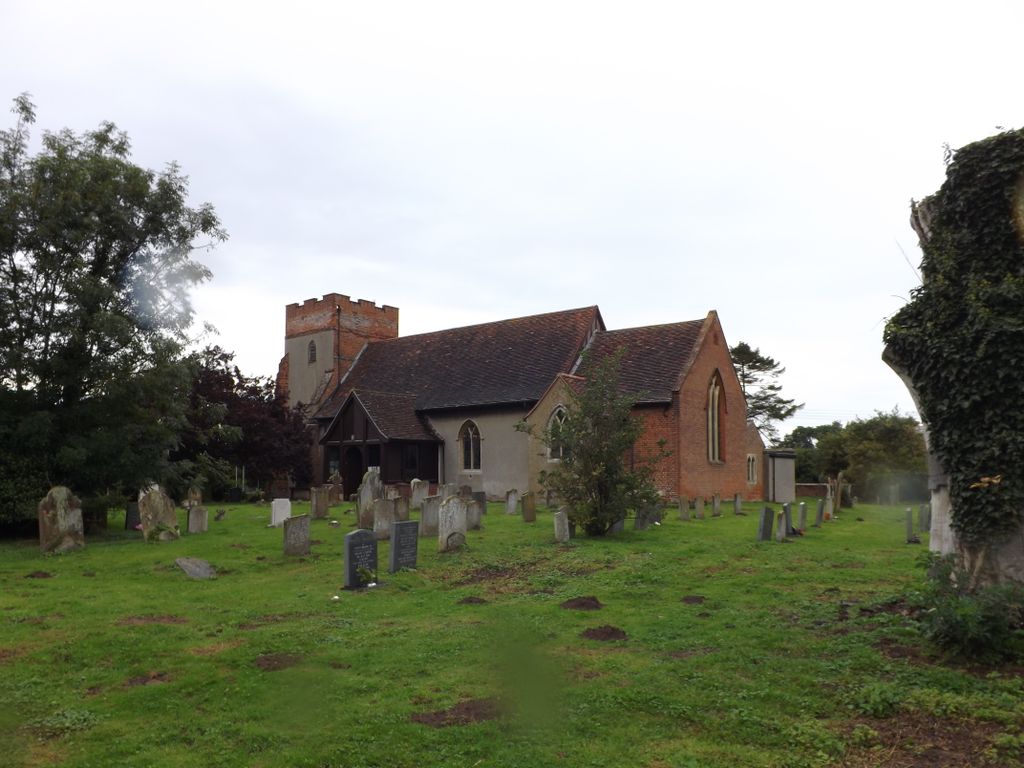
| Description | : | Trimley St. Martin is a parish and village that lies between two rivers, the Orwell and the Deben, on the long narrow tongue of land from Ipswich to Felixstowe referred to as the Colneis Hundred. The village, and its neighbour, Trimley St. Mary, are famous for their adjacent churches, which were built as the result of a historical family feud. St. Martin's church is the northerly church, actually in the village of Trimley St Mary. There is no clear dividing line between the two churchyards.There are a number of areas of the churchyard given over to cremated remains.There is a war memorial... Read More |
frequently asked questions (FAQ):
-
Where is St. Martin Churchyard?
St. Martin Churchyard is located at High Road Trimley St Martin, Suffolk Coastal District ,Suffolk , IP11 0TNEngland.
-
St. Martin Churchyard cemetery's updated grave count on graveviews.com?
1 memorials
-
Where are the coordinates of the St. Martin Churchyard?
Latitude: 51.9851680
Longitude: 1.3142220
Nearby Cemetories:
1. St. Mary's Parish Churchyard
Trimley St Mary, Suffolk Coastal District, England
Coordinate: 51.9846250, 1.3145370
2. Walton Cemetery
Felixstowe, Suffolk Coastal District, England
Coordinate: 51.9723000, 1.3412500
3. St Ethelbert Churchyard
Falkenham, Suffolk Coastal District, England
Coordinate: 52.0023900, 1.3401700
4. St. Mary and St. Martin Church Cemetery
Kirton, Suffolk Coastal District, England
Coordinate: 52.0090070, 1.3226860
5. Felixstowe Cemetery
Felixstowe, Suffolk Coastal District, England
Coordinate: 51.9649780, 1.3368740
6. War Memorial
Felixstowe, Suffolk Coastal District, England
Coordinate: 51.9593220, 1.3493472
7. Ss Peter and Paul Churchyard
Felixstowe, Suffolk Coastal District, England
Coordinate: 51.9716420, 1.3678780
8. Shotley Royal Naval Cemetery
Shotley, Babergh District, England
Coordinate: 51.9780006, 1.2569460
9. St. Mary's Church Cemetery
Shotley, Babergh District, England
Coordinate: 51.9773400, 1.2562500
10. St Mary Churchyard
Shotley, Babergh District, England
Coordinate: 51.9776180, 1.2558960
11. St Peter's Churchyard
Levington, Suffolk Coastal District, England
Coordinate: 52.0047690, 1.2539900
12. St Nicholas Churchyard
Harwich, Tendring District, England
Coordinate: 51.9457150, 1.2886510
13. Landguard Fort Graveyard
Felixstowe, Suffolk Coastal District, England
Coordinate: 51.9405105, 1.3199968
14. All Saints Parish Church
Hemley, Suffolk Coastal District, England
Coordinate: 52.0324550, 1.3304610
15. All Saints Churchyard
Ramsholt, Suffolk Coastal District, England
Coordinate: 52.0294500, 1.3617700
16. St Mary Churchyard
Bucklesham, Suffolk Coastal District, England
Coordinate: 52.0316100, 1.2699200
17. St. Mary's Churchyard
Newbourne, Suffolk Coastal District, England
Coordinate: 52.0392970, 1.3127700
18. St Mary's Church
Erwarton (Arwarton), Babergh District, England
Coordinate: 51.9661220, 1.2315200
19. Seven Hills Crematorium
Nacton, Suffolk Coastal District, England
Coordinate: 52.0252130, 1.2489840
20. Parkeston Cemetery
Parkeston, Tendring District, England
Coordinate: 51.9384300, 1.2579700
21. St Martin Churchyard
Nacton, Suffolk Coastal District, England
Coordinate: 52.0113690, 1.2295000
22. St John the Baptist Churchyard
Brightwell, Suffolk Coastal District, England
Coordinate: 52.0445610, 1.2792080
23. Baptist Chapel's Burial Ground
Chelmondiston, Babergh District, England
Coordinate: 51.9898720, 1.2114610
24. All Saints Churchyard
Dovercourt, Tendring District, England
Coordinate: 51.9334060, 1.2546450