
| Memorials | : | 26 |
| Location | : | Fiddletown, Amador County, USA |
| Coordinate | : | 38.5021300, -120.7577150 |
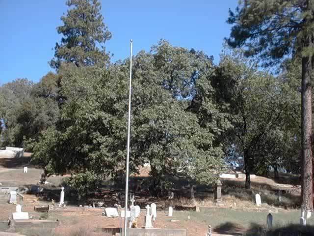
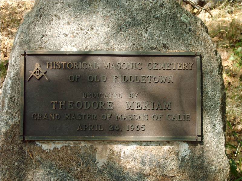
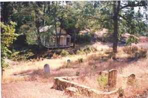
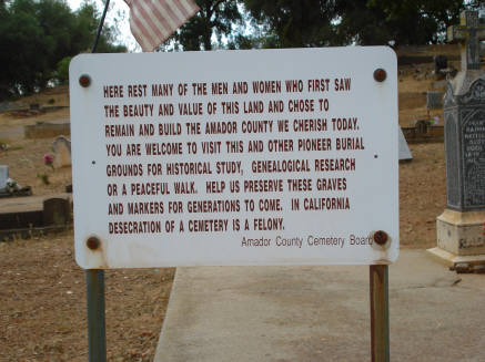
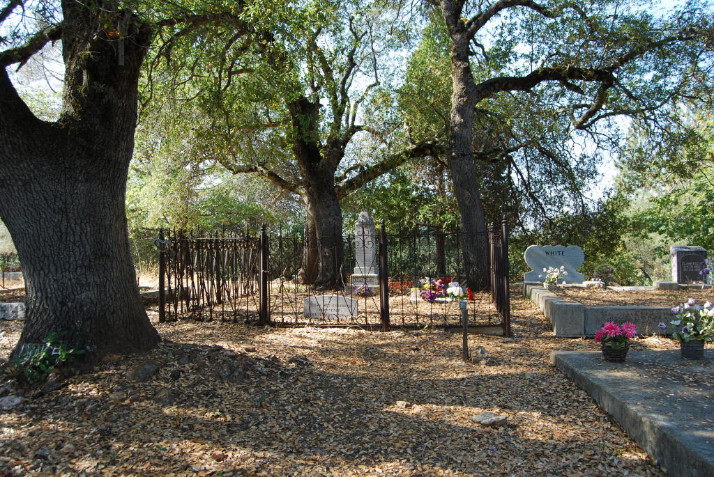
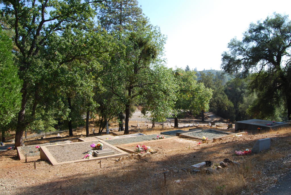
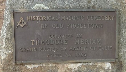
| Description | : | The Historic Masonic Section is a section within the Fiddletown cemetery. Fiddletown was founded in 1849 when a group of people from Missouri found gold here. There was no quartz mining just placer, which was limited to when the creek was running. The gold soon played out and people moved on to other areas. However, the area was rich in another resource, lumber, which all the mines needed and for people to build houses. There were several saw mills in the area. The Fiddletown Cemetery is in two parts, separated by a fence; the city and Masonic sections. The oldest existing... Read More |
frequently asked questions (FAQ):
-
Where is Fiddletown Cemetery?
Fiddletown Cemetery is located at American Flat Road Fiddletown, Amador County ,California , 95629USA.
-
Fiddletown Cemetery cemetery's updated grave count on graveviews.com?
26 memorials
-
Where are the coordinates of the Fiddletown Cemetery?
Latitude: 38.5021300
Longitude: -120.7577150
Nearby Cemetories:
1. IOOF Cemetery
Fiddletown, Amador County, USA
Coordinate: 38.5026290, -120.7490990
2. Chinese Cemetery
Fiddletown, Amador County, USA
Coordinate: 38.5017600, -120.7699500
3. Shenandoah Valley Cemetery
Amador County, USA
Coordinate: 38.5367012, -120.8016968
4. Gardner Delles Family Cemetery
Amador County, USA
Coordinate: 38.4557700, -120.7881900
5. Plymouth Memorial Cemetery
Plymouth, Amador County, USA
Coordinate: 38.4821160, -120.8496160
6. Plymouth IOOF Cemetery
Plymouth, Amador County, USA
Coordinate: 38.4791000, -120.8506800
7. Cowboy Park Cemetery
Plymouth, Amador County, USA
Coordinate: 38.4787060, -120.8522060
8. Parsons Plot
New Chicago, Amador County, USA
Coordinate: 38.4354000, -120.8174100
9. Oak Knoll Cemetery
Amador City, Amador County, USA
Coordinate: 38.4263992, -120.8300018
10. Saint Stephens Cemetery
Drytown, Amador County, USA
Coordinate: 38.4417730, -120.8522840
11. Amador City Cemetery
Amador City, Amador County, USA
Coordinate: 38.4198000, -120.8252000
12. Drytown City Cemetery
Amador County, USA
Coordinate: 38.4407425, -120.8577118
13. White Family Cemetery
Plymouth, Amador County, USA
Coordinate: 38.4915200, -120.9002200
14. Immaculate Conception Parish Cemetery
Sutter Creek, Amador County, USA
Coordinate: 38.3956980, -120.8063430
15. Odd Fellows Cemetery
Sutter Creek, Amador County, USA
Coordinate: 38.3964120, -120.8110550
16. Sutter Creek City Cemetery
Sutter Creek, Amador County, USA
Coordinate: 38.3957520, -120.8091940
17. Sutter Creek Catholic Cemetery
Sutter Creek, Amador County, USA
Coordinate: 38.3955780, -120.8101970
18. Volcano Catholic Cemetery
Volcano, Amador County, USA
Coordinate: 38.4459991, -120.6279984
19. Volcano Protestant Cemetery
Volcano, Amador County, USA
Coordinate: 38.4449997, -120.6269989
20. Pine Grove Cemetery
Pine Grove, Amador County, USA
Coordinate: 38.4118780, -120.6596340
21. Fairplay Cemetery
Fair Play, El Dorado County, USA
Coordinate: 38.5924430, -120.6560610
22. Chinese Cemetery
Placerville, El Dorado County, USA
Coordinate: 38.5836700, -120.8817100
23. Fanny Creek Cemetery
El Dorado County, USA
Coordinate: 38.5837700, -120.8816900
24. Lockwood Station Cemetery
Volcano, Amador County, USA
Coordinate: 38.4882670, -120.5954040