| Memorials | : | 8 |
| Location | : | New Chicago, Amador County, USA |
| Website | : | www.hmdb.org/Marker.asp?Marker=74124 |
| Coordinate | : | 38.4354000, -120.8174100 |
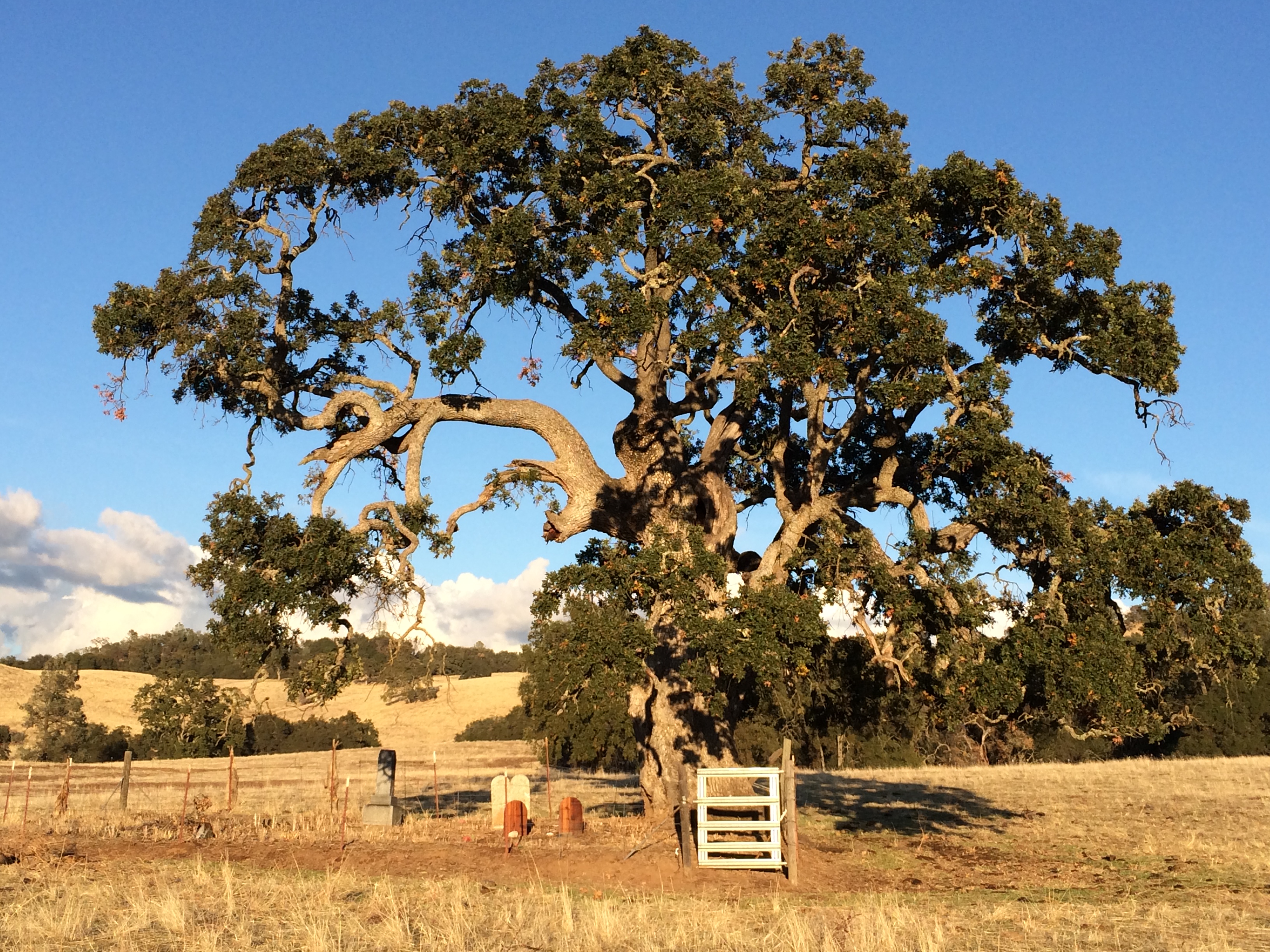
| Description | : | This burial site is all that remains of Lower Rancheria, a vanished gold rush ghost town in Amador County. It was famous for a massacre that occurred on August 6, 1855 and the overly vicious response from the mining community that resulted. The site is on private property at the base of a large oak tree that stands alone in a cattle field and is best visible from Turner Road looking north-east from where it intersects with Mayflower Road. |
frequently asked questions (FAQ):
-
Where is Parsons Plot?
Parsons Plot is located at Turner Road and Mayflower Roads New Chicago, Amador County ,California , 95685USA.
-
Parsons Plot cemetery's updated grave count on graveviews.com?
8 memorials
-
Where are the coordinates of the Parsons Plot?
Latitude: 38.4354000
Longitude: -120.8174100
Nearby Cemetories:
1. Oak Knoll Cemetery
Amador City, Amador County, USA
Coordinate: 38.4263992, -120.8300018
2. Amador City Cemetery
Amador City, Amador County, USA
Coordinate: 38.4198000, -120.8252000
3. Saint Stephens Cemetery
Drytown, Amador County, USA
Coordinate: 38.4417730, -120.8522840
4. Gardner Delles Family Cemetery
Amador County, USA
Coordinate: 38.4557700, -120.7881900
5. Drytown City Cemetery
Amador County, USA
Coordinate: 38.4407425, -120.8577118
6. Odd Fellows Cemetery
Sutter Creek, Amador County, USA
Coordinate: 38.3964120, -120.8110550
7. Sutter Creek City Cemetery
Sutter Creek, Amador County, USA
Coordinate: 38.3957520, -120.8091940
8. Sutter Creek Catholic Cemetery
Sutter Creek, Amador County, USA
Coordinate: 38.3955780, -120.8101970
9. Immaculate Conception Parish Cemetery
Sutter Creek, Amador County, USA
Coordinate: 38.3956980, -120.8063430
10. Plymouth IOOF Cemetery
Plymouth, Amador County, USA
Coordinate: 38.4791000, -120.8506800
11. Cowboy Park Cemetery
Plymouth, Amador County, USA
Coordinate: 38.4787060, -120.8522060
12. Plymouth Memorial Cemetery
Plymouth, Amador County, USA
Coordinate: 38.4821160, -120.8496160
13. Jackson Gate Perano Cemetery
Jackson, Amador County, USA
Coordinate: 38.3701640, -120.7778150
14. Chinese Cemetery
Fiddletown, Amador County, USA
Coordinate: 38.5017600, -120.7699500
15. Chinese Cemetery
Jackson, Amador County, USA
Coordinate: 38.3674680, -120.7655440
16. Fiddletown Cemetery
Fiddletown, Amador County, USA
Coordinate: 38.5021300, -120.7577150
17. Sunset View Cemetery
Martell, Amador County, USA
Coordinate: 38.3534390, -120.8328030
18. Saint Sava Serbian Orthodox Cemetery
Jackson, Amador County, USA
Coordinate: 38.3560530, -120.7764530
19. White Family Cemetery
Plymouth, Amador County, USA
Coordinate: 38.4915200, -120.9002200
20. IOOF Cemetery
Fiddletown, Amador County, USA
Coordinate: 38.5026290, -120.7490990
21. Saint Patrick Catholic Cemetery
Jackson, Amador County, USA
Coordinate: 38.3534780, -120.7742350
22. Pioneer Jewish Cemetery
Jackson, Amador County, USA
Coordinate: 38.3539790, -120.7724540
23. Jackson City Cemetery
Jackson, Amador County, USA
Coordinate: 38.3519640, -120.7731340
24. Amador County Museum
Jackson, Amador County, USA
Coordinate: 38.3507000, -120.7733900

