
| Memorials | : | 0 |
| Location | : | Volcano, Amador County, USA |
| Coordinate | : | 38.4459991, -120.6279984 |
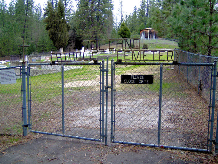
| Description | : | Early settlers arrived in Volcano in 1848. At that time, people who died were buried at Graveyard Hill. In 1852, the day after Christmas, the hillside collapsed and all of the remains that were found where reburied in the cemetery at the new church, the Methodist Episcopal. A second cemetery was started next door to the Methodist Church, surrounding the St Bridget Catholic Church, which was built circa 1857, replacing the original Catholic Church built nearby in 1854. The earliest known burials at St Bridget with existing headstones are Margaret Rowe and Mary Lucot in 1861. All that remains of... Read More |
frequently asked questions (FAQ):
-
Where is Volcano Catholic Cemetery?
Volcano Catholic Cemetery is located at Volcano, Amador County ,California ,USA.
-
Volcano Catholic Cemetery cemetery's updated grave count on graveviews.com?
0 memorials
-
Where are the coordinates of the Volcano Catholic Cemetery?
Latitude: 38.4459991
Longitude: -120.6279984
Nearby Cemetories:
1. Volcano Protestant Cemetery
Volcano, Amador County, USA
Coordinate: 38.4449997, -120.6269989
2. Pine Grove Cemetery
Pine Grove, Amador County, USA
Coordinate: 38.4118780, -120.6596340
3. Aqueduct City Cemetery
Pine Grove, Amador County, USA
Coordinate: 38.3978004, -120.6302872
4. Lockwood Station Cemetery
Volcano, Amador County, USA
Coordinate: 38.4882670, -120.5954040
5. Amador Memorial Cemetery
Pioneer, Amador County, USA
Coordinate: 38.4398918, -120.5428314
6. Saint Peter and Paul Catholic Cemetery
Clinton, Amador County, USA
Coordinate: 38.3750140, -120.6652150
7. West Point Cemetery
West Point, Calaveras County, USA
Coordinate: 38.3999650, -120.5327220
8. Andreason Cemetery
Apex, El Dorado County, USA
Coordinate: 38.5292015, -120.5800018
9. Sandy Gulch Cemetery
West Point, Calaveras County, USA
Coordinate: 38.3815700, -120.5377900
10. Indian Cemetery
West Point, Calaveras County, USA
Coordinate: 38.3811400, -120.5348700
11. Danielson Ranch Cemetery
Glencoe, Calaveras County, USA
Coordinate: 38.3578440, -120.5738220
12. Albers Ranch Family Cemetery
Glencoe, Calaveras County, USA
Coordinate: 38.3601000, -120.5673600
13. Indian Diggings Cemetery
El Dorado County, USA
Coordinate: 38.5508003, -120.5849991
14. IOOF Cemetery
Fiddletown, Amador County, USA
Coordinate: 38.5026290, -120.7490990
15. Fiddletown Cemetery
Fiddletown, Amador County, USA
Coordinate: 38.5021300, -120.7577150
16. Baker Ranch Family Cemetery
Indian Creek, Calaveras County, USA
Coordinate: 38.3269500, -120.6208800
17. Independence Cemetery
Rail Road Flat, Calaveras County, USA
Coordinate: 38.3564230, -120.5202020
18. Chinese Cemetery
Fiddletown, Amador County, USA
Coordinate: 38.5017600, -120.7699500
19. Gardner Delles Family Cemetery
Amador County, USA
Coordinate: 38.4557700, -120.7881900
20. Chinese Cemetery
Jackson, Amador County, USA
Coordinate: 38.3674680, -120.7655440
21. Jackson Gate Perano Cemetery
Jackson, Amador County, USA
Coordinate: 38.3701640, -120.7778150
22. Pioneer Jewish Cemetery
Jackson, Amador County, USA
Coordinate: 38.3539790, -120.7724540
23. Saint Sava Serbian Orthodox Cemetery
Jackson, Amador County, USA
Coordinate: 38.3560530, -120.7764530
24. Saint Patrick Catholic Cemetery
Jackson, Amador County, USA
Coordinate: 38.3534780, -120.7742350