
| Memorials | : | 0 |
| Location | : | Mouth of Wilson, Grayson County, USA |
| Coordinate | : | 36.6333710, -81.4127510 |
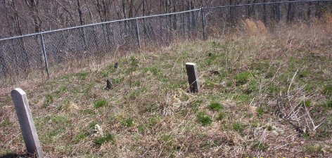
| Description | : | Location: Mouth of Wilson Directions: From the junction of Troutdale Hwy (SR 16) and Little Wilson Rd (Rt 738) go west approximately 0.3 mile on Little Wilson Rd to bridge entrance to Little Wilson Methodist Church. Take this bridge entrance; then turn right passing Little Wilson Church and continue on dirt road past the church approximately 0.4 mile up the draw to cemetery on right (north) side of road. The cemetery is approximately 300 feet from the road but is not visible from the road. GPS Coordinates: N36.633327 W81.412761. Surveyed by: Jeff Weaver 3 Apr 2003 Comments: The cemetery has a good fence around... Read More |
frequently asked questions (FAQ):
-
Where is Fielden Mack Young Cemetery?
Fielden Mack Young Cemetery is located at Mink Ridge Lane Mouth of Wilson, Grayson County ,Virginia , 24363USA.
-
Fielden Mack Young Cemetery cemetery's updated grave count on graveviews.com?
0 memorials
-
Where are the coordinates of the Fielden Mack Young Cemetery?
Latitude: 36.6333710
Longitude: -81.4127510
Nearby Cemetories:
1. Young Cemetery
Mouth of Wilson, Grayson County, USA
Coordinate: 36.6333997, -81.4127455
2. Pugh Cemetery
Grayson County, USA
Coordinate: 36.6445820, -81.4199140
3. Herald Pugh Family Cemetery
Grayson County, USA
Coordinate: 36.6465111, -81.4066467
4. James C A Perkins Cemetery
Mill Creek, Grayson County, USA
Coordinate: 36.6267730, -81.4382540
5. Pugh-Greear Cemetery
Grant, Grayson County, USA
Coordinate: 36.6552800, -81.4055330
6. Shelton Family Cemetery
Mouth of Wilson, Grayson County, USA
Coordinate: 36.6489000, -81.4358000
7. VanHoy Cemetery
Mouth of Wilson, Grayson County, USA
Coordinate: 36.6080075, -81.4178560
8. Osborne-Williams Cemetery
Low Gap, Grayson County, USA
Coordinate: 36.6266230, -81.4456550
9. Pickle-Peak Cemetery
Rugby, Grayson County, USA
Coordinate: 36.6120400, -81.4390410
10. Grant Community Cemetery
Grant, Grayson County, USA
Coordinate: 36.6624180, -81.4027100
11. Reedy Cemetery
Grayson County, USA
Coordinate: 36.6474991, -81.3752975
12. Corinth Baptist Church Cemetery
Rugby, Grayson County, USA
Coordinate: 36.6119240, -81.4470280
13. Liberty Hill Baptist Church Cemetery
Grant, Grayson County, USA
Coordinate: 36.6688995, -81.4064026
14. John Andrew Peak Cemetery
Mouth of Wilson, Grayson County, USA
Coordinate: 36.6016060, -81.3908140
15. Hugh Peak Cemetery
Mouth of Wilson, Grayson County, USA
Coordinate: 36.5946860, -81.4018440
16. Quillin Cemetery
Rugby, Grayson County, USA
Coordinate: 36.6006490, -81.4425210
17. Charles Hoffman Cemetery
Flat Ridge, Grayson County, USA
Coordinate: 36.6673760, -81.3832750
18. Grubb Cemetery
Grayson County, USA
Coordinate: 36.6757770, -81.4072420
19. Spencer Family Cemetery
Mouth of Wilson, Grayson County, USA
Coordinate: 36.5895190, -81.4181710
20. George D Reeves Cemetery
Mouth of Wilson, Grayson County, USA
Coordinate: 36.5906010, -81.3948010
21. Samuel Tucker Family Cemetery
Mouth of Wilson, Grayson County, USA
Coordinate: 36.6092250, -81.4614260
22. Fields M Young Cemetery
Mouth of Wilson, Grayson County, USA
Coordinate: 36.6105280, -81.3622860
23. Gideon Weaver Cemetery
Rugby, Grayson County, USA
Coordinate: 36.6156830, -81.4691750
24. Elijah Franklin Sexton Family Cemetery
Mill Creek, Grayson County, USA
Coordinate: 36.6156371, -81.4691845