
| Memorials | : | 1 |
| Location | : | Arundel, Arun District, England |
| Coordinate | : | 50.8556950, -0.5534210 |
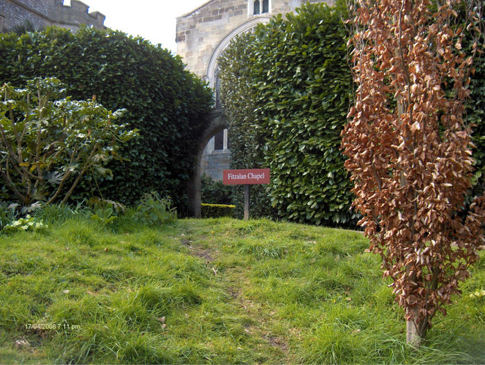
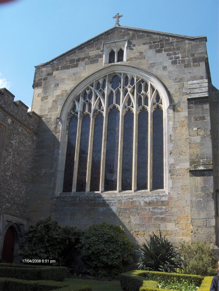
| Description | : | Founded on the feast of Corpus Christi in 1380 by Richard, 4th Earl of Arundel as a collegiate chapel served by secular canons. In the reign of Henry VIII the college was disolved; the chapel and other buildings were sold to the family and have been the private property of the Earls of Arundel and the Dukes fo Norfolk ever since. In 1879, an action heard before Lord Chief Justice Coleridge determined that the Fitzalan Chapel did not form a part of the Parish church but was an independent ecclesiastical structure. The chapel has therefore remained Catholic, an unusual, if... Read More |
frequently asked questions (FAQ):
-
Where is Fitzalan Chapel?
Fitzalan Chapel is located at Arundel, Arun District ,West Sussex ,England.
-
Fitzalan Chapel cemetery's updated grave count on graveviews.com?
0 memorials
-
Where are the coordinates of the Fitzalan Chapel?
Latitude: 50.8556950
Longitude: -0.5534210

Nearby Cemetories:
1. St. Nicholas' Churchyard
Arundel, Arun District, England
Coordinate: 50.8555520, -0.5570710
2. Arundel Cathedral
Arundel, Arun District, England
Coordinate: 50.8551180, -0.5588380
3. Arundel Roman Catholic Cemetery
Arundel, Arun District, England
Coordinate: 50.8550780, -0.5601950
4. Arundel Cemetery
Arundel, Arun District, England
Coordinate: 50.8517220, -0.5628240
5. Convent of Poor Clare Cemetery
Arundel, Arun District, England
Coordinate: 50.8468960, -0.5381370
6. St Mary Magdalene Churchyard
Lyminster, Arun District, England
Coordinate: 50.8335650, -0.5485680
7. St. Mary the Virgin Churchyard
Burpham, Arun District, England
Coordinate: 50.8709730, -0.5244080
8. Saint Mary Magdalene Churchyard
Tortington, Arun District, England
Coordinate: 50.8357610, -0.5768007
9. St Leonard’s Churchyard
South Stoke, Arun District, England
Coordinate: 50.8807500, -0.5420700
10. St Nicholas Churchyard
Poling, Arun District, England
Coordinate: 50.8315400, -0.5144600
11. St Andrew-by-the-Ford Church
Ford, Arun District, England
Coordinate: 50.8242700, -0.5780060
12. Littlehampton Cemetery
Littlehampton, Arun District, England
Coordinate: 50.8190710, -0.5282800
13. St Mary Churchyard
Walberton, Arun District, England
Coordinate: 50.8436840, -0.6186680
14. St Mary Churchyard
Climping (Clymping), Arun District, England
Coordinate: 50.8137720, -0.5777690
15. St. Mary the Virgin
Yapton, Arun District, England
Coordinate: 50.8230000, -0.6076000
16. St Mary Churchyard
Littlehampton, Arun District, England
Coordinate: 50.8089180, -0.5385450
17. Brookside Cemetery
Rustington, Arun District, England
Coordinate: 50.8182133, -0.5048826
18. St Wilfrid Roman Catholic Cemetery
Angmering, Arun District, England
Coordinate: 50.8300437, -0.4858832
19. St. Margaret's Parish Churchyard
Angmering, Arun District, England
Coordinate: 50.8289920, -0.4860946
20. St Peter and St Paul Churchyard
Rustington, Arun District, England
Coordinate: 50.8103200, -0.5107400
21. St. John the Evangelist Churchyard
Bury, Chichester District, England
Coordinate: 50.9084756, -0.5565667
22. St Mary Churchyard
Slindon, Arun District, England
Coordinate: 50.8666480, -0.6355800
23. St Richards Catholic Churchyard
Slindon, Arun District, England
Coordinate: 50.8680000, -0.6359000
24. St Mary the Virgin Churchyard
East Preston, Arun District, England
Coordinate: 50.8125610, -0.4897360