
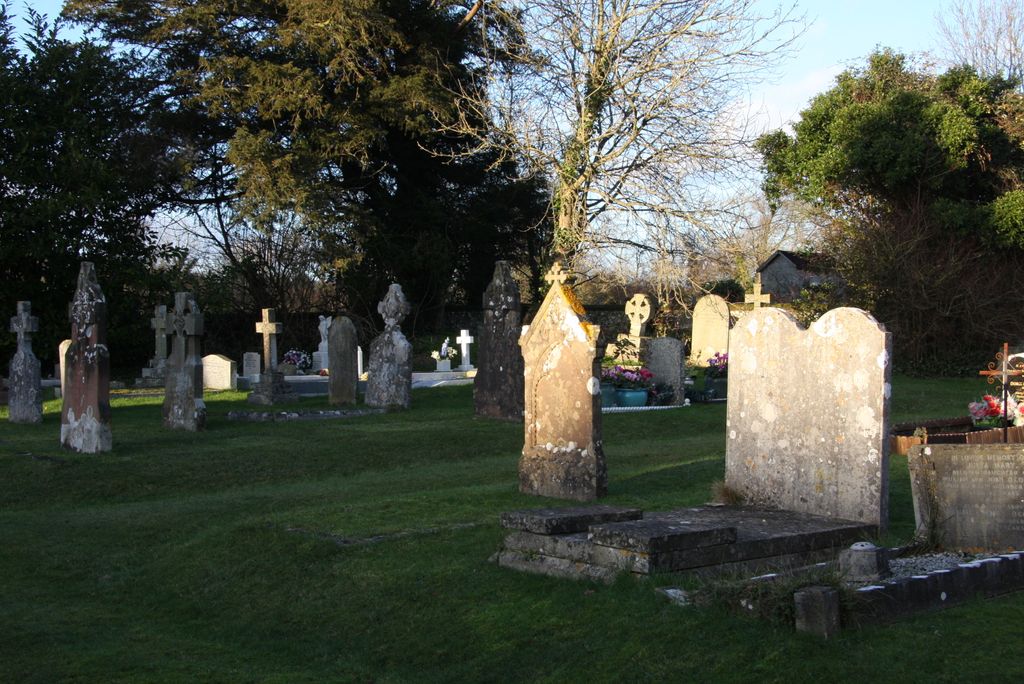
| Memorials | : | 0 |
| Location | : | Slindon, Arun District, England |
| Coordinate | : | 50.8680000, -0.6359000 |
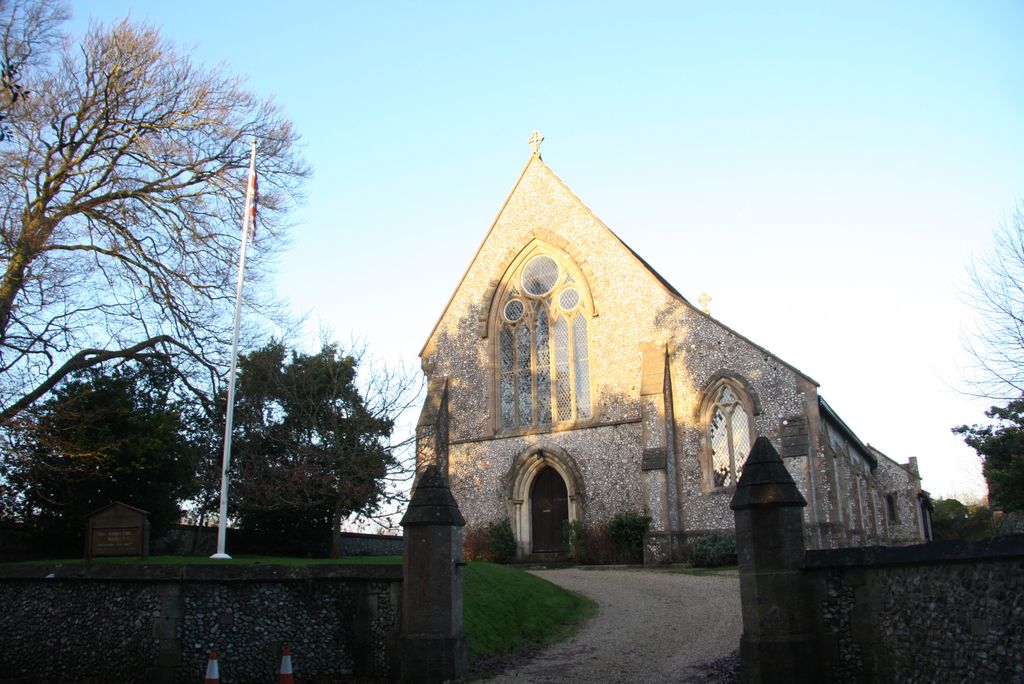
| Description | : | Roman Catholic Church. 1865, designed by C A Buckler, endowed by the Countess of Newburgh. Gothic style. Built of stone rubble with ashlar dressing and slate roof. Four bay nave, lower two bay chancel, south aisle and north porch. Traceried windows with leaded lights divided by buttresses. EXTERIOR: Liturgical west front has cross-shaped saddlestone, large arched west window with five trefoil-headed lancets surmounted by three circular openings and smaller south aisle window with two trefoil-headed lights and trefoil above. Arched west door with recessed colonnettes. Liturgical south side has paired lancets with trefoil heads and quatrefoils above. Liturgical north side... Read More |
frequently asked questions (FAQ):
-
Where is St Richards Catholic Churchyard?
St Richards Catholic Churchyard is located at 2 Church Hill, Slindon Slindon, Arun District ,West Sussex , BN18 0RHEngland.
-
St Richards Catholic Churchyard cemetery's updated grave count on graveviews.com?
0 memorials
-
Where are the coordinates of the St Richards Catholic Churchyard?
Latitude: 50.8680000
Longitude: -0.6359000

Nearby Cemetories:
1. St Mary Churchyard
Slindon, Arun District, England
Coordinate: 50.8666480, -0.6355800
2. St Mary Churchyard
Walberton, Arun District, England
Coordinate: 50.8436840, -0.6186680
3. Saint George's Churchyard
Eastergate, Arun District, England
Coordinate: 50.8379600, -0.6592400
4. St Mary Churchyard
Aldingbourne, Arun District, England
Coordinate: 50.8436400, -0.6935500
5. St Mary The Virgin Churchyard
Barnham, Arun District, England
Coordinate: 50.8236310, -0.6436550
6. St Mary and St Blaise Church
Boxgrove, Chichester District, England
Coordinate: 50.8599300, -0.7110320
7. St. Mary the Virgin
Yapton, Arun District, England
Coordinate: 50.8230000, -0.6076000
8. Arundel Cemetery
Arundel, Arun District, England
Coordinate: 50.8517220, -0.5628240
9. Saint Mary Magdalene Churchyard
Tortington, Arun District, England
Coordinate: 50.8357610, -0.5768007
10. Arundel Roman Catholic Cemetery
Arundel, Arun District, England
Coordinate: 50.8550780, -0.5601950
11. Arundel Cathedral
Arundel, Arun District, England
Coordinate: 50.8551180, -0.5588380
12. St Mary the Virgin
Upwaltham, Chichester District, England
Coordinate: 50.9164000, -0.6600810
13. St. Nicholas' Churchyard
Arundel, Arun District, England
Coordinate: 50.8555520, -0.5570710
14. Fitzalan Chapel
Arundel, Arun District, England
Coordinate: 50.8556950, -0.5534210
15. St Andrew-by-the-Ford Church
Ford, Arun District, England
Coordinate: 50.8242700, -0.5780060
16. St Andrew Churchyard
Tangmere, Chichester District, England
Coordinate: 50.8479850, -0.7207170
17. St Leonard’s Churchyard
South Stoke, Arun District, England
Coordinate: 50.8807500, -0.5420700
18. St Andrew Churchyard and Extension
Oving, Chichester District, England
Coordinate: 50.8379190, -0.7219220
19. St. John the Evangelist Churchyard
Bury, Chichester District, England
Coordinate: 50.9084756, -0.5565667
20. St Mary Magdalene Churchyard
Lyminster, Arun District, England
Coordinate: 50.8335650, -0.5485680
21. Convent of Poor Clare Cemetery
Arundel, Arun District, England
Coordinate: 50.8468960, -0.5381370
22. All Saints Churchyard
East Dean, Chichester District, England
Coordinate: 50.9111110, -0.7136340
23. St Mary Churchyard
Climping (Clymping), Arun District, England
Coordinate: 50.8137720, -0.5777690
24. Goodwood House
Chichester, Chichester District, England
Coordinate: 50.8723110, -0.7394830