
| Memorials | : | 0 |
| Location | : | Bury, Chichester District, England |
| Phone | : | 01798 839057 |
| Website | : | www.arunchurches.com/bchh/?page_id=183 |
| Coordinate | : | 50.9084756, -0.5565667 |
frequently asked questions (FAQ):
-
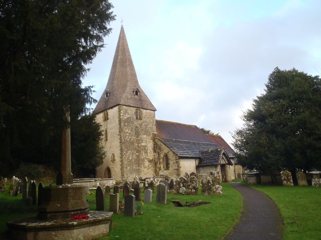
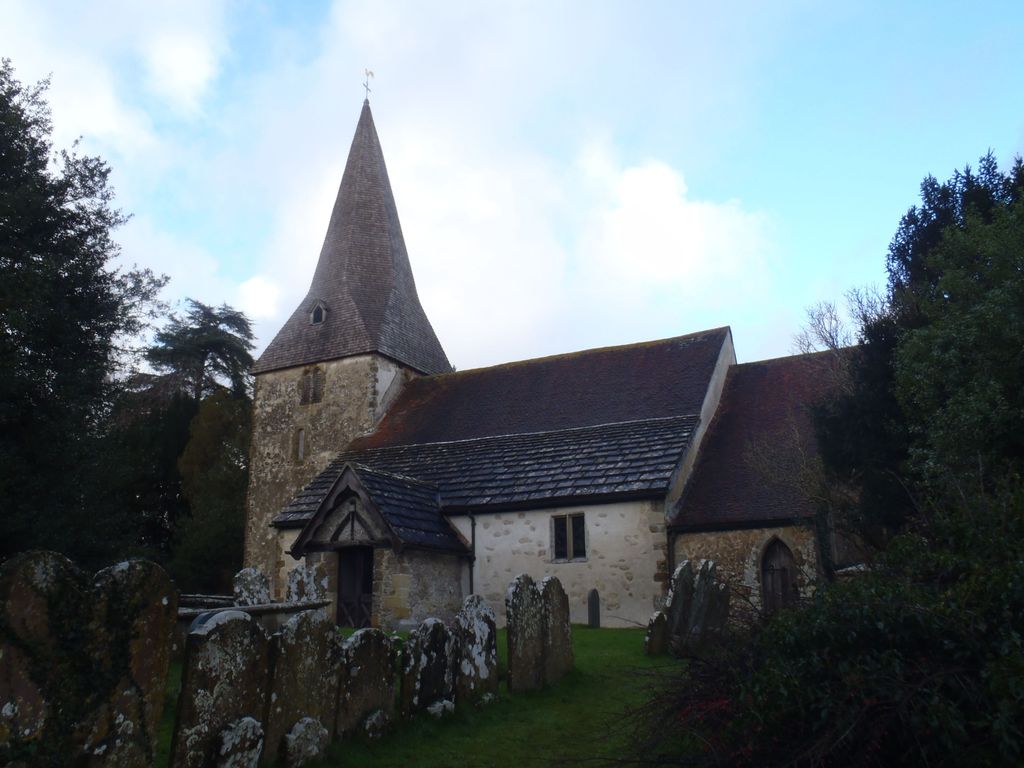
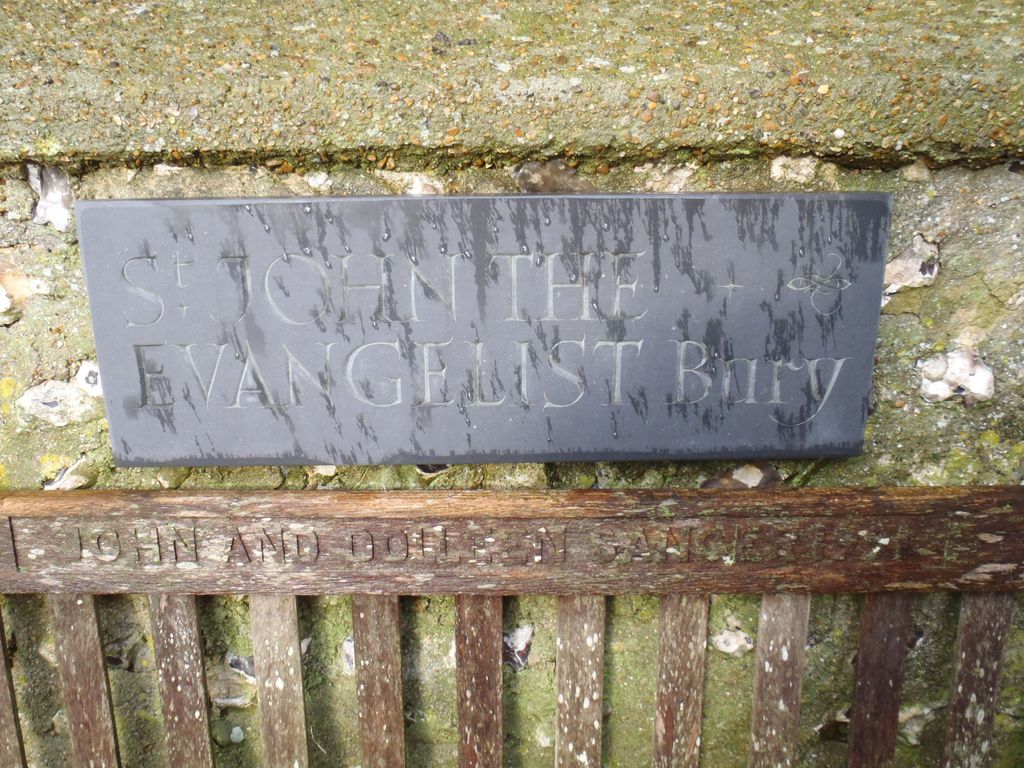
Where is St. John the Evangelist Churchyard?
St. John the Evangelist Churchyard is located at Church Lane, Bury, West Sussex Bury, Chichester District ,West Sussex , RH20 1PBEngland.
-
St. John the Evangelist Churchyard cemetery's updated grave count on graveviews.com?
0 memorials
-
Where are the coordinates of the St. John the Evangelist Churchyard?
Latitude: 50.9084756
Longitude: -0.5565667

Nearby Cemetories:
1. St Leonard’s Churchyard
South Stoke, Arun District, England
Coordinate: 50.8807500, -0.5420700
2. Greatham Parish Churchyard
Pulborough, Horsham District, England
Coordinate: 50.9339600, -0.5156300
3. St. John The Baptist Churchyard Cemetery
Sutton, Chichester District, England
Coordinate: 50.9316638, -0.6080123
4. St. Mary the Virgin Churchyard
Burpham, Arun District, England
Coordinate: 50.8709730, -0.5244080
5. St Botolph Churchyard
Hardham, Horsham District, England
Coordinate: 50.9485730, -0.5226740
6. St. Botolph's Churchyard
Pulborough, Horsham District, England
Coordinate: 50.9486804, -0.5228765
7. Wiggonholt Churchyard
Parham, Horsham District, England
Coordinate: 50.9404490, -0.4924910
8. Fitzalan Chapel
Arundel, Arun District, England
Coordinate: 50.8556950, -0.5534210
9. St. Nicholas' Churchyard
Arundel, Arun District, England
Coordinate: 50.8555520, -0.5570710
10. St Mary the Virgin Churchyard
Stopham, Chichester District, England
Coordinate: 50.9607210, -0.5397030
11. Arundel Cathedral
Arundel, Arun District, England
Coordinate: 50.8551180, -0.5588380
12. Arundel Roman Catholic Cemetery
Arundel, Arun District, England
Coordinate: 50.8550780, -0.5601950
13. St Mary the Virgin Churchyard
Fittleworth, Chichester District, England
Coordinate: 50.9641190, -0.5641100
14. Arundel Cemetery
Arundel, Arun District, England
Coordinate: 50.8517220, -0.5628240
15. St Richard's Church
Duncton, Chichester District, England
Coordinate: 50.9486600, -0.6230000
16. St. Mary’s Churchyard
Pulborough, Horsham District, England
Coordinate: 50.9588300, -0.5101400
17. Our Lady of England Churchyard
Storrington, Horsham District, England
Coordinate: 50.9164980, -0.4599130
18. Convent of Poor Clare Cemetery
Arundel, Arun District, England
Coordinate: 50.8468960, -0.5381370
19. Holy Trinity Churchyard
Duncton, Chichester District, England
Coordinate: 50.9491400, -0.6337740
20. St. Mary's Churchyard
Storrington, Horsham District, England
Coordinate: 50.9160360, -0.4566160
21. St Richards Catholic Churchyard
Slindon, Arun District, England
Coordinate: 50.8680000, -0.6359000
22. St Mary Churchyard
Slindon, Arun District, England
Coordinate: 50.8666480, -0.6355800
23. St Bartholomew Churchyard
Egdean, Chichester District, England
Coordinate: 50.9716740, -0.5819790
24. St Mary the Virgin
Upwaltham, Chichester District, England
Coordinate: 50.9164000, -0.6600810