
| Memorials | : | 0 |
| Location | : | Longsight, Metropolitan Borough of Manchester, England |
| Coordinate | : | 53.4570760, -2.2025800 |
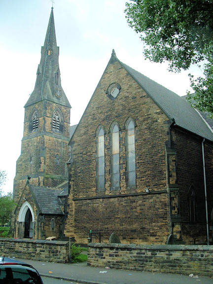
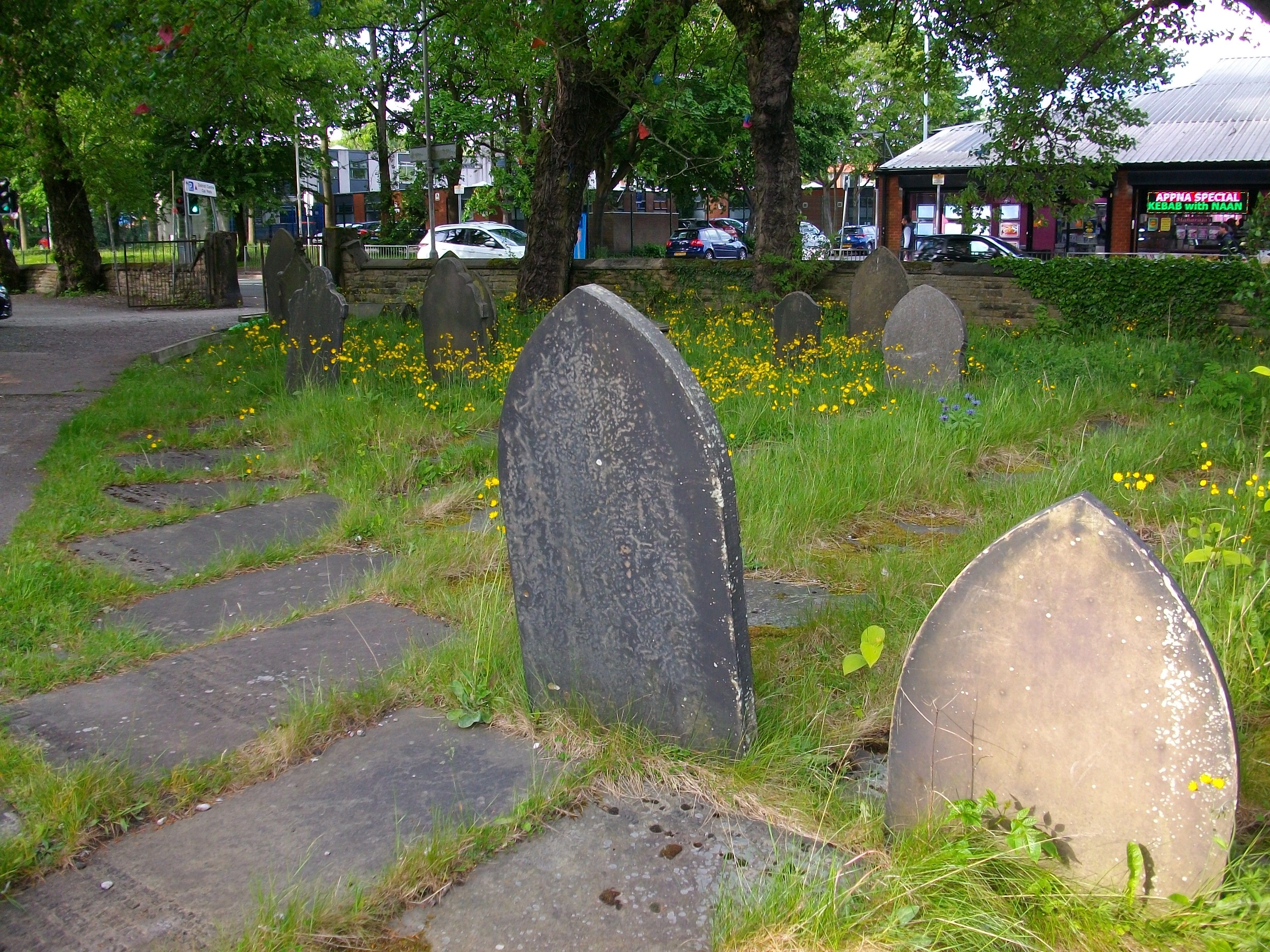
| Description | : | Currently the site of Qadria Jilania Islamic Social & Educational Centre Remaining gravestones are still in the old churchyard around the centre. |
frequently asked questions (FAQ):
-
Where is Former Saint Johns Churchyard?
Former Saint Johns Churchyard is located at Saint John's Road Longsight, Metropolitan Borough of Manchester ,Greater Manchester , M13 0WUEngland.
-
Former Saint Johns Churchyard cemetery's updated grave count on graveviews.com?
0 memorials
-
Where are the coordinates of the Former Saint Johns Churchyard?
Latitude: 53.4570760
Longitude: -2.2025800
Nearby Cemetories:
1. St James Churchyard
Rusholme, Metropolitan Borough of Manchester, England
Coordinate: 53.4490050, -2.2151450
2. All Saints Churchyard
Chorlton-on-Medlock, Metropolitan Borough of Manchester, England
Coordinate: 53.4666670, -2.2166670
3. St Savior Churchyard
Manchester, Metropolitan Borough of Manchester, England
Coordinate: 53.4654560, -2.2269220
4. St Thomas Churchyard
Ardwick, Metropolitan Borough of Manchester, England
Coordinate: 53.4720000, -2.2248900
5. Christ Church Churchyard
Chorlton-on-Medlock, Metropolitan Borough of Manchester, England
Coordinate: 53.4592000, -2.2362000
6. Gorton Cemetery
Manchester, Metropolitan Borough of Manchester, England
Coordinate: 53.4567080, -2.1632580
7. St Lukes Churchyard
Manchester, Metropolitan Borough of Manchester, England
Coordinate: 53.4704000, -2.2386500
8. St Cross Churchyard
Clayton, Metropolitan Borough of Manchester, England
Coordinate: 53.4832190, -2.1823530
9. St. Paul's Churchyard
Withington, Metropolitan Borough of Manchester, England
Coordinate: 53.4324900, -2.2280790
10. St Elisabeth Church
Reddish, Metropolitan Borough of Stockport, England
Coordinate: 53.4379400, -2.1633950
11. Saint Thomas the Apostle Heaton Chapel
Heaton Norris, Metropolitan Borough of Stockport, England
Coordinate: 53.4297783, -2.1797558
12. Philips Park Cemetery
Miles Platting, Metropolitan Borough of Manchester, England
Coordinate: 53.4898020, -2.2007400
13. Saint Peters Street
Manchester, Metropolitan Borough of Manchester, England
Coordinate: 53.4777660, -2.2453600
14. Great Bridgewater St. Wesleyan Methodist Churchyard
Manchester, Metropolitan Borough of Manchester, England
Coordinate: 53.4757580, -2.2500770
15. St Mary's Roman Catholic Church
Manchester, Metropolitan Borough of Manchester, England
Coordinate: 53.4800820, -2.2463900
16. Saint Ann's Churchyard
Manchester, Metropolitan Borough of Manchester, England
Coordinate: 53.4817542, -2.2457527
17. St John's Churchyard
Manchester, Metropolitan Borough of Manchester, England
Coordinate: 53.4780043, -2.2526487
18. St George Churchyard
Hulme, Metropolitan Borough of Manchester, England
Coordinate: 53.4721400, -2.2593000
19. St. Mary's Churchyard (Defunct)
Manchester, Metropolitan Borough of Manchester, England
Coordinate: 53.4825726, -2.2483873
20. Manchester Cathedral
Manchester, Metropolitan Borough of Manchester, England
Coordinate: 53.4852760, -2.2446010
21. St. Paul's Churchyard
Portwood, Metropolitan Borough of Stockport, England
Coordinate: 53.4215604, -2.1717953
22. Droylsden Cemetery
Droylsden, Metropolitan Borough of Tameside, England
Coordinate: 53.4849400, -2.1529696
23. Christ Church
Salford, Metropolitan Borough of Salford, England
Coordinate: 53.4864284, -2.2497653
24. New Jerusalem Temple Cemetery
Salford, Metropolitan Borough of Salford, England
Coordinate: 53.4827720, -2.2571250