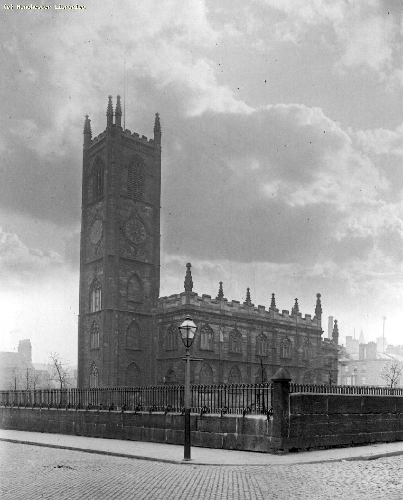
| Memorials | : | 108 |
| Location | : | Manchester, Metropolitan Borough of Manchester, England |
| Coordinate | : | 53.4780043, -2.2526487 |
| Description | : | A Brief History of St. John's Church and Graveyard by E. Smith The former location of the church and graveyard is now the St. John's Gardens. There is a commemorative cross in the centre of the gardens remembering those buried below. St. John’s Church was built in the Deansgate neighbourhood in 1769 by Edward Byrom, the eldest son of the Byrom Family for whom Byrom Street is named. With the growth of Manchester in the late 18th century, there arose a greater demand for churches. The new church, in typical fashion, included a graveyard. According to the commemorative cross,... Read More |
frequently asked questions (FAQ):
-
Where is St John's Churchyard?
St John's Churchyard is located at Lower Byrom St Manchester, Metropolitan Borough of Manchester ,Greater Manchester , M3 4APEngland.
-
St John's Churchyard cemetery's updated grave count on graveviews.com?
108 memorials
-
Where are the coordinates of the St John's Churchyard?
Latitude: 53.4780043
Longitude: -2.2526487
Nearby Cemetories:
1. Great Bridgewater St. Wesleyan Methodist Churchyard
Manchester, Metropolitan Borough of Manchester, England
Coordinate: 53.4757580, -2.2500770
2. St Mary's Roman Catholic Church
Manchester, Metropolitan Borough of Manchester, England
Coordinate: 53.4800820, -2.2463900
3. Saint Peters Street
Manchester, Metropolitan Borough of Manchester, England
Coordinate: 53.4777660, -2.2453600
4. St. Mary's Churchyard (Defunct)
Manchester, Metropolitan Borough of Manchester, England
Coordinate: 53.4825726, -2.2483873
5. New Jerusalem Temple Cemetery
Salford, Metropolitan Borough of Salford, England
Coordinate: 53.4827720, -2.2571250
6. Saint Ann's Churchyard
Manchester, Metropolitan Borough of Manchester, England
Coordinate: 53.4817542, -2.2457527
7. Irwell Street Wesleyan Chapel Cemetery
Salford, Metropolitan Borough of Salford, England
Coordinate: 53.4829750, -2.2587540
8. St George Churchyard
Hulme, Metropolitan Borough of Manchester, England
Coordinate: 53.4721400, -2.2593000
9. Christ Church
Salford, Metropolitan Borough of Salford, England
Coordinate: 53.4864284, -2.2497653
10. Manchester Cathedral
Manchester, Metropolitan Borough of Manchester, England
Coordinate: 53.4852760, -2.2446010
11. St Lukes Churchyard
Manchester, Metropolitan Borough of Manchester, England
Coordinate: 53.4704000, -2.2386500
12. Strangeways Prison Cemetery (Defunct)
Manchester, Metropolitan Borough of Manchester, England
Coordinate: 53.4925000, -2.2463890
13. St Chad's Churchyard
Cheetham Hill, Metropolitan Borough of Manchester, England
Coordinate: 53.4922100, -2.2400500
14. St Thomas Churchyard
Ardwick, Metropolitan Borough of Manchester, England
Coordinate: 53.4720000, -2.2248900
15. St Savior Churchyard
Manchester, Metropolitan Borough of Manchester, England
Coordinate: 53.4654560, -2.2269220
16. Christ Church Churchyard
Chorlton-on-Medlock, Metropolitan Borough of Manchester, England
Coordinate: 53.4592000, -2.2362000
17. St. Thomas' Churchyard
Salford, Metropolitan Borough of Salford, England
Coordinate: 53.4921430, -2.2856130
18. All Saints Churchyard
Chorlton-on-Medlock, Metropolitan Borough of Manchester, England
Coordinate: 53.4666670, -2.2166670
19. St Luke's Churchyard
Cheetham Hill, Metropolitan Borough of Manchester, England
Coordinate: 53.5041660, -2.2354680
20. Weaste Cemetery
Weaste, Metropolitan Borough of Salford, England
Coordinate: 53.4795227, -2.3017540
21. Philips Park Cemetery
Miles Platting, Metropolitan Borough of Manchester, England
Coordinate: 53.4898020, -2.2007400
22. St. Marks' Churchyard
Cheetham Hill, Metropolitan Borough of Manchester, England
Coordinate: 53.5113780, -2.2462660
23. Manchester General Cemetery
Manchester, Metropolitan Borough of Manchester, England
Coordinate: 53.5062710, -2.2179570
24. Former Saint Johns Churchyard
Longsight, Metropolitan Borough of Manchester, England
Coordinate: 53.4570760, -2.2025800


