
| Memorials | : | 0 |
| Location | : | Gladstone, Clay County, USA |
| Coordinate | : | 39.2078700, -94.5258500 |
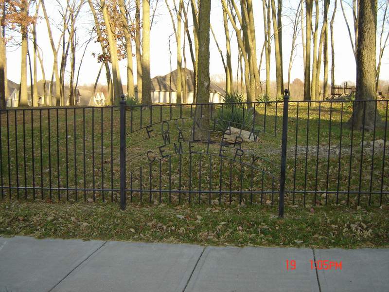
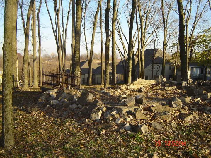
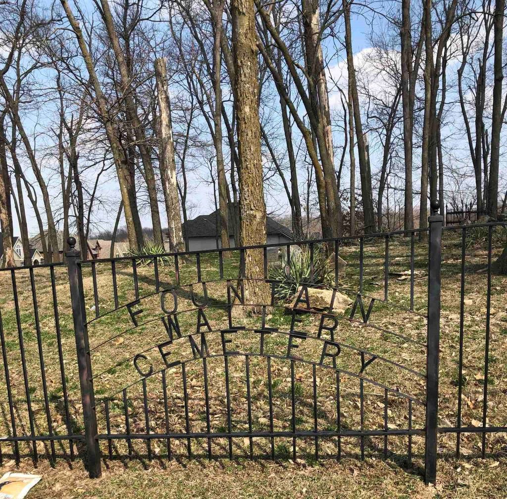
| Description | : | Small cemetery with several broken and illegible stones. Located between N. Brighton and Antioch Rd. in Glastone, Mo just off 64 th St. south. Heading East on 210 Hwy from North Kansas City, MO, take the N. Brighton exit. Turn left at the stop sign, go approx. 4 miles on N Brighton to the 5000 block. Turn left onto Shady Lane (Carriage Hills Estates Subdivision). Take the first right (Cypress St) and go about a block and a half. The cemetery is on the right hand side of the street, with a large fence around it |
frequently asked questions (FAQ):
-
Where is Fountain Waller Cemetery?
Fountain Waller Cemetery is located at Gladstone, Clay County ,Missouri ,USA.
-
Fountain Waller Cemetery cemetery's updated grave count on graveviews.com?
0 memorials
-
Where are the coordinates of the Fountain Waller Cemetery?
Latitude: 39.2078700
Longitude: -94.5258500
Nearby Cemetories:
1. New Stark Cemetery
Gladstone, Clay County, USA
Coordinate: 39.2056007, -94.5291977
2. Big Shoal Cemetery
Gladstone, Clay County, USA
Coordinate: 39.2098503, -94.5307312
3. White Chapel Memorial Gardens
Gladstone, Clay County, USA
Coordinate: 39.2111015, -94.5372009
4. Starks Cemetery
Clay County, USA
Coordinate: 39.2150210, -94.5464510
5. McMurry United Methodist Church Columbarium
Kansas City, Clay County, USA
Coordinate: 39.1967380, -94.5066140
6. Church of the Good Shepherd Episcopal Columbarium
Kansas City, Clay County, USA
Coordinate: 39.1852600, -94.5399800
7. Antioch Community Church Columbarium
Kansas City, Clay County, USA
Coordinate: 39.1813695, -94.5483659
8. Faubion Cemetery
Gladstone, Clay County, USA
Coordinate: 39.2246017, -94.5617981
9. Pence Cemetery
Pleasant Valley, Clay County, USA
Coordinate: 39.2308006, -94.4899979
10. Rogers Cemetery
Clay County, USA
Coordinate: 39.1805992, -94.4903030
11. Crowley Cemetery
Kansas City, Clay County, USA
Coordinate: 39.1800003, -94.4897003
12. North Cross Methodist Church Memorial Garden
Kansas City, Clay County, USA
Coordinate: 39.1806410, -94.5635200
13. Davidson Cemetery
Kansas City, Clay County, USA
Coordinate: 39.2332993, -94.4794006
14. Ricketts Cemetery
Kansas City, Clay County, USA
Coordinate: 39.1638718, -94.5430145
15. Craig Cemetery
Clay County, USA
Coordinate: 39.2477112, -94.5638733
16. Roberts Cemetery
Clay County, USA
Coordinate: 39.1581600, -94.5235900
17. Adkins Family Cemetery
Liberty, Callaway County, USA
Coordinate: 39.2206840, -94.4579870
18. Adkins Family Cemetery
Liberty, Clay County, USA
Coordinate: 39.2206840, -94.4579870
19. Arthur Cemetery
Liberty, Clay County, USA
Coordinate: 39.2083527, -94.4501364
20. Gash Cemetery
Gashland, Clay County, USA
Coordinate: 39.2467613, -94.5848846
21. Old German Cemetery
Kansas City, Clay County, USA
Coordinate: 39.1885300, -94.6010100
22. McQuiddy Cemetery
Kansas City, Clay County, USA
Coordinate: 39.2504437, -94.4658178
23. Minneville Cemetery
Minaville, Clay County, USA
Coordinate: 39.1671906, -94.4616928
24. Barry Cemetery
Barry, Clay County, USA
Coordinate: 39.2444000, -94.5963974