
| Memorials | : | 6 |
| Location | : | Franklin, Greenlee County, USA |
| Coordinate | : | 32.6797791, -109.0851288 |
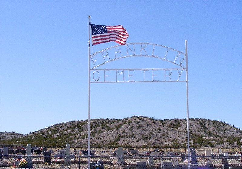
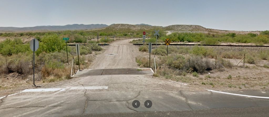
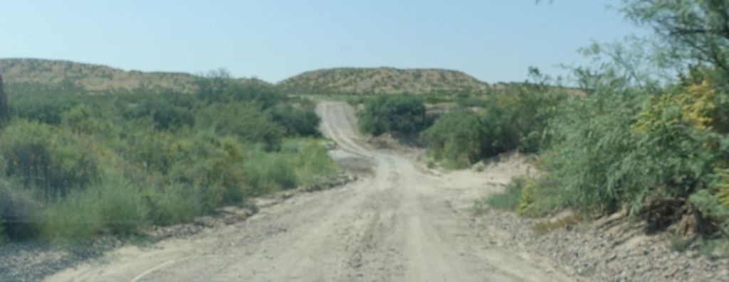
| Description | : | The Franklin Cemetery is 2.2 miles east of Duncan, Arizona on US Hwy 70 and just about 3 miles west of New Mexico and is visible from the highway. To get to the cemetery, exit Hwy 70 to the south just west of the Franklin turnoff. NOTE: Between the highway and the cemetery is a wide, deep wash which you have to cross. The road through this wash is washed out numerous times during the rainy season. |
frequently asked questions (FAQ):
-
Where is Franklin Cemetery?
Franklin Cemetery is located at Franklin, Greenlee County ,Arizona ,USA.
-
Franklin Cemetery cemetery's updated grave count on graveviews.com?
6 memorials
-
Where are the coordinates of the Franklin Cemetery?
Latitude: 32.6797791
Longitude: -109.0851288
Nearby Cemetories:
1. Duncan Valley Cemetery
Duncan, Greenlee County, USA
Coordinate: 32.7075005, -109.0999985
2. Old Duncan Cemetery
Greenlee County, USA
Coordinate: 32.7113000, -109.0978000
3. Virden Cemetery
Virden, Hidalgo County, USA
Coordinate: 32.6923100, -109.0047800
4. Virden Catholic Cemetery
Virden, Hidalgo County, USA
Coordinate: 32.6838913, -108.9832993
5. Hill Family Cemetery
Grant County, USA
Coordinate: 32.8115300, -109.0078900
6. Sheldon Cemetery
Duncan, Greenlee County, USA
Coordinate: 32.8193600, -109.1728900
7. Ash Peak Cemetery
Graham County, USA
Coordinate: 32.7724860, -109.2816950
8. Posey Homestead Burial Site
Whitlock Cienega, Graham County, USA
Coordinate: 32.4536602, -109.3569780
9. Redrock Cemetery
Redrock, Grant County, USA
Coordinate: 32.7083015, -108.7024994
10. Black Hills Byway Burial Site
Graham County, USA
Coordinate: 32.8455405, -109.4197850
11. John James Gidding Gravesite
Cochise County, USA
Coordinate: 32.3375015, -109.0532990
12. Clifton Cemetery
Clifton, Greenlee County, USA
Coordinate: 33.0293999, -109.2647018
13. Metcalf Cemetery
Greenlee County, USA
Coordinate: 33.0438995, -109.3110962
14. Metcalf Indian Cemetery
Greenlee County, USA
Coordinate: 33.0445595, -109.3101807
15. Sacred Heart Cemetery
Clifton, Greenlee County, USA
Coordinate: 33.0491982, -109.3131027
16. Earven Family Cemetery
Sanchez, Graham County, USA
Coordinate: 32.8654500, -109.5314600
17. Sacred Heart Church Columbarium
Clifton, Greenlee County, USA
Coordinate: 33.0555540, -109.3054630
18. Serna Family Cemetery
Sanchez, Graham County, USA
Coordinate: 32.8696800, -109.5404400
19. Railroad Cemetery
San Simon, Cochise County, USA
Coordinate: 32.2698750, -109.2301130
20. Sanchez Cemetery
Sanchez, Graham County, USA
Coordinate: 32.8705300, -109.5426300
21. Billings Cemetery
Gila, Grant County, USA
Coordinate: 32.8129900, -108.5989700
22. Molina Farm Cemetery
San Jose, Graham County, USA
Coordinate: 32.8456640, -109.5612950
23. Bunkers Cemetery
Morenci, Greenlee County, USA
Coordinate: 33.0600014, -109.3392029
24. Homewood Cemetery
San Simon, Cochise County, USA
Coordinate: 32.2645000, -109.2463000