| Memorials | : | 5 |
| Location | : | Montana, Labette County, USA |
| Coordinate | : | 37.3182983, -95.1746979 |
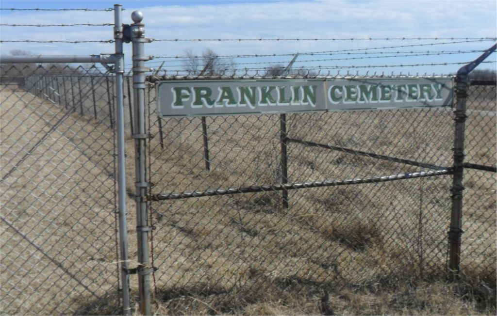
| Description | : | Franklin Cemetery is located about 4 miles east of Parsons, Kansas and 4 miles northwest of Montana, Kansas. Fairview Cemetery is a few miles southeast of Franklin Cemetery. These two cemeteries are on over 13000 acres of land that was taken by the US Government in the early 1940s to became the Kansas Army Ammunition Plant. The plant operated until 2009 making primarily artillery shells, bombs and grenades for the US military forces in World War II, Korean war and Vietnam war. During that time, access to these two cemeteries was restricted to Memorial Day and... Read More |
frequently asked questions (FAQ):
-
Where is Franklin Cemetery?
Franklin Cemetery is located at Montana, Labette County ,Kansas ,USA.
-
Franklin Cemetery cemetery's updated grave count on graveviews.com?
5 memorials
-
Where are the coordinates of the Franklin Cemetery?
Latitude: 37.3182983
Longitude: -95.1746979
Nearby Cemetories:
1. Center Cemetery
Labette County, USA
Coordinate: 37.3396730, -95.1576630
2. Fairview Cemetery
Parsons, Labette County, USA
Coordinate: 37.2963700, -95.1408800
3. Oakwood Cemetery
Parsons, Labette County, USA
Coordinate: 37.3375500, -95.2402800
4. Montana Cemetery
Montana, Labette County, USA
Coordinate: 37.2661157, -95.1315282
5. Spring Hill Cemetery
Parsons, Labette County, USA
Coordinate: 37.2882000, -95.2497500
6. Labette Cemetery
Labette, Labette County, USA
Coordinate: 37.2447014, -95.1772003
7. Hinman Cemetery
Labette County, USA
Coordinate: 37.2812790, -95.0935470
8. Oak Grove Cemetery
Neosho County, USA
Coordinate: 37.3968925, -95.1700974
9. Mitchell Cemetery
Oswego, Labette County, USA
Coordinate: 37.2517014, -95.1213989
10. Jacksonville Cemetery
Strauss, Labette County, USA
Coordinate: 37.3704000, -95.0974600
11. Evergreen Cemetery
Neosho County, USA
Coordinate: 37.4008446, -95.2063217
12. Old Oak Grove Cemetery
Neosho County, USA
Coordinate: 37.4050751, -95.1635742
13. Memorial Lawn Cemetery
Parsons, Labette County, USA
Coordinate: 37.3013992, -95.2833023
14. Mount Olivet Roman Catholic Cemetery
Parsons, Labette County, USA
Coordinate: 37.2998500, -95.2857500
15. Richland Cemetery
Neosho County, USA
Coordinate: 37.4024162, -95.1253357
16. Lucken Cemetery
Parsons, Labette County, USA
Coordinate: 37.3547870, -95.2854960
17. Harley Cemetery
Sherman, Cherokee County, USA
Coordinate: 37.3260994, -95.0550003
18. Pefley Cemetery
Parsons, Labette County, USA
Coordinate: 37.3564900, -95.2856000
19. Parsons State Hospital Cemetery
Parsons, Labette County, USA
Coordinate: 37.3571060, -95.2856310
20. Calvary Cemetery
Parsons, Labette County, USA
Coordinate: 37.3578100, -95.2855000
21. Mason Cemetery
Labette, Labette County, USA
Coordinate: 37.2150200, -95.1946700
22. Brown Cemetery
Neosho County, USA
Coordinate: 37.4244003, -95.1725006
23. East Bethany Cemetery
Neosho County, USA
Coordinate: 37.3983002, -95.2692032
24. West Bethany Cemetery
Neosho County, USA
Coordinate: 37.3983002, -95.2699966

