
| Memorials | : | 0 |
| Location | : | Gunding, Landkreis Dachau, Germany |
| Coordinate | : | 48.2551880, 11.3943892 |
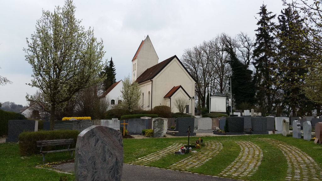
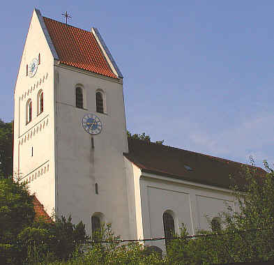
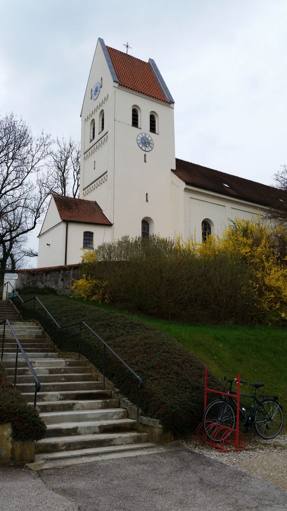
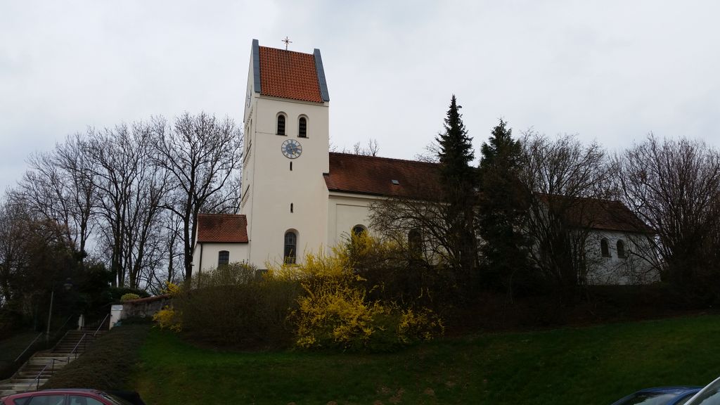
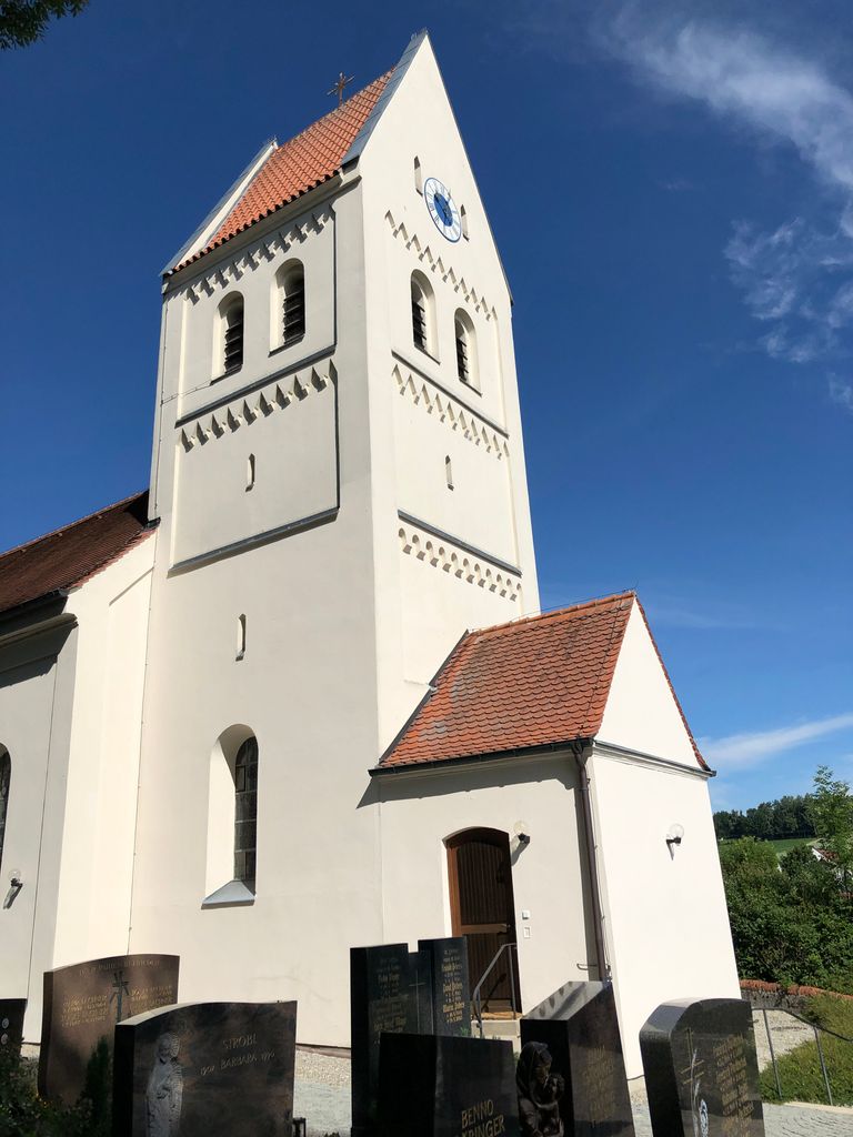
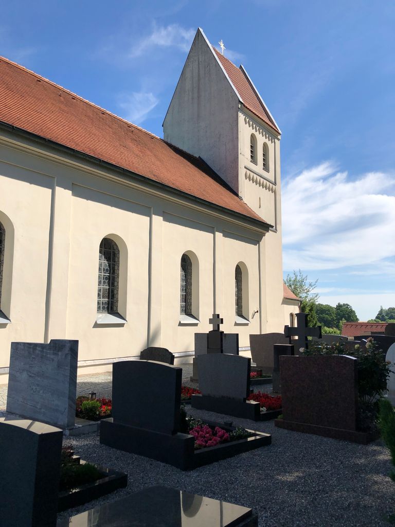
| Description | : | Günding is a small village just West of the city of Dachau in Bavaria. It has a population of about 1200 inhabitants. The small village cemetery surrounds St. Vitus Church. The original church building was constructed in 1315. In 1524 it was rebuilt, enlarged and dedicated to St. Vitus. Like so many other churches in this area of Bavaria the building was totally renovated and architecturally changed after the end of the 30-Year-War (1618-1648) and by 1698 constructions were finally completed. It's now a typical Bavarian Baroque church from the 17th century. As often in Germany the cemetery and it's church... Read More |
frequently asked questions (FAQ):
-
Where is Friedhof Günding?
Friedhof Günding is located at St.-Vitus-Str. 10 Gunding, Landkreis Dachau ,Bavaria (Bayern) , 85232Germany.
-
Friedhof Günding cemetery's updated grave count on graveviews.com?
0 memorials
-
Where are the coordinates of the Friedhof Günding?
Latitude: 48.2551880
Longitude: 11.3943892
Nearby Cemetories:
1. Friedhof Mittendorf
Mitterndorf, Landkreis Dachau, Germany
Coordinate: 48.2566414, 11.4177446
2. Gemeindefriedhof Bergkirchen
Bergkirchen, Landkreis Dachau, Germany
Coordinate: 48.2556114, 11.3634996
3. Friedhof Unterbachern
Unterbachern, Landkreis Dachau, Germany
Coordinate: 48.2792091, 11.3841429
4. Dachau Waldfriedhof
Dachau, Landkreis Dachau, Germany
Coordinate: 48.2678566, 11.4297724
5. Alter Stadtfriedhof Dachau
Dachau, Landkreis Dachau, Germany
Coordinate: 48.2615623, 11.4339352
6. Dachauer Pfarrkirche St. Jakob
Dachau, Landkreis Dachau, Germany
Coordinate: 48.2596100, 11.4346500
7. Neuer Friedhof Unterbachern
Unterbachern, Landkreis Dachau, Germany
Coordinate: 48.2837313, 11.3859010
8. Friedhof Etzenhausen
Etzenhausen, Landkreis Dachau, Germany
Coordinate: 48.2711716, 11.4381142
9. Friedhof Oberbachern
Oberbachern, Landkreis Dachau, Germany
Coordinate: 48.2828941, 11.3664398
10. Friedhof Deutenhausen
Deutenhausen, Landkreis Dachau, Germany
Coordinate: 48.2630463, 11.3419781
11. Eschenried Cemetery
Eschenried, Landkreis Dachau, Germany
Coordinate: 48.2162200, 11.4118400
12. Friedhof Pellheim
Pellheim, Landkreis Dachau, Germany
Coordinate: 48.2950821, 11.4164104
13. Gemeindefriedhof Pellheim
Pellheim, Landkreis Dachau, Germany
Coordinate: 48.2975338, 11.4164202
14. Friedhof Sankt Kastulus
Prittlbach, Landkreis Dachau, Germany
Coordinate: 48.2857456, 11.4469161
15. Friedhof St. Laurentius
Rumeltshausen, Landkreis Dachau, Germany
Coordinate: 48.3018740, 11.3841920
16. Kreuzholzhausen Cemetery
Kreuzholzhausen, Landkreis Dachau, Germany
Coordinate: 48.2736397, 11.3290815
17. Gemeindefriedhof Rumelsthausen
Rumeltshausen, Landkreis Dachau, Germany
Coordinate: 48.3033578, 11.3884687
18. Puchschlagen Cemetery
Puchschlagen, Landkreis Dachau, Germany
Coordinate: 48.2897600, 11.3429900
19. Konzentrationslager Dachau
Dachau, Landkreis Dachau, Germany
Coordinate: 48.2688800, 11.4686000
20. Friedhof Palsweis
Palsweis, Landkreis Dachau, Germany
Coordinate: 48.2540016, 11.3149738
21. Schwabhausen Kirchfriedhof
Schwabhausen, Landkreis Dachau, Germany
Coordinate: 48.3071700, 11.3526500
22. Kirchhof St. Johannes und Paulus
Arzbach, Landkreis Dachau, Germany
Coordinate: 48.3099595, 11.4362108
23. Hebertshausen Kirchfriedhof
Hebertshausen, Landkreis Dachau, Germany
Coordinate: 48.2920300, 11.4688300
24. Schwabhausen Neuer Friedhof am Wasserturm
Schwabhausen, Landkreis Dachau, Germany
Coordinate: 48.3111900, 11.3547000