
| Memorials | : | 0 |
| Location | : | Rudow, Neukölln, Germany |
| Coordinate | : | 52.4209061, 13.5033989 |
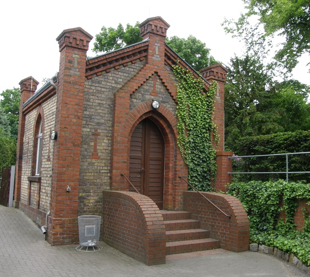
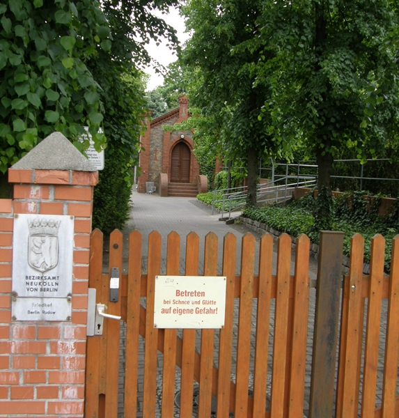
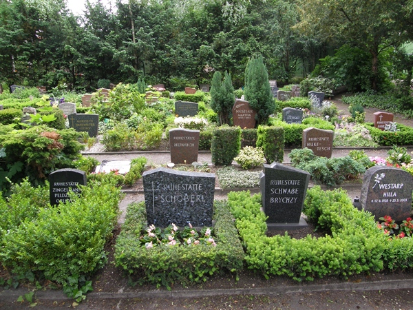
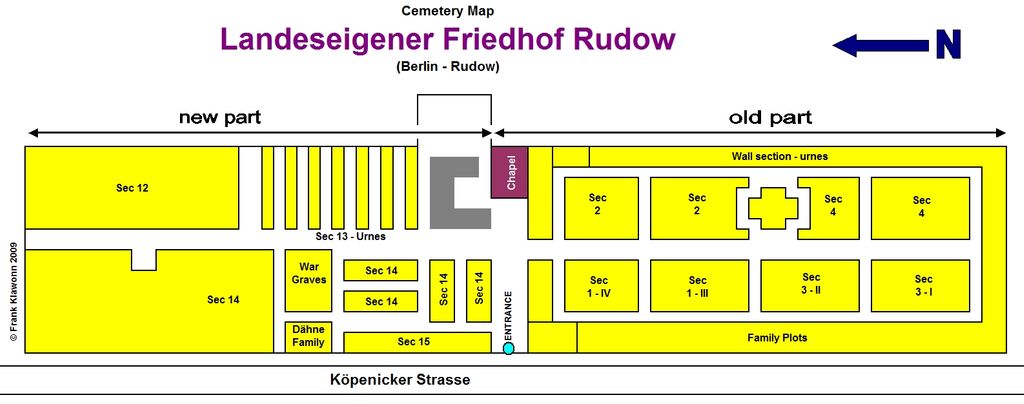
| Description | : | Also known as the Friedhof Rudow, which leads to confusion, because there is another Friedhof in Rudow managed by a Lutheran congregation. Click on MORE PHOTOS to see a map of the cemetery. This city owned and managed cemetery has been in use since 1856. Before 1920 known as the "Alleequartiersfriedhof". It covers an area of 10,634 square meters (2.6 acres). It is non-denominational. The original old part is south of the chapel. The newer part is north. In the middle of the old part is a war memorial, dedicated to the civilian victims of both World Wars. Located in Sec. 14... Read More |
frequently asked questions (FAQ):
-
Where is Friedhof Köpenicker Strasse?
Friedhof Köpenicker Strasse is located at Köpenicker Strasse 131 Rudow, Neukölln ,Berlin , 12355Germany.
-
Friedhof Köpenicker Strasse cemetery's updated grave count on graveviews.com?
0 memorials
-
Where are the coordinates of the Friedhof Köpenicker Strasse?
Latitude: 52.4209061
Longitude: 13.5033989
Nearby Cemetories:
1. Friedhof Ostburger Weg
Rudow, Neukölln, Germany
Coordinate: 52.4108734, 13.5106192
2. Kirchhof Alt-Glienicke
Altglienicke, Treptow-Köpenick, Germany
Coordinate: 52.4211210, 13.5289660
3. Friedhof Altglienicke
Altglienicke, Treptow-Köpenick, Germany
Coordinate: 52.4110760, 13.5274100
4. Friedhof Adlershof
Adlershof, Treptow-Köpenick, Germany
Coordinate: 52.4412560, 13.5466580
5. Alter Friedhof Schönefeld
Schonefeld, Landkreis Dahme-Spreewald, Germany
Coordinate: 52.3872400, 13.5062690
6. Friedhof Schönefeld
Landkreis Dahme-Spreewald, Germany
Coordinate: 52.3847740, 13.5120870
7. Friedhof Bohnsdorf
Bohnsdorf, Treptow-Köpenick, Germany
Coordinate: 52.3998620, 13.5587280
8. Friedhof Baumschulenweg
Baumschulenweg, Treptow-Köpenick, Germany
Coordinate: 52.4608330, 13.4938890
9. Alter Kirchhof Grossziethen
Grossziethen, Landkreis Dahme-Spreewald, Germany
Coordinate: 52.3962975, 13.4482527
10. Neuer Friedhof Grossziethen
Grossziethen, Landkreis Dahme-Spreewald, Germany
Coordinate: 52.3991013, 13.4445515
11. Kriegsgräberanlage Rudower Strasse
Treptow-Köpenick, Germany
Coordinate: 52.4437480, 13.5653580
12. St. Laurentius-Friedhof
Kopenick, Treptow-Köpenick, Germany
Coordinate: 52.4437500, 13.5653600
13. Dorfkirchhof Alt-Buckow
Buckow, Neukölln, Germany
Coordinate: 52.4220110, 13.4310010
14. Friedhof Alt-Buckow
Buckow, Neukölln, Germany
Coordinate: 52.4205025, 13.4309062
15. Waldfriedhof Oberschöneweide
Oberschoneweide, Treptow-Köpenick, Germany
Coordinate: 52.4638000, 13.5335000
16. Parkfriedhof Neukölln
Neukölln, Neukölln, Germany
Coordinate: 52.4301300, 13.4267282
17. Parkfriedhof Neukölln Urnenhain
Neukölln, Neukölln, Germany
Coordinate: 52.4275322, 13.4257011
18. Dorfkirchhof Alt-Britz
Britz, Neukölln, Germany
Coordinate: 52.4479050, 13.4367990
19. Rathaus Köpenick
Treptow-Köpenick, Germany
Coordinate: 52.4457220, 13.5747500
20. Friedhof Britz II
Britz, Neukölln, Germany
Coordinate: 52.4456711, 13.4312687
21. Friedhof Britz I
Britz, Neukölln, Germany
Coordinate: 52.4599953, 13.4460802
22. Kirchhof Wassmannsdorf
Schonefeld, Landkreis Dahme-Spreewald, Germany
Coordinate: 52.3710100, 13.4724170
23. Friedhof Wassmannsdorf
Schonefeld, Landkreis Dahme-Spreewald, Germany
Coordinate: 52.3715324, 13.4651613
24. Waldfriedhof Grünau
Grunau, Treptow-Köpenick, Germany
Coordinate: 52.4072760, 13.5905280