
| Memorials | : | 0 |
| Location | : | Bohnsdorf, Treptow-Köpenick, Germany |
| Coordinate | : | 52.3998620, 13.5587280 |
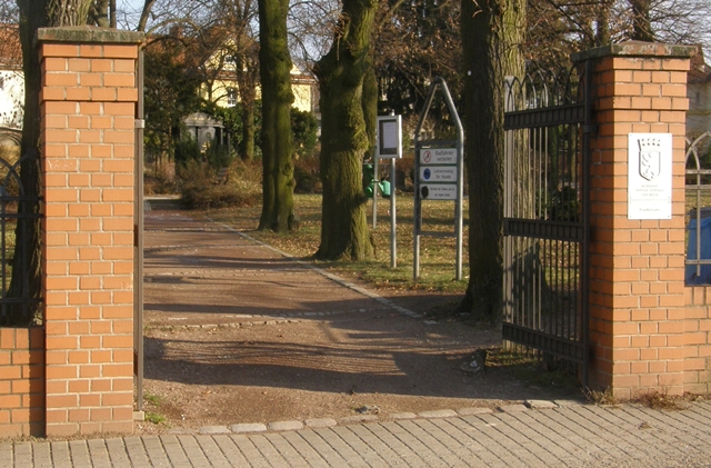
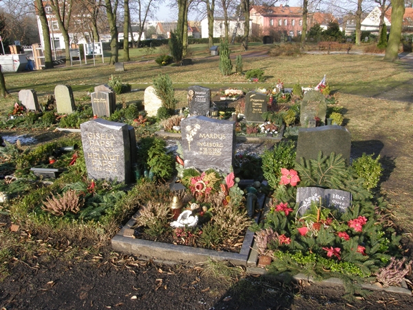
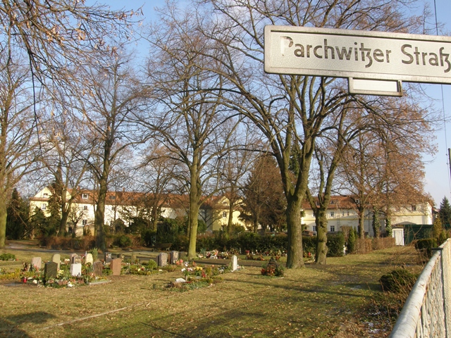
| Description | : | AKAs: Landeseigener Friedhof Bohnsdorf Städtischer Friedhof Bohnsdorf Address: Buntzelstraße 141 12526 Berlin Administration: Landeseigene Friedhöfe Berlin (Treptow-Köpenick) Rinkartstrasse 13 12437 Berlin This small cemetery is still active, just about 5650 square meters large, or 1.4 acres in size. It's non-denominational and run by the city of Berlin, district of Treptow-Köpenick. The names listed were compiled during a walk and census taken in 2008, and from local church documents. The cemetery was established in 1851, in 1980 the city closed the cemetery and had plans to eventually flatten the area and use it for urban development. Enough opposition came from the public so that the cemetery was re-opened in 1990 and... Read More |
frequently asked questions (FAQ):
-
Where is Friedhof Bohnsdorf?
Friedhof Bohnsdorf is located at Buntzelstraße 141 Bohnsdorf, Treptow-Köpenick ,Berlin , 12526Germany.
-
Friedhof Bohnsdorf cemetery's updated grave count on graveviews.com?
0 memorials
-
Where are the coordinates of the Friedhof Bohnsdorf?
Latitude: 52.3998620
Longitude: 13.5587280
Nearby Cemetories:
1. Waldfriedhof Grünau
Grunau, Treptow-Köpenick, Germany
Coordinate: 52.4072760, 13.5905280
2. Friedhof Altglienicke
Altglienicke, Treptow-Köpenick, Germany
Coordinate: 52.4110760, 13.5274100
3. Kirchhof Alt-Glienicke
Altglienicke, Treptow-Köpenick, Germany
Coordinate: 52.4211210, 13.5289660
4. Friedhof Ostburger Weg
Rudow, Neukölln, Germany
Coordinate: 52.4108734, 13.5106192
5. Friedhof Schönefeld
Landkreis Dahme-Spreewald, Germany
Coordinate: 52.3847740, 13.5120870
6. Alter Friedhof Schönefeld
Schonefeld, Landkreis Dahme-Spreewald, Germany
Coordinate: 52.3872400, 13.5062690
7. Friedhof Waltersdorf
Schonefeld, Landkreis Dahme-Spreewald, Germany
Coordinate: 52.3626519, 13.5494779
8. Kirchhof Waltersdorf
Schonefeld, Landkreis Dahme-Spreewald, Germany
Coordinate: 52.3619950, 13.5556590
9. Friedhof Köpenicker Strasse
Rudow, Neukölln, Germany
Coordinate: 52.4209061, 13.5033989
10. Friedhof Adlershof
Adlershof, Treptow-Köpenick, Germany
Coordinate: 52.4412560, 13.5466580
11. Kriegsgräberanlage Rudower Strasse
Treptow-Köpenick, Germany
Coordinate: 52.4437480, 13.5653580
12. St. Laurentius-Friedhof
Kopenick, Treptow-Köpenick, Germany
Coordinate: 52.4437500, 13.5653600
13. Notfriedhof Karolinenhof
Schmockwitz, Treptow-Köpenick, Germany
Coordinate: 52.3854880, 13.6274460
14. Rathaus Köpenick
Treptow-Köpenick, Germany
Coordinate: 52.4457220, 13.5747500
15. Kirchhof Wassmannsdorf
Schonefeld, Landkreis Dahme-Spreewald, Germany
Coordinate: 52.3710100, 13.4724170
16. Kirchhof Schmöckwitz
Schmockwitz, Treptow-Köpenick, Germany
Coordinate: 52.3756390, 13.6497780
17. Christophorus Friedhof
Friedrichshagen, Treptow-Köpenick, Germany
Coordinate: 52.4499290, 13.6186230
18. Friedhof Wassmannsdorf
Schonefeld, Landkreis Dahme-Spreewald, Germany
Coordinate: 52.3715324, 13.4651613
19. Friedhof Zeuthen
Zeuthen, Landkreis Dahme-Spreewald, Germany
Coordinate: 52.3520629, 13.6297516
20. Waldfriedhof Oberschöneweide
Oberschoneweide, Treptow-Köpenick, Germany
Coordinate: 52.4638000, 13.5335000
21. Friedhof Rauchfangswerder
Schmockwitz, Treptow-Köpenick, Germany
Coordinate: 52.3584620, 13.6437320
22. Friedhof Selchow
Schonefeld, Landkreis Dahme-Spreewald, Germany
Coordinate: 52.3571810, 13.4745870
23. Friedhof Rotberg
Rotberg, Landkreis Dahme-Spreewald, Germany
Coordinate: 52.3407569, 13.5066658
24. Kirchhof Selchow
Schonefeld, Landkreis Dahme-Spreewald, Germany
Coordinate: 52.3582210, 13.4725110