
| Memorials | : | 0 |
| Location | : | Altglienicke, Treptow-Köpenick, Germany |
| Coordinate | : | 52.4110760, 13.5274100 |
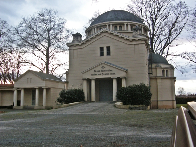
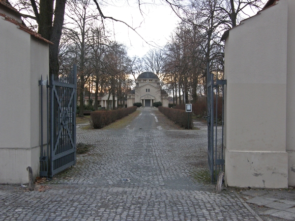
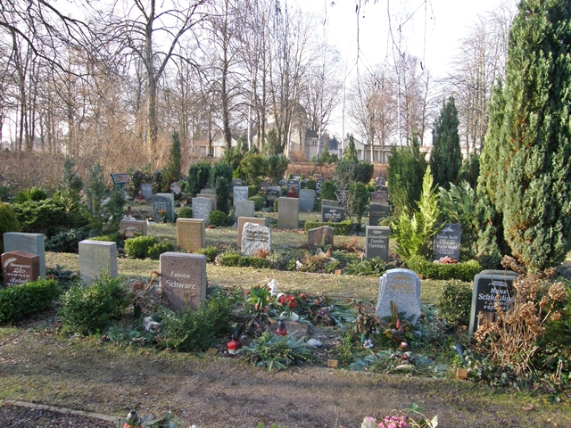
| Description | : | AKA Städtischer Friedhof Altglienicke or Landeseigener Friedhof Berlin-Altglienicke This non-denominational cemetery was opened in the first decade of the 19th century and is owned and run by the city of Berlin ("Landeseigener Friedhof"). It is one of the smaller cemeteries in the district of Treptow-Köpenick in Berlin. It has a size of 23.520 square meters or 5.8 acres. In the back of the cemetery there is a mourner's hall with two wings of larger family plots, which form an almost half circle. Behind this structure there is a memorial field with war graves of both world wars. Most German cemeteries have a period of... Read More |
frequently asked questions (FAQ):
-
Where is Friedhof Altglienicke?
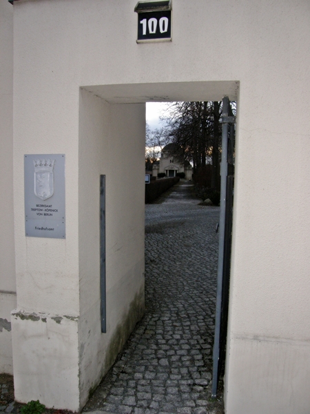
Friedhof Altglienicke is located at Schönefelder Chaussee 100 Altglienicke, Treptow-Köpenick ,Berlin , 12524Germany.
-
Friedhof Altglienicke cemetery's updated grave count on graveviews.com?
0 memorials
-
Where are the coordinates of the Friedhof Altglienicke?
Latitude: 52.4110760
Longitude: 13.5274100
Nearby Cemetories:
1. Kirchhof Alt-Glienicke
Altglienicke, Treptow-Köpenick, Germany
Coordinate: 52.4211210, 13.5289660
2. Friedhof Ostburger Weg
Rudow, Neukölln, Germany
Coordinate: 52.4108734, 13.5106192
3. Friedhof Köpenicker Strasse
Rudow, Neukölln, Germany
Coordinate: 52.4209061, 13.5033989
4. Friedhof Bohnsdorf
Bohnsdorf, Treptow-Köpenick, Germany
Coordinate: 52.3998620, 13.5587280
5. Alter Friedhof Schönefeld
Schonefeld, Landkreis Dahme-Spreewald, Germany
Coordinate: 52.3872400, 13.5062690
6. Friedhof Schönefeld
Landkreis Dahme-Spreewald, Germany
Coordinate: 52.3847740, 13.5120870
7. Friedhof Adlershof
Adlershof, Treptow-Köpenick, Germany
Coordinate: 52.4412560, 13.5466580
8. Waldfriedhof Grünau
Grunau, Treptow-Köpenick, Germany
Coordinate: 52.4072760, 13.5905280
9. Kriegsgräberanlage Rudower Strasse
Treptow-Köpenick, Germany
Coordinate: 52.4437480, 13.5653580
10. St. Laurentius-Friedhof
Kopenick, Treptow-Köpenick, Germany
Coordinate: 52.4437500, 13.5653600
11. Rathaus Köpenick
Treptow-Köpenick, Germany
Coordinate: 52.4457220, 13.5747500
12. Friedhof Waltersdorf
Schonefeld, Landkreis Dahme-Spreewald, Germany
Coordinate: 52.3626519, 13.5494779
13. Alter Kirchhof Grossziethen
Grossziethen, Landkreis Dahme-Spreewald, Germany
Coordinate: 52.3962975, 13.4482527
14. Neuer Friedhof Grossziethen
Grossziethen, Landkreis Dahme-Spreewald, Germany
Coordinate: 52.3991013, 13.4445515
15. Kirchhof Waltersdorf
Schonefeld, Landkreis Dahme-Spreewald, Germany
Coordinate: 52.3619950, 13.5556590
16. Kirchhof Wassmannsdorf
Schonefeld, Landkreis Dahme-Spreewald, Germany
Coordinate: 52.3710100, 13.4724170
17. Waldfriedhof Oberschöneweide
Oberschoneweide, Treptow-Köpenick, Germany
Coordinate: 52.4638000, 13.5335000
18. Friedhof Baumschulenweg
Baumschulenweg, Treptow-Köpenick, Germany
Coordinate: 52.4608330, 13.4938890
19. Friedhof Wassmannsdorf
Schonefeld, Landkreis Dahme-Spreewald, Germany
Coordinate: 52.3715324, 13.4651613
20. Friedhof Alt-Buckow
Buckow, Neukölln, Germany
Coordinate: 52.4205025, 13.4309062
21. Dorfkirchhof Alt-Buckow
Buckow, Neukölln, Germany
Coordinate: 52.4220110, 13.4310010
22. Kirchhof Selchow
Schonefeld, Landkreis Dahme-Spreewald, Germany
Coordinate: 52.3582210, 13.4725110
23. Friedhof Selchow
Schonefeld, Landkreis Dahme-Spreewald, Germany
Coordinate: 52.3571810, 13.4745870
24. Parkfriedhof Neukölln Urnenhain
Neukölln, Neukölln, Germany
Coordinate: 52.4275322, 13.4257011