
| Memorials | : | 0 |
| Location | : | Adel, Metropolitan Borough of Leeds, England |
| Coordinate | : | 53.8494970, -1.6000480 |
| Description | : | Adel is a suburb of North Leeds, West Yorkshire, and is situated near the site of a Roman fort, the ancient road from Tadcaster to Ilkley passing nearby. (The footpath by the side of Long Causeway was said to be made from the original Roman stones, until they were removed by the council in the 1960's).The Roman name for the area was Burgodunum and it is probable that a Saxon village sprang up around the fort and that a church was built in the village. The village is mentioned in the 1086 Domesday Book as Adele. Another spelling used until... Read More |
frequently asked questions (FAQ):
-
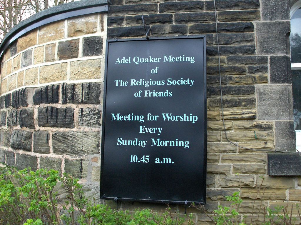
Where is Friends Burial Ground?
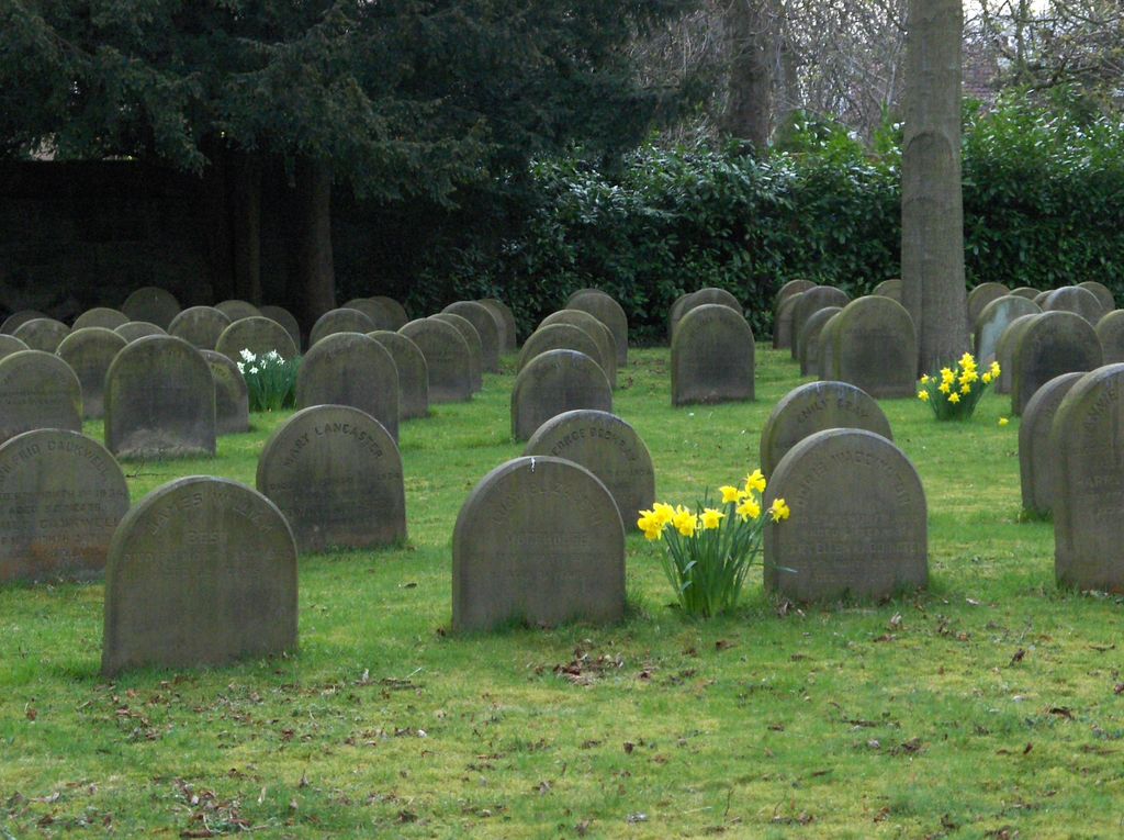
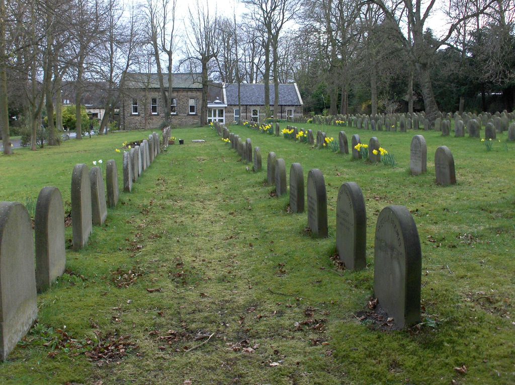
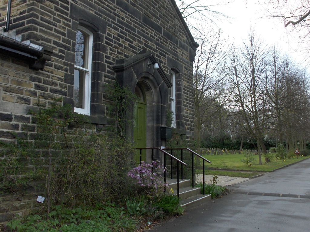
Friends Burial Ground is located at New Adel Lane Adel, Metropolitan Borough of Leeds ,West Yorkshire , LS16 6AZEngland.
-
Friends Burial Ground cemetery's updated grave count on graveviews.com?
0 memorials
-
Where are the coordinates of the Friends Burial Ground?
Latitude: 53.8494970
Longitude: -1.6000480
Nearby Cemetories:
1. Lawnswood Cemetery and Crematorium
Adel, Metropolitan Borough of Leeds, England
Coordinate: 53.8469310, -1.5931250
2. St. John the Baptist Churchyard
Adel, Metropolitan Borough of Leeds, England
Coordinate: 53.8577950, -1.5837140
3. St James Woodside Churchyard
Horsforth, Metropolitan Borough of Leeds, England
Coordinate: 53.8405990, -1.6252410
4. St Chads Churchyard
Headingley, Metropolitan Borough of Leeds, England
Coordinate: 53.8279390, -1.5867090
5. Far Headingley War Memorial
Headingley, Metropolitan Borough of Leeds, England
Coordinate: 53.8277860, -1.5835480
6. Cragg Hill Baptist Chapelyard
Horsforth, Metropolitan Borough of Leeds, England
Coordinate: 53.8333600, -1.6349900
7. Holy Trinity Churchyard
Meanwood, Metropolitan Borough of Leeds, England
Coordinate: 53.8312630, -1.5665280
8. St Margaret's Burial Ground
Horsforth, Metropolitan Borough of Leeds, England
Coordinate: 53.8376300, -1.6428400
9. Horsforth Peace Gardens
Horsforth, Metropolitan Borough of Leeds, England
Coordinate: 53.8364395, -1.6430796
10. St. Stephen's Churchyard
Kirkstall, Metropolitan Borough of Leeds, England
Coordinate: 53.8180960, -1.5990780
11. Bramhope Cemetery
Bramhope, Metropolitan Borough of Leeds, England
Coordinate: 53.8779000, -1.6242700
12. St Michael and All Angels Churchyard
Headingley, Metropolitan Borough of Leeds, England
Coordinate: 53.8191970, -1.5764670
13. Horsforth Cemetery
Horsforth, Metropolitan Borough of Leeds, England
Coordinate: 53.8334500, -1.6516100
14. St John the Evangelist Churchyard
Moortown, Metropolitan Borough of Leeds, England
Coordinate: 53.8494900, -1.5356800
15. Rawdon Crematorium
Rawdon, Metropolitan Borough of Leeds, England
Coordinate: 53.8401170, -1.6628580
16. Moor Allerton War Memorial
Moortown, Metropolitan Borough of Leeds, England
Coordinate: 53.8487160, -1.5346230
17. St. Peter's Churchyard
Rawdon, Metropolitan Borough of Leeds, England
Coordinate: 53.8486800, -1.6658000
18. St Giles Churchyard
Bramhope, Metropolitan Borough of Leeds, England
Coordinate: 53.8865500, -1.6226490
19. Puritan Chapelyard
Bramhope, Metropolitan Borough of Leeds, England
Coordinate: 53.8878420, -1.6227120
20. St Peter Churchyard
Bramley, Metropolitan Borough of Leeds, England
Coordinate: 53.8110770, -1.6295020
21. Chapel Allerton War Memorial
Leeds, Metropolitan Borough of Leeds, England
Coordinate: 53.8284200, -1.5375400
22. St. Matthew's Old Churchyard
Chapel Allerton, Metropolitan Borough of Leeds, England
Coordinate: 53.8281400, -1.5364600
23. Bramley Baptist Churchyard
Bramley, Metropolitan Borough of Leeds, England
Coordinate: 53.8100700, -1.6310800
24. Greenhill Wesleyan Methodist Chapelyard
Rawdon, Metropolitan Borough of Leeds, England
Coordinate: 53.8503020, -1.6771360