
| Memorials | : | 0 |
| Location | : | Horsforth, Metropolitan Borough of Leeds, England |
| Coordinate | : | 53.8333600, -1.6349900 |
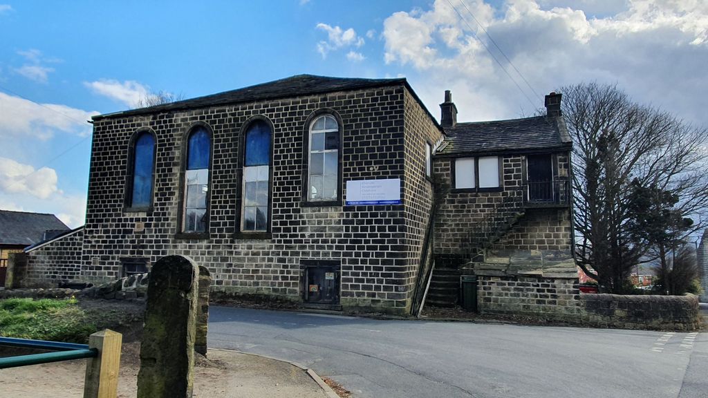
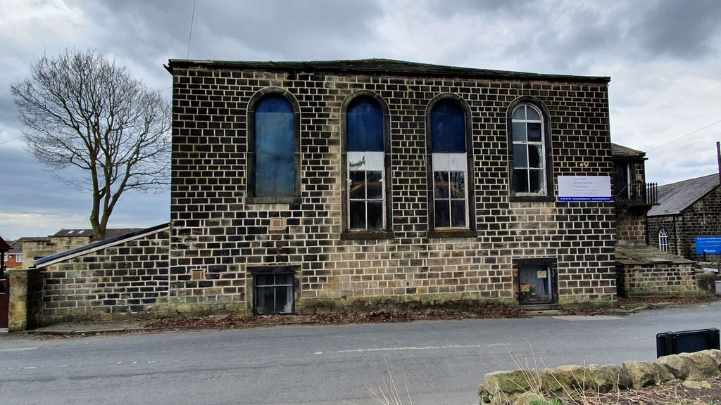
| Description | : | The chapel, with a seating capacity for about 250 persons, was opened for public worship in June 1803. The first person was buried in 1809; the last in 1951 when the burial ground was closed. The chapel building was sold and is now used as a nursery. The Cragg Hill Baptist congregation still uses original Sunday School across the street. |
frequently asked questions (FAQ):
-
Where is Cragg Hill Baptist Chapelyard?
Cragg Hill Baptist Chapelyard is located at Cragg Hill Horsforth, Metropolitan Borough of Leeds ,West Yorkshire , LS18 4NUEngland.
-
Cragg Hill Baptist Chapelyard cemetery's updated grave count on graveviews.com?
0 memorials
-
Where are the coordinates of the Cragg Hill Baptist Chapelyard?
Latitude: 53.8333600
Longitude: -1.6349900
Nearby Cemetories:
1. Horsforth Peace Gardens
Horsforth, Metropolitan Borough of Leeds, England
Coordinate: 53.8364395, -1.6430796
2. St Margaret's Burial Ground
Horsforth, Metropolitan Borough of Leeds, England
Coordinate: 53.8376300, -1.6428400
3. St James Woodside Churchyard
Horsforth, Metropolitan Borough of Leeds, England
Coordinate: 53.8405990, -1.6252410
4. Horsforth Cemetery
Horsforth, Metropolitan Borough of Leeds, England
Coordinate: 53.8334500, -1.6516100
5. Rawdon Crematorium
Rawdon, Metropolitan Borough of Leeds, England
Coordinate: 53.8401170, -1.6628580
6. St Peter Churchyard
Bramley, Metropolitan Borough of Leeds, England
Coordinate: 53.8110770, -1.6295020
7. Bramley Baptist Churchyard
Bramley, Metropolitan Borough of Leeds, England
Coordinate: 53.8100700, -1.6310800
8. Rehoboth Baptist Burial Ground
Farsley, Metropolitan Borough of Leeds, England
Coordinate: 53.8160750, -1.6622590
9. St. Peter's Churchyard
Rawdon, Metropolitan Borough of Leeds, England
Coordinate: 53.8486800, -1.6658000
10. St. Stephen's Churchyard
Kirkstall, Metropolitan Borough of Leeds, England
Coordinate: 53.8180960, -1.5990780
11. Friends Burial Ground
Adel, Metropolitan Borough of Leeds, England
Coordinate: 53.8494970, -1.6000480
12. Lawnswood Cemetery and Crematorium
Adel, Metropolitan Borough of Leeds, England
Coordinate: 53.8469310, -1.5931250
13. St. Thomas' Churchyard
Stanningley, Metropolitan Borough of Leeds, England
Coordinate: 53.8077200, -1.6562500
14. St Chads Churchyard
Headingley, Metropolitan Borough of Leeds, England
Coordinate: 53.8279390, -1.5867090
15. St. Wilfrid Churchyard
Calverley, Metropolitan Borough of Leeds, England
Coordinate: 53.8303600, -1.6849920
16. Greenhill Wesleyan Methodist Chapelyard
Rawdon, Metropolitan Borough of Leeds, England
Coordinate: 53.8503020, -1.6771360
17. Far Headingley War Memorial
Headingley, Metropolitan Borough of Leeds, England
Coordinate: 53.8277860, -1.5835480
18. St. John the Evangelist Churchyard
Farsley, Metropolitan Borough of Leeds, England
Coordinate: 53.8109500, -1.6720100
19. Armley Hill Top Cemetery
Leeds, Metropolitan Borough of Leeds, England
Coordinate: 53.8020600, -1.6128900
20. St Paul Churchyard
Stanningley, Metropolitan Borough of Leeds, England
Coordinate: 53.8043000, -1.6650200
21. Cragg Wood Baptist Burial Ground
Rawdon, Metropolitan Borough of Leeds, England
Coordinate: 53.8453830, -1.6898020
22. St Michael and All Angels Churchyard
Headingley, Metropolitan Borough of Leeds, England
Coordinate: 53.8191970, -1.5764670
23. Friends Burial Ground
Rawdon, Metropolitan Borough of Leeds, England
Coordinate: 53.8562540, -1.6856120
24. Cragg Baptist Chapelyard
Rawdon, Metropolitan Borough of Leeds, England
Coordinate: 53.8517260, -1.6919510