
| Memorials | : | 0 |
| Location | : | Horsforth, Metropolitan Borough of Leeds, England |
| Coordinate | : | 53.8334500, -1.6516100 |
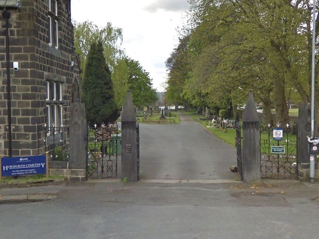
| Description | : | Location Information This is between the Ilkley - Leeds road and Calverley railway station It was opened in 1881, and now belongs to the Urban District Council. |
frequently asked questions (FAQ):
-
Where is Horsforth Cemetery?
Horsforth Cemetery is located at Horsforth, Metropolitan Borough of Leeds ,West Yorkshire ,England.
-
Horsforth Cemetery cemetery's updated grave count on graveviews.com?
0 memorials
-
Where are the coordinates of the Horsforth Cemetery?
Latitude: 53.8334500
Longitude: -1.6516100
Nearby Cemetories:
1. Horsforth Peace Gardens
Horsforth, Metropolitan Borough of Leeds, England
Coordinate: 53.8364395, -1.6430796
2. St Margaret's Burial Ground
Horsforth, Metropolitan Borough of Leeds, England
Coordinate: 53.8376300, -1.6428400
3. Rawdon Crematorium
Rawdon, Metropolitan Borough of Leeds, England
Coordinate: 53.8401170, -1.6628580
4. Cragg Hill Baptist Chapelyard
Horsforth, Metropolitan Borough of Leeds, England
Coordinate: 53.8333600, -1.6349900
5. St James Woodside Churchyard
Horsforth, Metropolitan Borough of Leeds, England
Coordinate: 53.8405990, -1.6252410
6. St. Peter's Churchyard
Rawdon, Metropolitan Borough of Leeds, England
Coordinate: 53.8486800, -1.6658000
7. Rehoboth Baptist Burial Ground
Farsley, Metropolitan Borough of Leeds, England
Coordinate: 53.8160750, -1.6622590
8. St. Wilfrid Churchyard
Calverley, Metropolitan Borough of Leeds, England
Coordinate: 53.8303600, -1.6849920
9. Greenhill Wesleyan Methodist Chapelyard
Rawdon, Metropolitan Borough of Leeds, England
Coordinate: 53.8503020, -1.6771360
10. Cragg Wood Baptist Burial Ground
Rawdon, Metropolitan Borough of Leeds, England
Coordinate: 53.8453830, -1.6898020
11. St. John the Evangelist Churchyard
Farsley, Metropolitan Borough of Leeds, England
Coordinate: 53.8109500, -1.6720100
12. St. Thomas' Churchyard
Stanningley, Metropolitan Borough of Leeds, England
Coordinate: 53.8077200, -1.6562500
13. St Peter Churchyard
Bramley, Metropolitan Borough of Leeds, England
Coordinate: 53.8110770, -1.6295020
14. Bramley Baptist Churchyard
Bramley, Metropolitan Borough of Leeds, England
Coordinate: 53.8100700, -1.6310800
15. Cragg Baptist Chapelyard
Rawdon, Metropolitan Borough of Leeds, England
Coordinate: 53.8517260, -1.6919510
16. St Paul Churchyard
Stanningley, Metropolitan Borough of Leeds, England
Coordinate: 53.8043000, -1.6650200
17. Friends Burial Ground
Rawdon, Metropolitan Borough of Leeds, England
Coordinate: 53.8562540, -1.6856120
18. Benton Park Congregational Chapelyard
Rawdon, Metropolitan Borough of Leeds, England
Coordinate: 53.8576300, -1.6881400
19. Friends Burial Ground
Adel, Metropolitan Borough of Leeds, England
Coordinate: 53.8494970, -1.6000480
20. St. Stephen's Churchyard
Kirkstall, Metropolitan Borough of Leeds, England
Coordinate: 53.8180960, -1.5990780
21. St John the Evangelist Churchyard
Yeadon, Metropolitan Borough of Leeds, England
Coordinate: 53.8610120, -1.6908590
22. Lawnswood Cemetery and Crematorium
Adel, Metropolitan Borough of Leeds, England
Coordinate: 53.8469310, -1.5931250
23. Pudsey Cemetery
Pudsey, Metropolitan Borough of Leeds, England
Coordinate: 53.7975970, -1.6679480
24. Wesleyan Burial Ground
Yeadon, Metropolitan Borough of Leeds, England
Coordinate: 53.8655770, -1.6852220