
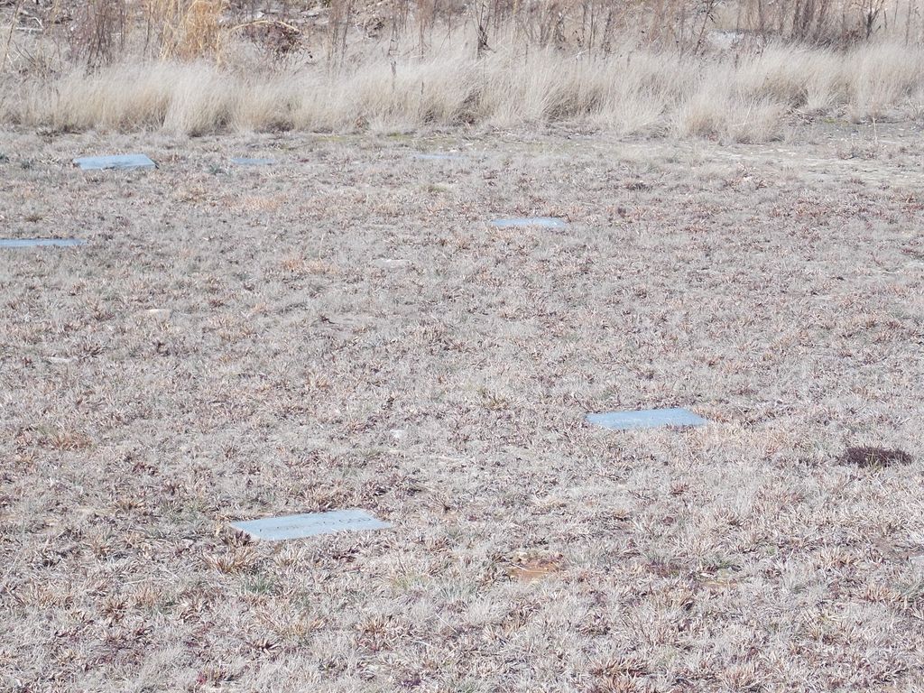
| Memorials | : | 1 |
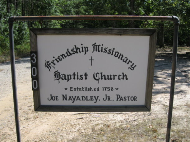
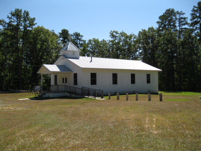
| Location | : | Carthage, Moore County, USA |
| Coordinate | : | 35.4245660, -79.4727640 |
frequently asked questions (FAQ):
-
Where is Friendship Baptist Church Cemetery?
Friendship Baptist Church Cemetery is located at Friendship Church Road Carthage, Moore County ,North Carolina , 28327USA.
-
Friendship Baptist Church Cemetery cemetery's updated grave count on graveviews.com?
0 memorials
-
Where are the coordinates of the Friendship Baptist Church Cemetery?
Latitude: 35.4245660
Longitude: -79.4727640
Nearby Cemetories:
1. Putnam Friends Church Cemetery
Carthage, Moore County, USA
Coordinate: 35.4430860, -79.4723730
2. Pleasant Hill Freewill Baptist Church Cemetery
Carthage, Moore County, USA
Coordinate: 35.4067770, -79.4425240
3. Chestley Horner Grave Marker
Robbins, Moore County, USA
Coordinate: 35.3925143, -79.5013028
4. Calvary Baptist Church Cemetery
Carthage, Moore County, USA
Coordinate: 35.3935980, -79.5044520
5. Ike Wallace Gravesite
Robbins, Moore County, USA
Coordinate: 35.4062281, -79.5196652
6. Cool Springs Methodist Church Cemetery
Carthage, Moore County, USA
Coordinate: 35.4679260, -79.4444680
7. Old Cool Springs Methodist Church Cemetery
Glendon, Moore County, USA
Coordinate: 35.4682070, -79.4438800
8. Davis Family Cemetery
Robbins, Moore County, USA
Coordinate: 35.3798600, -79.4992600
9. Cockman Cemetery
Robbins, Moore County, USA
Coordinate: 35.4133060, -79.5326550
10. Melton-Muse Family Cemetery
Robbins, Moore County, USA
Coordinate: 35.3974497, -79.5280123
11. Thomas J. Williams Cemetery
Robbins, Moore County, USA
Coordinate: 35.4233030, -79.5486440
12. High Falls United Methodist Church Cemetery
High Falls, Moore County, USA
Coordinate: 35.4803650, -79.5172570
13. Glendon Independent Christian Church Cemetery
Glendon, Moore County, USA
Coordinate: 35.4795950, -79.4232370
14. Bellview AME Zion Church Cemetery
Robbins, Moore County, USA
Coordinate: 35.4397130, -79.5546770
15. Sampson Delaney Wallace Gravesite
Robbins, Moore County, USA
Coordinate: 35.3908535, -79.5469594
16. Flint Hill Baptist Church Cemetery
Robbins, Moore County, USA
Coordinate: 35.4053500, -79.5564300
17. Prosperity Friends Meeting Cemetery
High Falls, Moore County, USA
Coordinate: 35.4941040, -79.4942180
18. Saint Johns Holy Church of God Cemetery
Carthage, Moore County, USA
Coordinate: 35.3574510, -79.4405290
19. Mount Olive AME Zion Church Cemetery
Carthage, Moore County, USA
Coordinate: 35.3567530, -79.4424460
20. Bethlehem Baptist Church Cemetery
Carthage, Moore County, USA
Coordinate: 35.3525150, -79.4856250
21. High Falls Friends Church Cemetery
High Falls, Moore County, USA
Coordinate: 35.4872330, -79.5211110
22. Muse-Glascock Family Cemetery
Carthage, Moore County, USA
Coordinate: 35.3575211, -79.4321289
23. Street Family Burying Ground-Street Plantation
Glendon, Moore County, USA
Coordinate: 35.4644900, -79.3948500
24. First Missionary Baptist Church Cemetery
Carthage, Moore County, USA
Coordinate: 35.3654450, -79.4160830