
| Memorials | : | 0 |
| Location | : | Garlock, Kern County, USA |
| Coordinate | : | 35.4233300, -117.7566600 |
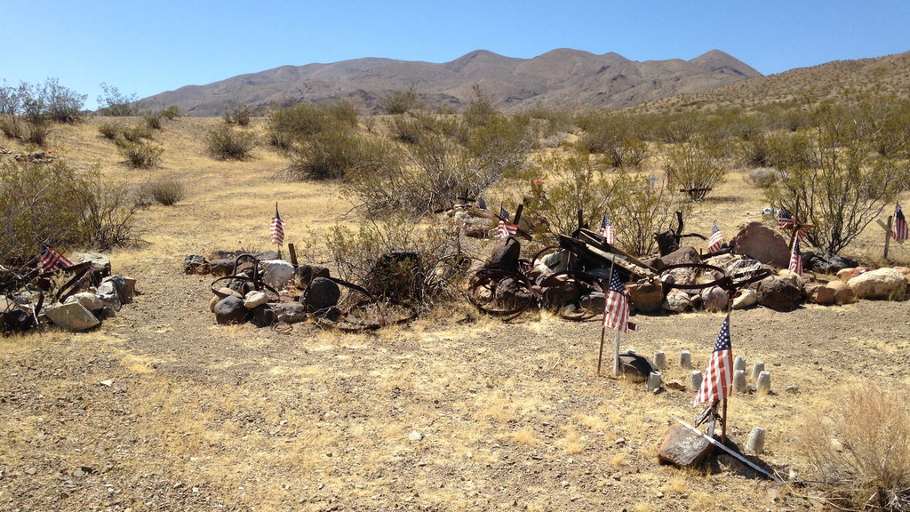
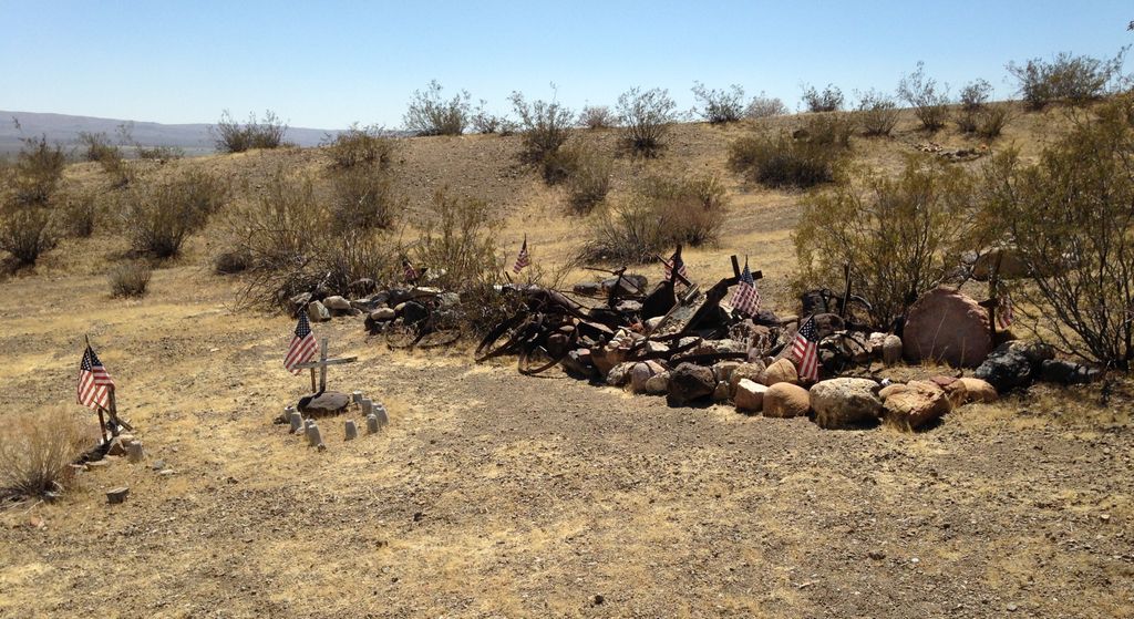
| Description | : | ____________________ Benson Canyon Cemetery also known as Goler Cemetery or Garlock Goler Cemetery or Goler Mine Cemetery is on Benson Canyon Road, near Ransburg, off off Garlock Road. As of 2010 there are no older memorial markers visable. A few modern but homemade markers indicate there may be some current burials or cremation ashes placed here in recent years. The Daily Californian December 28, 1894 states: "The Goler Mines. At Goler about 150 people are at work, with varied fortunes. It is said that about 100 of these are barely making a living while the other 50 are making money, some... Read More |
frequently asked questions (FAQ):
-
Where is Garlock-Goler Cemetery?
Garlock-Goler Cemetery is located at Garlock, Kern County ,California ,USA.
-
Garlock-Goler Cemetery cemetery's updated grave count on graveviews.com?
0 memorials
-
Where are the coordinates of the Garlock-Goler Cemetery?
Latitude: 35.4233300
Longitude: -117.7566600
Nearby Cemetories:
1. Roger McGavin Gravesite
Johannesburg, Kern County, USA
Coordinate: 35.4460880, -117.6508070
2. Rand District Cemetery
Johannesburg, Kern County, USA
Coordinate: 35.3678280, -117.6399730
3. Desert Memorial Park
Ridgecrest, Kern County, USA
Coordinate: 35.6117600, -117.6345400
4. Josie Bishop Mining Claims and Grave Site
Cantil, Kern County, USA
Coordinate: 35.3803940, -118.0518260
5. California City Memorial Park
California City, Kern County, USA
Coordinate: 35.1384080, -117.9275040
6. Mount Owens Cemetery
Kern County, USA
Coordinate: 35.7331009, -117.9227982
7. Kelso Cemetery
Weldon, Kern County, USA
Coordinate: 35.5255200, -118.2148500
8. Argus Cemetery
Argus, San Bernardino County, USA
Coordinate: 35.7434050, -117.3996480
9. Kramer Cemetery
San Bernardino County, USA
Coordinate: 34.9956017, -117.5802994
10. Cottage Grove Cemetery
Onyx, Kern County, USA
Coordinate: 35.6960983, -118.2097015
11. Onyx Indian Cemetery
Onyx, Kern County, USA
Coordinate: 35.6797470, -118.2271330
12. Searles Valley Cemetery
Trona, San Bernardino County, USA
Coordinate: 35.7737503, -117.3817520
13. Mojave Cemetery
Mojave, Kern County, USA
Coordinate: 35.0550117, -118.1694565
14. Pauls Place Cemetery
Kern County, USA
Coordinate: 35.6565900, -118.3188700
15. Trier-Pfalzel
Pfalzel, Stadtkreis Trier, Germany
Coordinate: 34.9245895, -117.9339504
16. Little Lake Cemetery
Little Lake, Inyo County, USA
Coordinate: 35.9370150, -117.9079410
17. Mountain Springs Cemetery
Little Lake, Inyo County, USA
Coordinate: 35.9384700, -117.5967100
18. Sand Canyon Cemetery
Tehachapi, Kern County, USA
Coordinate: 35.1331320, -118.3150210
19. Paris-Loraine Cemetery
Loraine, Kern County, USA
Coordinate: 35.3059000, -118.4355000
20. Williams Burial Site
Walker Basin, Kern County, USA
Coordinate: 35.4320950, -118.4815680
21. Bruce Canyon Burial Site
Valley Wells, Inyo County, USA
Coordinate: 35.9285200, -117.3749000
22. Tehachapi Eastside Cemetery
Tehachapi, Kern County, USA
Coordinate: 35.1329000, -118.4153200
23. James Foley Gravesite
Tehachapi, Kern County, USA
Coordinate: 35.0509590, -118.3561170
24. Buhn Ranch Cemetery
Tehachapi, Kern County, USA
Coordinate: 35.1352210, -118.4319290