
| Memorials | : | 0 |
| Location | : | Cantil, Kern County, USA |
| Coordinate | : | 35.3803940, -118.0518260 |
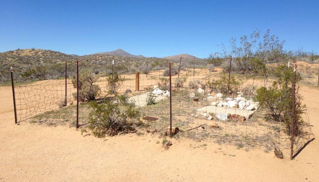
| Description | : | The California State Historical Resources Commission, Department of Parks and Recreation approved the JOSIE BISHOP MINING CLAIM AND GRAVE SITE as California Point of Historical Interest KER-010 on November 4, 1994. The Bishop family was notified by a letter dated March 28, 1995 and signed by Sandra J. Elder, Assistant Executive Secretary. |
frequently asked questions (FAQ):
-
Where is Josie Bishop Mining Claims and Grave Site?
Josie Bishop Mining Claims and Grave Site is located at Cantil, Kern County ,California ,USA.
-
Josie Bishop Mining Claims and Grave Site cemetery's updated grave count on graveviews.com?
0 memorials
-
Where are the coordinates of the Josie Bishop Mining Claims and Grave Site?
Latitude: 35.3803940
Longitude: -118.0518260
Nearby Cemetories:
1. Kelso Cemetery
Weldon, Kern County, USA
Coordinate: 35.5255200, -118.2148500
2. Garlock-Goler Cemetery
Garlock, Kern County, USA
Coordinate: 35.4233300, -117.7566600
3. California City Memorial Park
California City, Kern County, USA
Coordinate: 35.1384080, -117.9275040
4. Paris-Loraine Cemetery
Loraine, Kern County, USA
Coordinate: 35.3059000, -118.4355000
5. Sand Canyon Cemetery
Tehachapi, Kern County, USA
Coordinate: 35.1331320, -118.3150210
6. Onyx Indian Cemetery
Onyx, Kern County, USA
Coordinate: 35.6797470, -118.2271330
7. Roger McGavin Gravesite
Johannesburg, Kern County, USA
Coordinate: 35.4460880, -117.6508070
8. Rand District Cemetery
Johannesburg, Kern County, USA
Coordinate: 35.3678280, -117.6399730
9. Mojave Cemetery
Mojave, Kern County, USA
Coordinate: 35.0550117, -118.1694565
10. Cottage Grove Cemetery
Onyx, Kern County, USA
Coordinate: 35.6960983, -118.2097015
11. Pauls Place Cemetery
Kern County, USA
Coordinate: 35.6565900, -118.3188700
12. Williams Burial Site
Walker Basin, Kern County, USA
Coordinate: 35.4320950, -118.4815680
13. Mount Owens Cemetery
Kern County, USA
Coordinate: 35.7331009, -117.9227982
14. Tehachapi Eastside Cemetery
Tehachapi, Kern County, USA
Coordinate: 35.1329000, -118.4153200
15. Buhn Ranch Cemetery
Tehachapi, Kern County, USA
Coordinate: 35.1352210, -118.4319290
16. Rankin Cemetery
Walker Basin, Kern County, USA
Coordinate: 35.3844560, -118.5388890
17. Saint Joseph Cemetery
Havilah, Kern County, USA
Coordinate: 35.5147500, -118.5177700
18. Desert Memorial Park
Ridgecrest, Kern County, USA
Coordinate: 35.6117600, -117.6345400
19. James Foley Gravesite
Tehachapi, Kern County, USA
Coordinate: 35.0509590, -118.3561170
20. Tehachapi Westside Cemetery
Tehachapi, Kern County, USA
Coordinate: 35.1387400, -118.4633600
21. Old Tehachapi Cemetery
Tehachapi, Kern County, USA
Coordinate: 35.1400990, -118.4795570
22. Palmer Family Cemetery
Bodfish, Kern County, USA
Coordinate: 35.6087200, -118.4908600
23. Cesar E. Chavez National Monument
Keene, Kern County, USA
Coordinate: 35.2236000, -118.5592400
24. Keyesville Cemetery
Keyesville, Kern County, USA
Coordinate: 35.6252690, -118.5066220