
| Memorials | : | 0 |
| Location | : | Wrightsville, Johnson County, USA |
| Coordinate | : | 32.6951870, -82.6303580 |
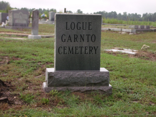
| Description | : | The GARNTO CEMETERY is located about five miles east of Wrightsville on Highway 57. Turn right (south) at the Moore's Chapel Church onto Sa Attaway Road. Bear right on Truitt Poole Road and the cemetery is about a mile south of the church on the left. |
frequently asked questions (FAQ):
-
Where is Garnto Cemetery?
Garnto Cemetery is located at Wrightsville, Johnson County ,Georgia ,USA.
-
Garnto Cemetery cemetery's updated grave count on graveviews.com?
0 memorials
-
Where are the coordinates of the Garnto Cemetery?
Latitude: 32.6951870
Longitude: -82.6303580
Nearby Cemetories:
1. Union Hill Baptist Church Cemetery
Johnson County, USA
Coordinate: 32.7271400, -82.6405760
2. Sand Hill Missionary Baptist Church Cemetery
Kite, Johnson County, USA
Coordinate: 32.7283270, -82.6221200
3. Liberty Grove Cemetery
Johnson County, USA
Coordinate: 32.6588510, -82.6493950
4. Snell Cemetery
Meeks, Johnson County, USA
Coordinate: 32.6547012, -82.6355972
5. Cypress Grove Church Cemetery
Wrightsville, Johnson County, USA
Coordinate: 32.7188900, -82.6741700
6. Rehoboth Baptist Church Cemetery
Johnson County, USA
Coordinate: 32.6933190, -82.5769750
7. Kent-Dixon-Rowland Family Cemetery
Johnson County, USA
Coordinate: 32.7353940, -82.6752480
8. Anderson Cemetery
Kite, Johnson County, USA
Coordinate: 32.6775017, -82.5639038
9. Harriett Carter Cemetery
Wrightsville, Johnson County, USA
Coordinate: 32.6549750, -82.6830800
10. Stephens
Kite, Johnson County, USA
Coordinate: 32.6984800, -82.5578800
11. Saint Paul Cemetery
Kite, Johnson County, USA
Coordinate: 32.6976400, -82.5577110
12. Community Missionary Baptist Church Cemetery
Wrightsville, Johnson County, USA
Coordinate: 32.7030550, -82.7140480
13. Providence-Pullen Cemetery
Meeks, Johnson County, USA
Coordinate: 32.6278300, -82.5997800
14. Fortner Cemetery
Kite, Johnson County, USA
Coordinate: 32.7069016, -82.5456009
15. Sumner-Anthony Cemetery
Wrightsville, Johnson County, USA
Coordinate: 32.7034264, -82.7170105
16. Meeks Cemetery
Johnson County, USA
Coordinate: 32.6296997, -82.5828018
17. Kersey Family Cemetery
Kite, Johnson County, USA
Coordinate: 32.6751621, -82.5417982
18. New Home Missionary Baptist Church Cemetery
Wrightsville, Johnson County, USA
Coordinate: 32.7636700, -82.5838150
19. Abattoir Cemetery
Wrightsville, Johnson County, USA
Coordinate: 32.7341700, -82.7157100
20. Home Circle Cemetery
Wrightsville, Johnson County, USA
Coordinate: 32.7358670, -82.7164980
21. Piney Mount Cemetery
Wrightsville, Johnson County, USA
Coordinate: 32.6459300, -82.7100340
22. John W Harrison Cemetery
Wrightsville, Johnson County, USA
Coordinate: 32.7587340, -82.5658560
23. Galilee Church Cemetery
Wrightsville, Johnson County, USA
Coordinate: 32.7059010, -82.7299100
24. Pinehill Holiness Church Cemetery
Wrightsville, Johnson County, USA
Coordinate: 32.6665800, -82.7313620