
| Memorials | : | 0 |
| Location | : | Wrightsville, Johnson County, USA |
| Coordinate | : | 32.7341700, -82.7157100 |
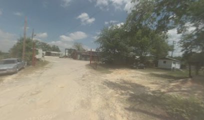
| Description | : | This cemetery is now referred to as "Abattoir Cemetery" -- it is not known what the original name of the cemetery was or how old it is. The graves here have no names or dates on them. "Searching for our Ancestors Among the Gravestones", compiled 1998-99 by the Johnson County Historical Society, states the following: LOCATION: The Abattoir Cemetery is located in Wrightsville city limits directly behind McAfee Packing Company. HISTORY: Many people have asked about the three unmarked graves behind the abattoir. There is no information concerning the identity of the graves. There are two adults and one child. The... Read More |
frequently asked questions (FAQ):
-
Where is Abattoir Cemetery?
Abattoir Cemetery is located at Wrightsville, Johnson County ,Georgia ,USA.
-
Abattoir Cemetery cemetery's updated grave count on graveviews.com?
0 memorials
-
Where are the coordinates of the Abattoir Cemetery?
Latitude: 32.7341700
Longitude: -82.7157100
Nearby Cemetories:
1. Home Circle Cemetery
Wrightsville, Johnson County, USA
Coordinate: 32.7358670, -82.7164980
2. West View Cemetery
Wrightsville, Johnson County, USA
Coordinate: 32.7310982, -82.7319031
3. Galilee Church Cemetery
Wrightsville, Johnson County, USA
Coordinate: 32.7059010, -82.7299100
4. Sumner-Anthony Cemetery
Wrightsville, Johnson County, USA
Coordinate: 32.7034264, -82.7170105
5. Community Missionary Baptist Church Cemetery
Wrightsville, Johnson County, USA
Coordinate: 32.7030550, -82.7140480
6. Kent-Dixon-Rowland Family Cemetery
Johnson County, USA
Coordinate: 32.7353940, -82.6752480
7. Pine Grove AME Church Cemetery
Donovan, Johnson County, USA
Coordinate: 32.7698610, -82.7221440
8. Cypress Grove Church Cemetery
Wrightsville, Johnson County, USA
Coordinate: 32.7188900, -82.6741700
9. Vickers Hill Baptist Church Cemetery
Wrightsville, Johnson County, USA
Coordinate: 32.7509940, -82.7570824
10. Price Parker Cemetery
Wrightsville, Johnson County, USA
Coordinate: 32.7486200, -82.7710400
11. John M. Raines Cemetery
Wrightsville, Johnson County, USA
Coordinate: 32.7416590, -82.7732390
12. Beulah Baptist Church Cemetery
Johnson County, USA
Coordinate: 32.7794820, -82.6910540
13. Maddux Cemetery
Wrightsville, Johnson County, USA
Coordinate: 32.7242610, -82.7768500
14. Lovett Grove Community Baptist Church Cemetery
Wrightsville, Johnson County, USA
Coordinate: 32.6800750, -82.7399620
15. McAfee Family Cemetery
Johnson County, USA
Coordinate: 32.7463270, -82.7838510
16. Brantley Chapel Church Cemetery
Wrightsville, Johnson County, USA
Coordinate: 32.6779300, -82.7384700
17. U. R. Jenkins Cemetery
Wrightsville, Johnson County, USA
Coordinate: 32.7667780, -82.7777660
18. Mitchell Grove Baptist Church Cemetery
Wrightsville, Johnson County, USA
Coordinate: 32.6987990, -82.7770830
19. Union Hill Baptist Church Cemetery
Johnson County, USA
Coordinate: 32.7271400, -82.6405760
20. Pinehill Holiness Church Cemetery
Wrightsville, Johnson County, USA
Coordinate: 32.6665800, -82.7313620
21. Pleasant Grove Baptist Church Cemetery
Wrightsville, Johnson County, USA
Coordinate: 32.6900690, -82.7841220
22. Price-Knight Cemetery
Johnson County, USA
Coordinate: 32.7602220, -82.7970040
23. Williams Cemetery
Johnson County, USA
Coordinate: 32.7024994, -82.7966995
24. Sand Hill Missionary Baptist Church Cemetery
Kite, Johnson County, USA
Coordinate: 32.7283270, -82.6221200