
| Memorials | : | 0 |
| Location | : | Arnheim, Brown County, USA |
| Coordinate | : | 38.9311066, -83.8263702 |
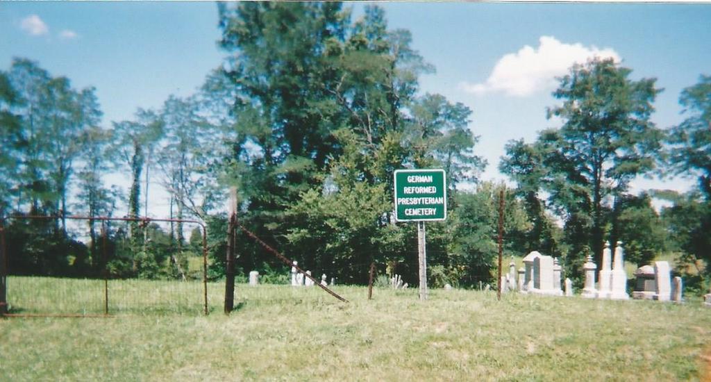
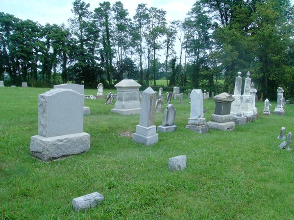
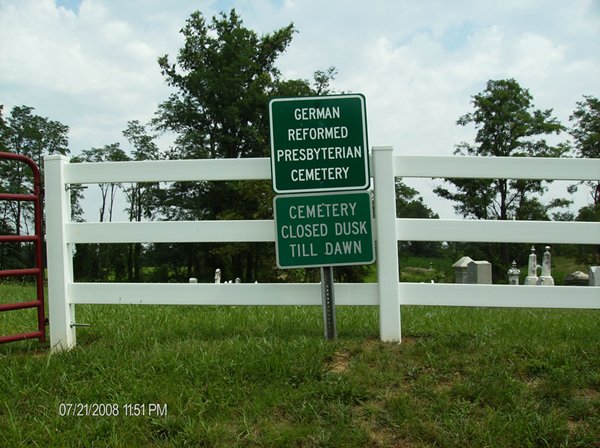
| Description | : | The cemetery is located on the north side of Delhi Arnheim Road (County Road 17A) about 700 feet west of its intersection with Main Street. The cemetery is located in Franklin Township, Brown County, Ohio, and is # 1081 (Presbyterian Cemetery / German Reformed Cemetery) in “Ohio Cemeteries 1803-2003”, compiled by the Ohio Genealogical Society. The cemetery is registered with the Ohio Division of Real Estate and Professional Licensing (ODRE) as German Reformed Presbyterian Cemetery with registration license number CGR.0000981501. The U.S. Geological Survey (USGS) Geographic Names Information System (GNIS) feature ID for the cemetery is 1699141 (Presbyterian Cemetery). |
frequently asked questions (FAQ):
-
Where is German Reformed Presbyterian Cemetery?
German Reformed Presbyterian Cemetery is located at Delhi Arnheim Road (County Road 17A) Arnheim, Brown County ,Ohio , 45141USA.
-
German Reformed Presbyterian Cemetery cemetery's updated grave count on graveviews.com?
0 memorials
-
Where are the coordinates of the German Reformed Presbyterian Cemetery?
Latitude: 38.9311066
Longitude: -83.8263702
Nearby Cemetories:
1. Lutheran Cemetery
Arnheim, Brown County, USA
Coordinate: 38.9281006, -83.8283005
2. Straight Creek Baptist Cemetery
Arnheim, Brown County, USA
Coordinate: 38.9317017, -83.8193970
3. Saint Marys Cemetery
Arnheim, Brown County, USA
Coordinate: 38.9407997, -83.8293991
4. Bohrer Cemetery
Franklin Township, Brown County, USA
Coordinate: 38.9019012, -83.8257980
5. West Fork Cemetery
Franklin Township, Brown County, USA
Coordinate: 38.9105988, -83.8578033
6. Wardlow Cemetery
Franklin Township, Brown County, USA
Coordinate: 38.8944016, -83.8358002
7. Abbott Burying Ground
Arnheim, Brown County, USA
Coordinate: 38.8944360, -83.8361210
8. Ashridge Cemetery
Ash Ridge, Brown County, USA
Coordinate: 38.9164009, -83.7536011
9. McFaddin Cemetery
Georgetown, Brown County, USA
Coordinate: 38.8819008, -83.8735962
10. Lucas Homestead Cemetery
Sardinia, Brown County, USA
Coordinate: 38.9853680, -83.7854220
11. Shaw Cemetery
Russellville, Brown County, USA
Coordinate: 38.8737950, -83.7898490
12. Barngrover Family Cemetery
Wahlsburg, Brown County, USA
Coordinate: 38.9317390, -83.9115140
13. Mount Carmel Cemetery
Washington Township, Brown County, USA
Coordinate: 38.9924210, -83.7926600
14. Biehn Cemetery
Washington Township, Brown County, USA
Coordinate: 38.9894370, -83.7840220
15. Wardlow Cemetery
Scott Township, Brown County, USA
Coordinate: 38.9780998, -83.8878021
16. Kimball Family Cemetery
New Hope, Brown County, USA
Coordinate: 38.9547650, -83.9071960
17. Davidson Cemetery
Scott Township, Brown County, USA
Coordinate: 38.9360300, -83.9128290
18. McCall Cemetery
Scott Township, Brown County, USA
Coordinate: 38.9325760, -83.9171320
19. Applegate Cemetery
New Hope, Brown County, USA
Coordinate: 38.9716180, -83.9008720
20. Gregory Cemetery
Washington Township, Brown County, USA
Coordinate: 39.0004120, -83.8464900
21. Young Cemetery
New Hope, Brown County, USA
Coordinate: 38.9580994, -83.9119034
22. Confidence Cemetery
Georgetown, Brown County, USA
Coordinate: 38.8852997, -83.9000015
23. Brush Creek Cemetery
Eagle Township, Brown County, USA
Coordinate: 38.9810982, -83.7566986
24. Associated Reformed Churchyard
Russellville, Brown County, USA
Coordinate: 38.8657990, -83.7822037