
| Memorials | : | 6 |
| Location | : | Arnheim, Brown County, USA |
| Phone | : | 937-515-4028 |
| Coordinate | : | 38.8944360, -83.8361210 |
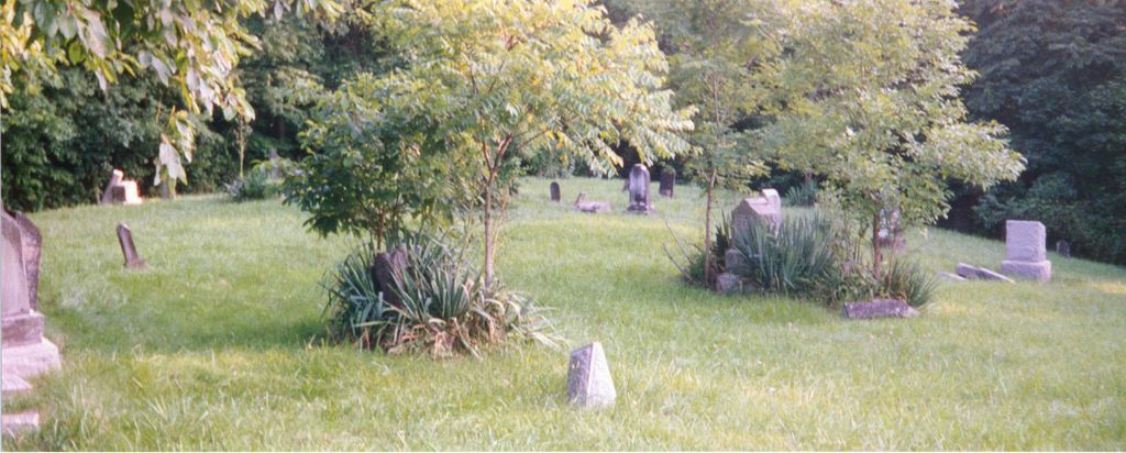
| Description | : | The cemetery is located about 200 feet east of Day Hill-Arnheim Road (County Road 3B) about 0.4 miles north of its intersection with Baker Hanselman Road (Township Road 179). The cemetery is located in Franklin Township, Brown County, Ohio, and is # 1077 (Abbott Burying Ground) and # 1085 (Wardlow Cemetery) in “Ohio Cemeteries 1803-2003”, compiled by the Ohio Genealogical Society. The U.S. Geological Survey (USGS) Geographic Names Information System (GNIS) feature ID for the cemetery is 1047563 (Wardlow Cemetery). |
frequently asked questions (FAQ):
-
Where is Abbott Burying Ground?
Abbott Burying Ground is located at Day Hill-Arnheim Road (County Road 3B) Arnheim, Brown County ,Ohio , 45121USA.
-
Abbott Burying Ground cemetery's updated grave count on graveviews.com?
6 memorials
-
Where are the coordinates of the Abbott Burying Ground?
Latitude: 38.8944360
Longitude: -83.8361210
Nearby Cemetories:
1. Wardlow Cemetery
Franklin Township, Brown County, USA
Coordinate: 38.8944016, -83.8358002
2. Bohrer Cemetery
Franklin Township, Brown County, USA
Coordinate: 38.9019012, -83.8257980
3. West Fork Cemetery
Franklin Township, Brown County, USA
Coordinate: 38.9105988, -83.8578033
4. McFaddin Cemetery
Georgetown, Brown County, USA
Coordinate: 38.8819008, -83.8735962
5. Lutheran Cemetery
Arnheim, Brown County, USA
Coordinate: 38.9281006, -83.8283005
6. German Reformed Presbyterian Cemetery
Arnheim, Brown County, USA
Coordinate: 38.9311066, -83.8263702
7. Dye Cemetery
Brown County, USA
Coordinate: 38.8586006, -83.8516998
8. Straight Creek Baptist Cemetery
Arnheim, Brown County, USA
Coordinate: 38.9317017, -83.8193970
9. Jennings Family Cemetery
Georgetown, Brown County, USA
Coordinate: 38.8641982, -83.8689216
10. Shaw Cemetery
Russellville, Brown County, USA
Coordinate: 38.8737950, -83.7898490
11. Saint Marys Cemetery
Arnheim, Brown County, USA
Coordinate: 38.9407997, -83.8293991
12. Confidence Cemetery
Georgetown, Brown County, USA
Coordinate: 38.8852997, -83.9000015
13. Associated Reformed Churchyard
Russellville, Brown County, USA
Coordinate: 38.8657990, -83.7822037
14. Old Russellville Cemetery
Russellville, Brown County, USA
Coordinate: 38.8513985, -83.7878036
15. Linwood Cemetery
Russellville, Brown County, USA
Coordinate: 38.8671989, -83.7671967
16. Hillman Ridge Cemetery
Georgetown, Brown County, USA
Coordinate: 38.8353004, -83.8621979
17. Jacobs Family Cemetery
Georgetown, Brown County, USA
Coordinate: 38.8988753, -83.9182039
18. Old Georgetown Cemetery
Georgetown, Brown County, USA
Coordinate: 38.8642006, -83.9096985
19. Glaze Cemetery
Jefferson Township, Brown County, USA
Coordinate: 38.8342300, -83.8029280
20. Berry Family Cemetery
Pleasant Township, Brown County, USA
Coordinate: 38.9047000, -83.9218000
21. Ashridge Cemetery
Ash Ridge, Brown County, USA
Coordinate: 38.9164009, -83.7536011
22. Baird Cemetery
Russellville, Brown County, USA
Coordinate: 38.8594360, -83.7610016
23. Barngrover Family Cemetery
Wahlsburg, Brown County, USA
Coordinate: 38.9317390, -83.9115140
24. Infirmary Cemetery
Georgetown, Brown County, USA
Coordinate: 38.8759410, -83.9224280