
| Memorials | : | 16 |
| Location | : | Sebastopol, Sonoma County, USA |
| Coordinate | : | 38.3968010, -122.8637009 |
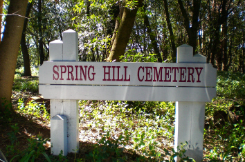
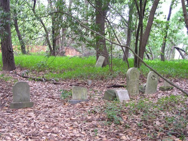
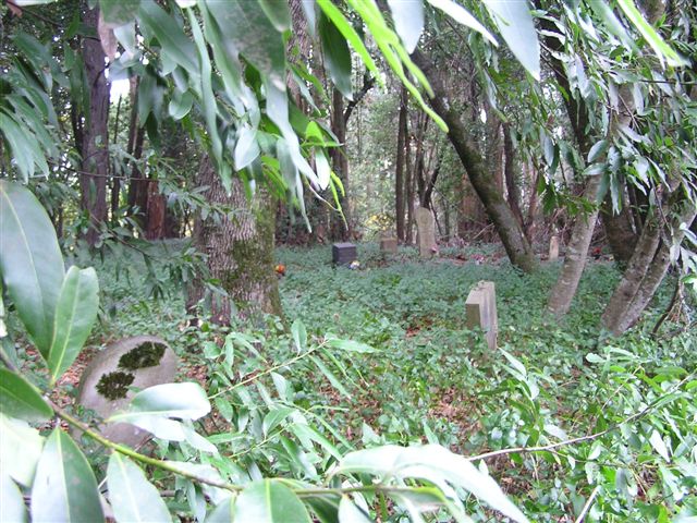
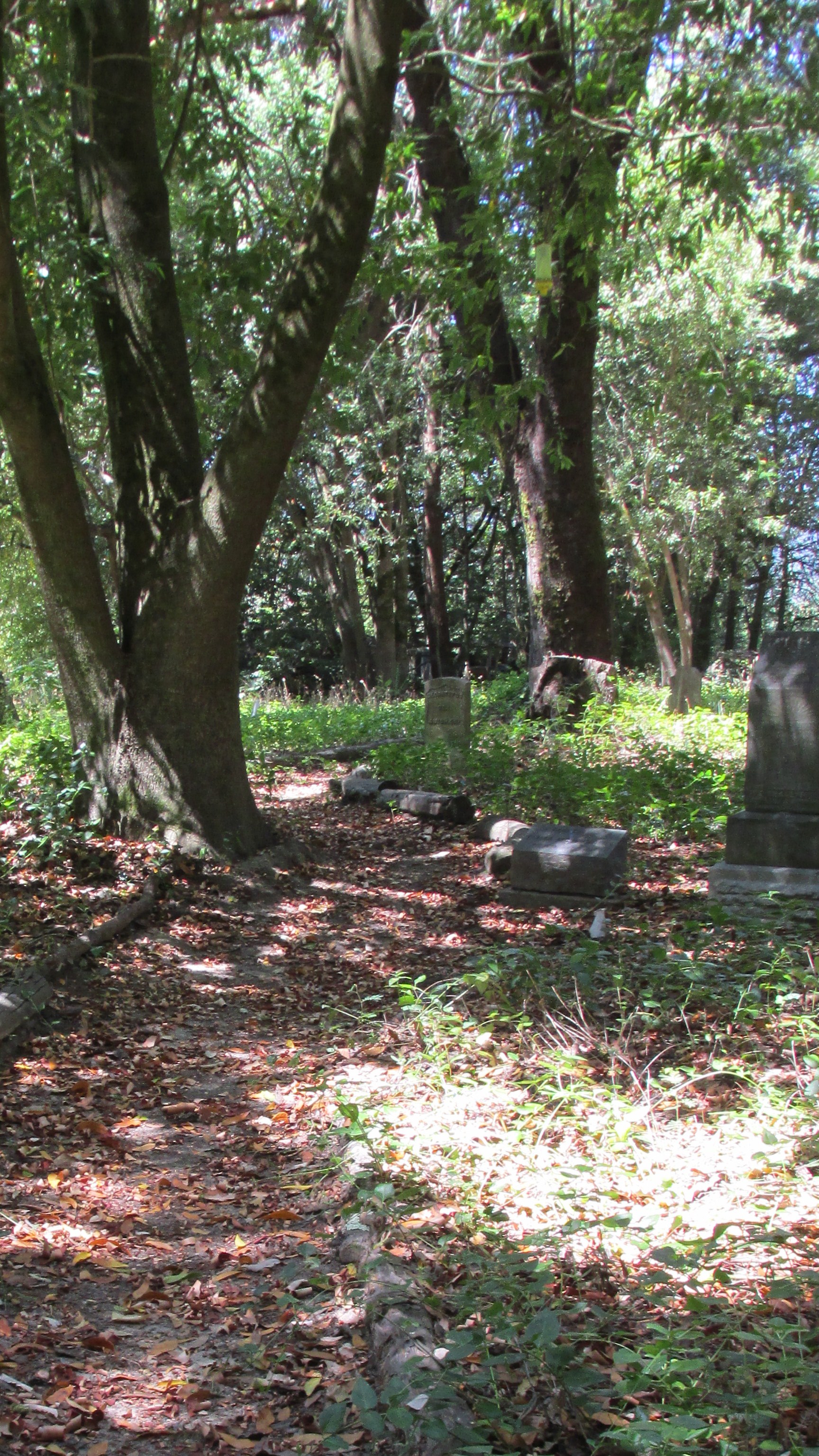
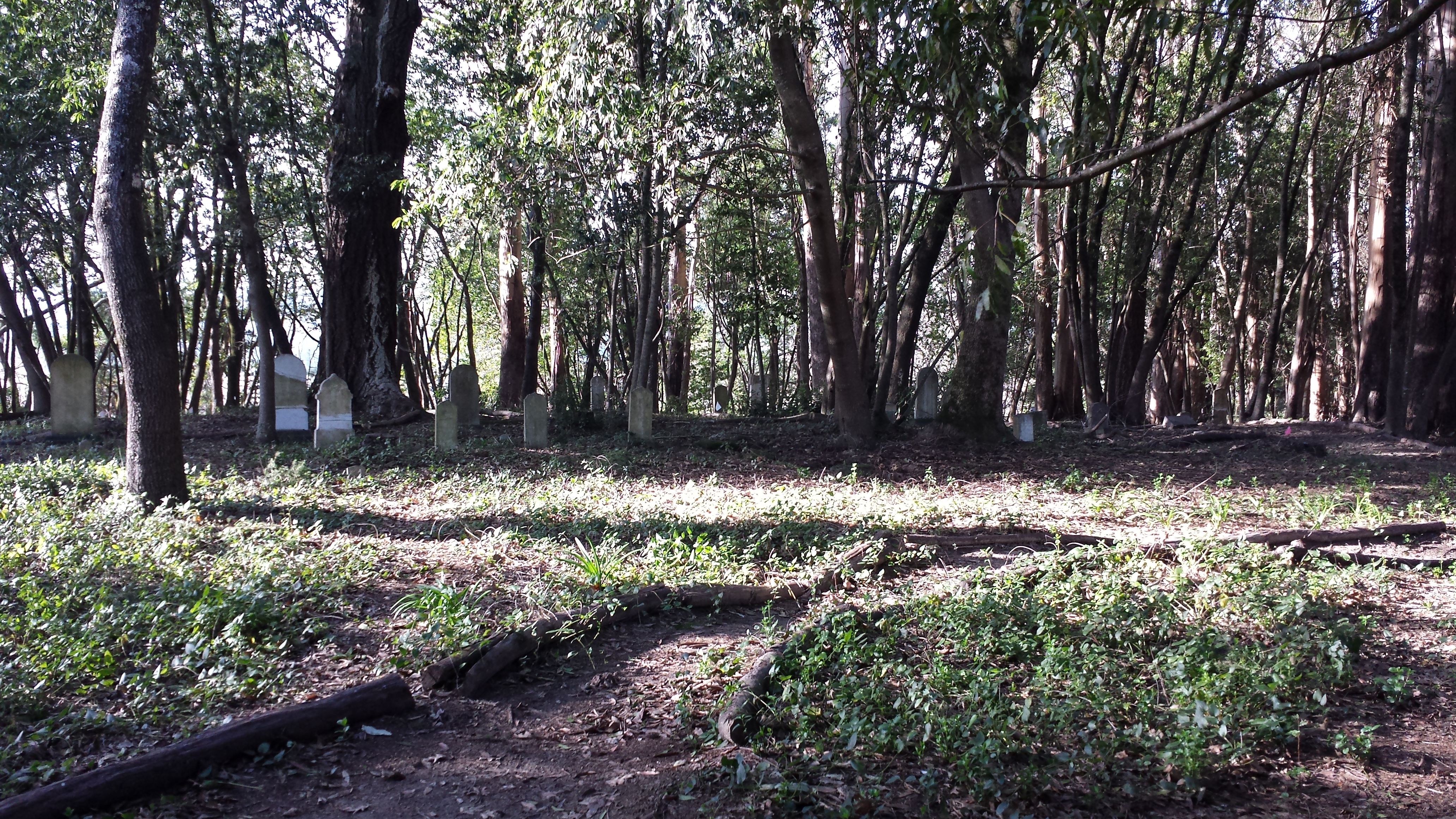
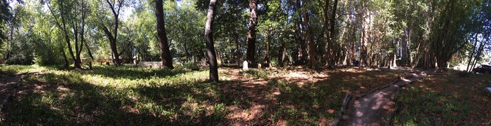
| Description | : | Highway 12 east to Sebastopol. Go straight and road becomes Bodega Road, then Bodega Highway. Several miles out of town where Bodega Hwy goes down and left, stay straight and go onto Spring Hill School Road. 100 yds down the road splits 3 ways: Spring Hill School Road goes left; a residence diectly in front, and a gravel road on the right -take the gravel road. 50 yds up the road look closely for the cemetery on the left side in a grove of trees. Untended for decades, the cemetery is overgrown and littered with fallen trees and laced... Read More |
frequently asked questions (FAQ):
-
Where is Spring Hill Cemetery?
Spring Hill Cemetery is located at Spring Hill School Road Sebastopol, Sonoma County ,California ,USA.
-
Spring Hill Cemetery cemetery's updated grave count on graveviews.com?
16 memorials
-
Where are the coordinates of the Spring Hill Cemetery?
Latitude: 38.3968010
Longitude: -122.8637009
Nearby Cemetories:
1. Sebastopol Memorial Lawn Cemetery
Sebastopol, Sonoma County, USA
Coordinate: 38.3981018, -122.8366013
2. Pleasant Hills Memorial Park and Mortuary
Sebastopol, Sonoma County, USA
Coordinate: 38.3792000, -122.8350983
3. Gilliam Cemetery
Graton, Sonoma County, USA
Coordinate: 38.4314995, -122.8816986
4. Jasper O'Farrell Ranch Cemetery
Freestone, Sonoma County, USA
Coordinate: 38.3758300, -122.9090300
5. Green Valley Cemetery
Sebastopol, Sonoma County, USA
Coordinate: 38.4424019, -122.8869019
6. Canfield Cemetery
Sebastopol, Sonoma County, USA
Coordinate: 38.3512430, -122.8147040
7. Druids Occidental Cemetery
Occidental, Sonoma County, USA
Coordinate: 38.4104996, -122.9419022
8. Steele Family Cemetery
Santa Rosa, Sonoma County, USA
Coordinate: 38.4523730, -122.8065610
9. Forestview Cemetery
Forestville, Sonoma County, USA
Coordinate: 38.4677010, -122.8834000
10. Macedonia Methodist Episcopal Church Cemetery
Sebastopol, Sonoma County, USA
Coordinate: 38.3594860, -122.7727270
11. Bloomfield Cemetery
Bloomfield, Sonoma County, USA
Coordinate: 38.3135986, -122.8583984
12. Saint Theresa of Avila Church Cemetery
Bodega, Sonoma County, USA
Coordinate: 38.3461342, -122.9723663
13. Calvary Cemetery
Bodega, Sonoma County, USA
Coordinate: 38.3414993, -122.9749985
14. Fulton Cemetery
Fulton, Sonoma County, USA
Coordinate: 38.4888000, -122.7786026
15. Chapel of the Chimes Cemetery and Mausoleum
Santa Rosa, Sonoma County, USA
Coordinate: 38.4141998, -122.7137985
16. McPeak Cemetery
Hacienda, Sonoma County, USA
Coordinate: 38.5097008, -122.9272003
17. McPeak Cemetery
Forestville, Sonoma County, USA
Coordinate: 38.5098190, -122.9280929
18. Luther Burbank Memorial Home and Gardens Cemetery
Santa Rosa, Sonoma County, USA
Coordinate: 38.4355810, -122.7118050
19. Santa Rosa Memorial Park Shiloh Annex
Windsor, Sonoma County, USA
Coordinate: 38.5247993, -122.8143005
20. Shiloh Cemetery
Windsor, Sonoma County, USA
Coordinate: 38.5256004, -122.8142014
21. Saint Catherines Church Cemetery
Monte Rio, Sonoma County, USA
Coordinate: 38.4691010, -123.0104980
22. Beth Ami Cemetery
Santa Rosa, Sonoma County, USA
Coordinate: 38.4590920, -122.7086070
23. Shomrei Torah Cemetery
Santa Rosa, Sonoma County, USA
Coordinate: 38.4593760, -122.7086480
24. Santa Rosa Odd Fellows Cemetery
Santa Rosa, Sonoma County, USA
Coordinate: 38.4573690, -122.7066530