
| Memorials | : | 54 |
| Location | : | Glorit, Auckland Council, New Zealand |
| Coordinate | : | -36.4599760, 174.4448830 |
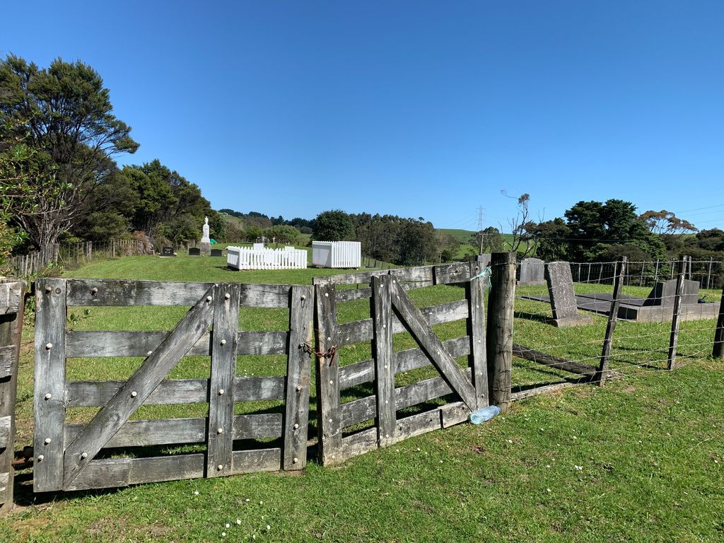
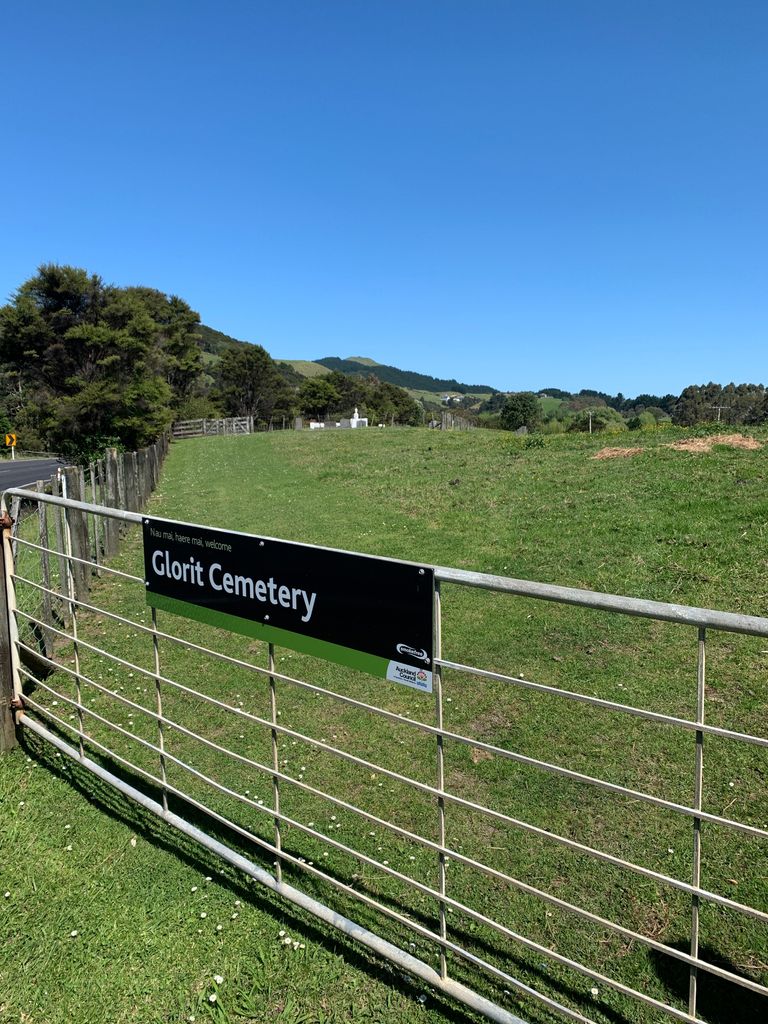
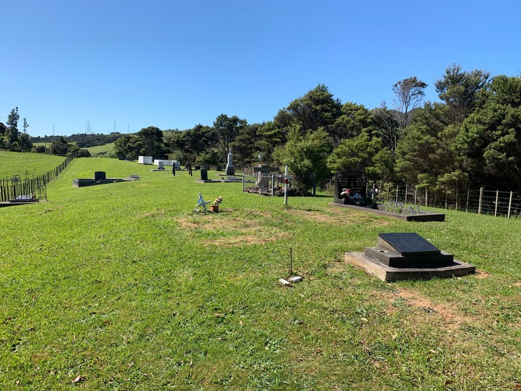
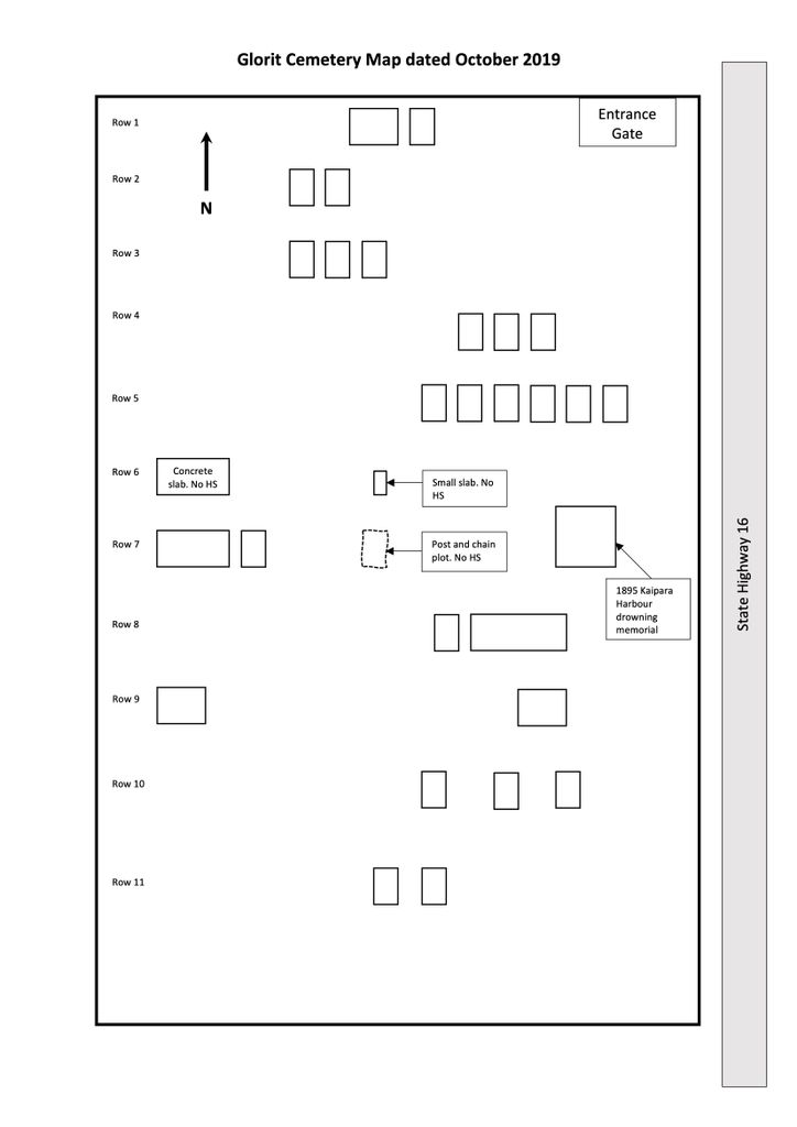
| Description | : | Glorit Cemetery is a rural cemetery located on the left side of State Highway 16 approximately 2km north of Glorit Memorial Hall. SH 16 starts in Auckland CBD and the cemetery is approximately 70km from the start. It is accessed through a farmer’s paddock and there is no carpark. The cemetery is well kept and has a seating area at the southern end. A memorial to the Kaipara Harbour fishing boat tragedy on 11th January 1895 which claimed nine lives, many of them children, is prominent. This is the oldest memorial in the cemetery. In 1985 the New Zealand... Read More |
frequently asked questions (FAQ):
-
Where is Glorit Cemetery?
Glorit Cemetery is located at 3180 Kaipara Coast Highway Glorit, Auckland Council ,Auckland ,New Zealand.
-
Glorit Cemetery cemetery's updated grave count on graveviews.com?
54 memorials
-
Where are the coordinates of the Glorit Cemetery?
Latitude: -36.4599760
Longitude: 174.4448830
Nearby Cemetories:
1. Kaipara Flats Cemetery
Kaipara Flats, Auckland Council, New Zealand
Coordinate: -36.5017800, 174.4534100
2. Komokoriki Cemetery
Manukau, Auckland Council, New Zealand
Coordinate: -36.5026370, 174.5033710
3. Tauhoa Cemetery
Tauhoa, Auckland Council, New Zealand
Coordinate: -36.3671330, 174.4449600
4. Hoteo North Cemetery
Hoteo North, Auckland Council, New Zealand
Coordinate: -36.3255803, 174.4957872
5. Minniesdale Chapel Cemetery
Wharehine, Auckland Council, New Zealand
Coordinate: -36.3139990, 174.3996600
6. Puhoi Cemetery
Puhoi, Auckland Council, New Zealand
Coordinate: -36.5052400, 174.6476300
7. Kaukapakapa Cemetery
Kaukapakapa, Auckland Council, New Zealand
Coordinate: -36.6268500, 174.5013400
8. Warkworth Roman Catholic Cemetery
Warkworth, Auckland Council, New Zealand
Coordinate: -36.3895340, 174.6457850
9. Port Albert Cemetery
Port Albert, Auckland Council, New Zealand
Coordinate: -36.2813200, 174.4483850
10. Warkworth Anglican Church Cemetery
Warkworth, Auckland Council, New Zealand
Coordinate: -36.4022100, 174.6628800
11. Wellsford Cemetery
Wellsford, Auckland Council, New Zealand
Coordinate: -36.2826700, 174.5106800
12. Warkworth Cemetery
Warkworth, Auckland Council, New Zealand
Coordinate: -36.4128510, 174.6674360
13. Kaukapakapa Public Cemetery
Kaukapakapa, Auckland Council, New Zealand
Coordinate: -36.6397740, 174.5057450
14. Pukapuka Cemetery
Pohuehue, Auckland Council, New Zealand
Coordinate: -36.4858910, 174.6783405
15. Wainui Public Cemetery
Wainui, Auckland Council, New Zealand
Coordinate: -36.6069500, 174.6322800
16. Wainui Settlers Cemetery
Wainui, Auckland Council, New Zealand
Coordinate: -36.6077200, 174.6324400
17. Helensville Cemetery
Helensville, Auckland Council, New Zealand
Coordinate: -36.6832600, 174.4548700
18. Te Muri
Puhoi, Auckland Council, New Zealand
Coordinate: -36.5182030, 174.7204840
19. Mahurangi Heads Presbyterian Church Cemetery
Mahurangi, Auckland Council, New Zealand
Coordinate: -36.4589100, 174.7317400
20. Te Kapa Cemetery
Mahurangi, Auckland Council, New Zealand
Coordinate: -36.4511910, 174.7502920
21. Auckland Memorial Park Cemetery
Silverdale, Auckland Council, New Zealand
Coordinate: -36.6273150, 174.6725690
22. Matakana Public Cemetery
Matakana, Auckland Council, New Zealand
Coordinate: -36.3488910, 174.7232640
23. National Erebus Memorial
Parnell, Auckland Council, New Zealand
Coordinate: -36.4546695, 174.7720847
24. Kakaraea Churchyard
Kaipara Flats, Auckland Council, New Zealand
Coordinate: -36.2085010, 174.3415440