
| Memorials | : | 8 |
| Location | : | Kaukapakapa, Auckland Council, New Zealand |
| Phone | : | 64 9 4207834 |
| Website | : | aucklandanglican.org.nz/find-a-church/rodney/kaukapakapa/kaukapakapa-church-kaukapakapa/ |
| Coordinate | : | -36.6268500, 174.5013400 |
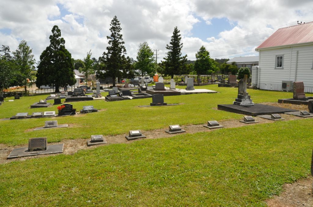
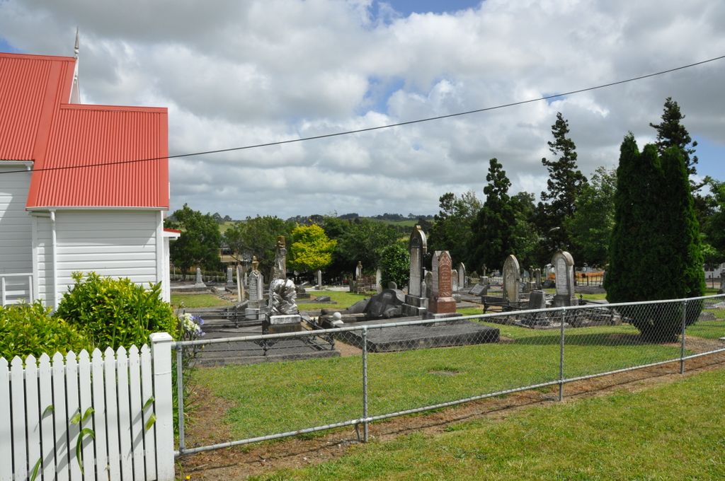
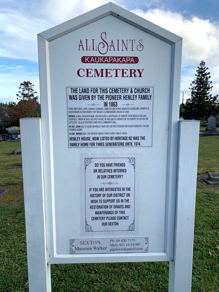
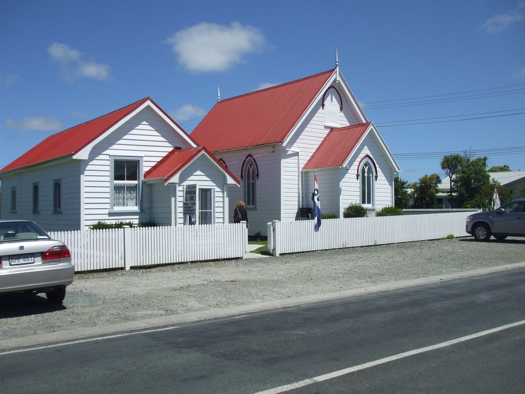
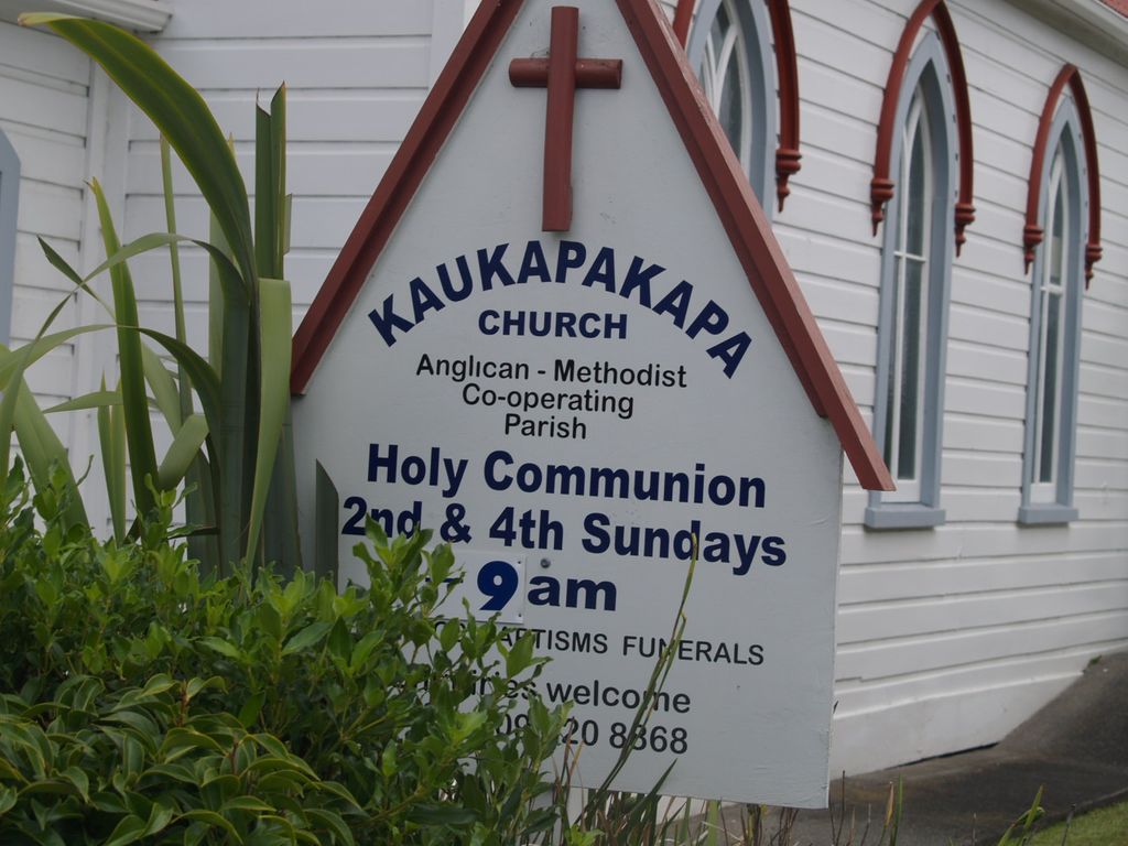
| Description | : | In 1864 settlers built a church which was controlled by the Wesleyan Methodists and named the Kaukapakapa Methodist Church. Although primarily a Methodist church, it was used by all denominations. Early settlers, brothers Edward, John and Morris Henley were sons of a Methodist Minister and over the years provided significant support to the church and community. In 1867, the Crown granted the land to Edward Clark Henley (Grant No. 34739, 22 Jan 1867) who then gifted the land to the church. The gift was not legalised until the 30th May 1871 (Deed No. 43624). John Henley built a... Read More |
frequently asked questions (FAQ):
-
Where is Kaukapakapa Cemetery?
Kaukapakapa Cemetery is located at State Highway 16 and Peak Road Kaukapakapa, Auckland Council ,Auckland , 0840New Zealand.
-
Kaukapakapa Cemetery cemetery's updated grave count on graveviews.com?
8 memorials
-
Where are the coordinates of the Kaukapakapa Cemetery?
Latitude: -36.6268500
Longitude: 174.5013400
Nearby Cemetories:
1. Kaukapakapa Public Cemetery
Kaukapakapa, Auckland Council, New Zealand
Coordinate: -36.6397740, 174.5057450
2. Helensville Cemetery
Helensville, Auckland Council, New Zealand
Coordinate: -36.6832600, 174.4548700
3. Wainui Settlers Cemetery
Wainui, Auckland Council, New Zealand
Coordinate: -36.6077200, 174.6324400
4. Wainui Public Cemetery
Wainui, Auckland Council, New Zealand
Coordinate: -36.6069500, 174.6322800
5. Komokoriki Cemetery
Manukau, Auckland Council, New Zealand
Coordinate: -36.5026370, 174.5033710
6. Kaipara Flats Cemetery
Kaipara Flats, Auckland Council, New Zealand
Coordinate: -36.5017800, 174.4534100
7. Auckland Memorial Park Cemetery
Silverdale, Auckland Council, New Zealand
Coordinate: -36.6273150, 174.6725690
8. Kumeu Anglican Cemetery
Kumeu, Auckland Council, New Zealand
Coordinate: -36.7861800, 174.5500100
9. Puhoi Cemetery
Puhoi, Auckland Council, New Zealand
Coordinate: -36.5052400, 174.6476300
10. Glorit Cemetery
Glorit, Auckland Council, New Zealand
Coordinate: -36.4599760, 174.4448830
11. Albany Village Cemetery
Albany, Auckland Council, New Zealand
Coordinate: -36.7298900, 174.6972700
12. Holy Trinity Cemetery
Silverdale, Auckland Council, New Zealand
Coordinate: -36.7429008, 174.6940822
13. North Shore Memorial Park
Auckland, Auckland Council, New Zealand
Coordinate: -36.7545800, 174.6838900
14. Stanmore Bay Beach Cemetery
Whangaparāoa, Auckland Council, New Zealand
Coordinate: -36.6244131, 174.7445165
15. Pukapuka Cemetery
Pohuehue, Auckland Council, New Zealand
Coordinate: -36.4858910, 174.6783405
16. Te Muri
Puhoi, Auckland Council, New Zealand
Coordinate: -36.5182030, 174.7204840
17. St. Mary's Pioneer Cemetery
Torbay, Auckland Council, New Zealand
Coordinate: -36.6959500, 174.7512400
18. Hobsonville Church and Settlers' Cemetery
Hobsonville, Auckland Council, New Zealand
Coordinate: -36.8000500, 174.6551800
19. Birkenhead-Glenfield Cemetery
Birkenhead, Auckland Council, New Zealand
Coordinate: -36.7989000, 174.7234700
20. Mahurangi Heads Presbyterian Church Cemetery
Mahurangi, Auckland Council, New Zealand
Coordinate: -36.4589100, 174.7317400
21. Pompallier Cemetery
Birkenhead, Auckland Council, New Zealand
Coordinate: -36.8036900, 174.7251200
22. Warkworth Cemetery
Warkworth, Auckland Council, New Zealand
Coordinate: -36.4128510, 174.6674360
23. Swanson Cemetery
Swanson, Auckland Council, New Zealand
Coordinate: -36.8718400, 174.5836200
24. Warkworth Anglican Church Cemetery
Warkworth, Auckland Council, New Zealand
Coordinate: -36.4022100, 174.6628800