| Memorials | : | 13 |
| Location | : | Darnestown, Montgomery County, USA |
| Coordinate | : | 39.1098340, -77.3033990 |
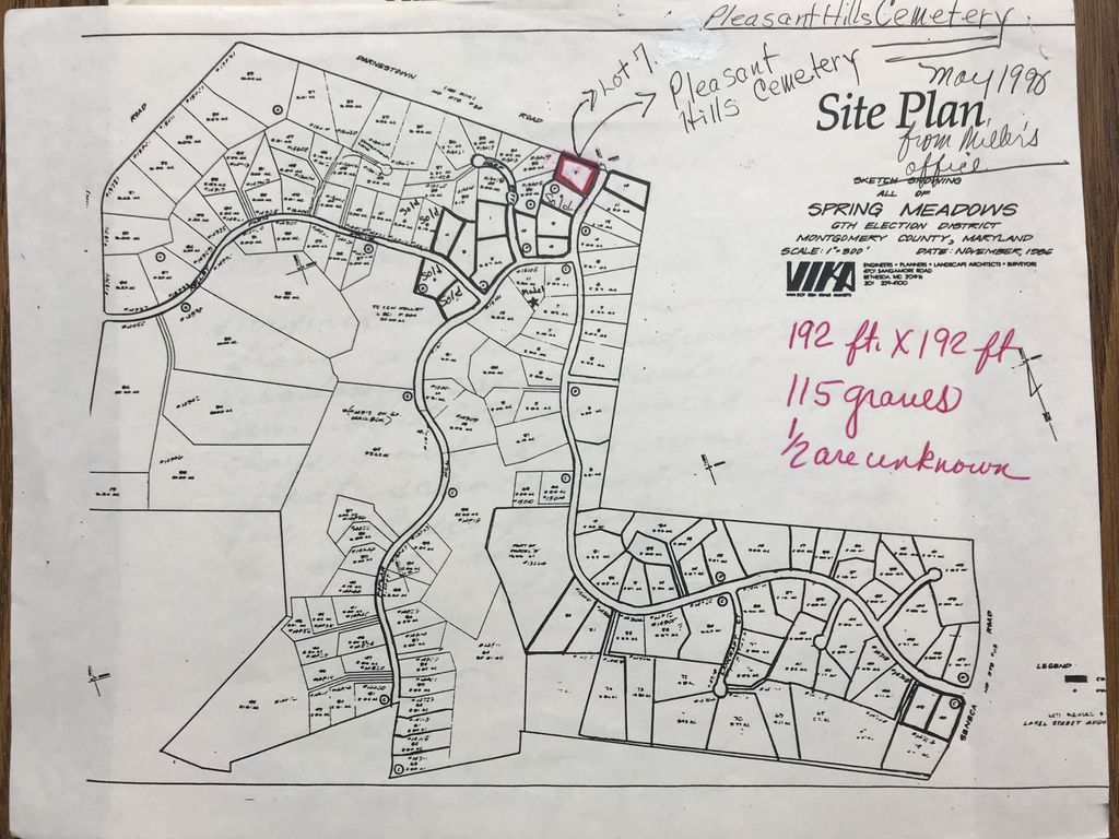
| Description | : | This cemetery is no longer in existence. The location and burial information comes from direct descendants of the interred. A Methodist church and graveyard were on this site until 1844. In 1846, it became the Darnestown Baptist Church -- organized by Rev. S. R. White -- and remained in operation until 1873. The church was dissolved and the property was abandoned. The property was eventually purchased in 1951 for back taxes by Mr. Kelley, a farmer. The farmer buried the tombstones at the head of each grave in 1951 after receiving signed releases from relatives of the deceased. The current... Read More |
frequently asked questions (FAQ):
-
Where is Pleasant Hills Cemetery?
Pleasant Hills Cemetery is located at 15408 Spring Meadows Drive Darnestown, Montgomery County ,Maryland ,USA.
-
Pleasant Hills Cemetery cemetery's updated grave count on graveviews.com?
13 memorials
-
Where are the coordinates of the Pleasant Hills Cemetery?
Latitude: 39.1098340
Longitude: -77.3033990
Nearby Cemetories:
1. Darne Family Cemetery (Defunct)
Darnestown, Montgomery County, USA
Coordinate: 39.1033520, -77.2909020
2. Darnestown Presbyterian Church Cemetery
Darnestown, Montgomery County, USA
Coordinate: 39.1029400, -77.2860400
3. Button Farm Slavery Burials
Germantown, Montgomery County, USA
Coordinate: 39.1283456, -77.3118924
4. Offutt Family Cemetery
Darnestown, Montgomery County, USA
Coordinate: 39.0865700, -77.3071900
5. Asbury United Methodist Cemetery
Germantown, Montgomery County, USA
Coordinate: 39.1418991, -77.2975006
6. Query Family Cemetery
Darnestown, Montgomery County, USA
Coordinate: 39.0771800, -77.2892500
7. Dawson Family Cemetery
Dawsonville, Montgomery County, USA
Coordinate: 39.1376330, -77.3307140
8. Germantown Baptist Church Cemetery
Germantown, Montgomery County, USA
Coordinate: 39.1456300, -77.2898800
9. Seneca Community Church Cemetery
Darnestown, Montgomery County, USA
Coordinate: 39.0725000, -77.3276100
10. Montevideo Cemetery
Seneca, Montgomery County, USA
Coordinate: 39.0872900, -77.3507500
11. Mount of Olives Church Cemetery
Gaithersburg, Montgomery County, USA
Coordinate: 39.1140785, -77.2447891
12. Darnall Family Cemetery
Poolesville, Montgomery County, USA
Coordinate: 39.1275300, -77.3682300
13. Musser Cemetery
Germantown, Montgomery County, USA
Coordinate: 39.1572200, -77.2660700
14. Magers-Mobley-Arnold Cemetery
Germantown, Montgomery County, USA
Coordinate: 39.1620000, -77.2779500
15. Trinity United Methodist Church Historic Cemetery
Germantown, Montgomery County, USA
Coordinate: 39.1635010, -77.2833310
16. Gott Family Farm - The Fertile Plains
Bucklodge, Montgomery County, USA
Coordinate: 39.1614100, -77.3408300
17. Hunt Ridge Cemetery
Potomac, Montgomery County, USA
Coordinate: 39.0612090, -77.2586880
18. Merry Go Round Farm
Potomac, Montgomery County, USA
Coordinate: 39.0530100, -77.2736300
19. Saint Rose of Lima Cemetery
Gaithersburg, Montgomery County, USA
Coordinate: 39.1501400, -77.2432700
20. Clipper Family Cemetery
Seneca, Montgomery County, USA
Coordinate: 39.0694770, -77.3641010
21. Ward Family Cemetery
Montgomery County, USA
Coordinate: 39.0982285, -77.2239761
22. Saint Paul Community Church Cemetery
Poolesville, Montgomery County, USA
Coordinate: 39.0976100, -77.3832900
23. Wood Family Cemetery
Poolesville, Montgomery County, USA
Coordinate: 39.1211540, -77.3844750
24. Garrett Family Cemetery
Germantown, Montgomery County, USA
Coordinate: 39.1036213, -77.2214028


