
| Memorials | : | 0 |
| Location | : | Tawa, Wellington City, New Zealand |
| Coordinate | : | -41.1647415, 174.8284302 |
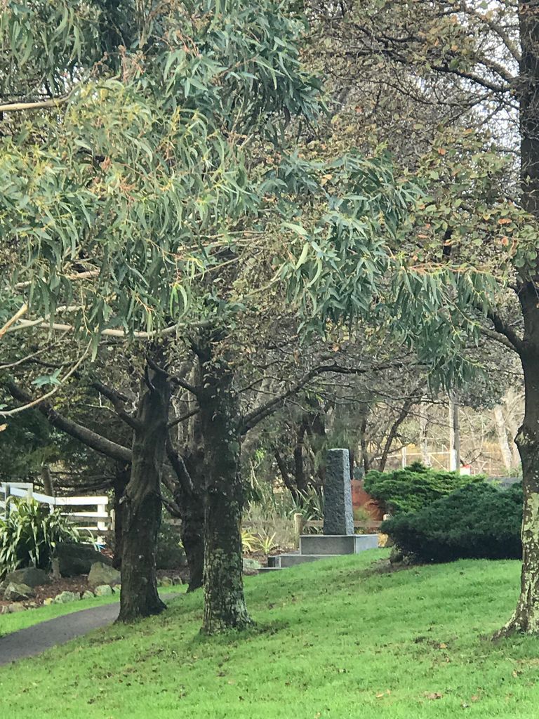
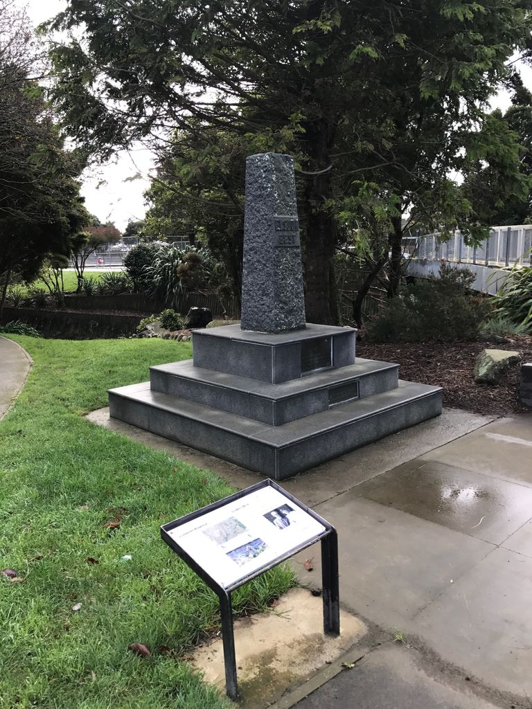
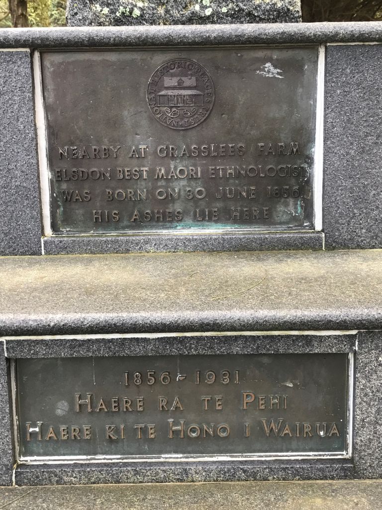
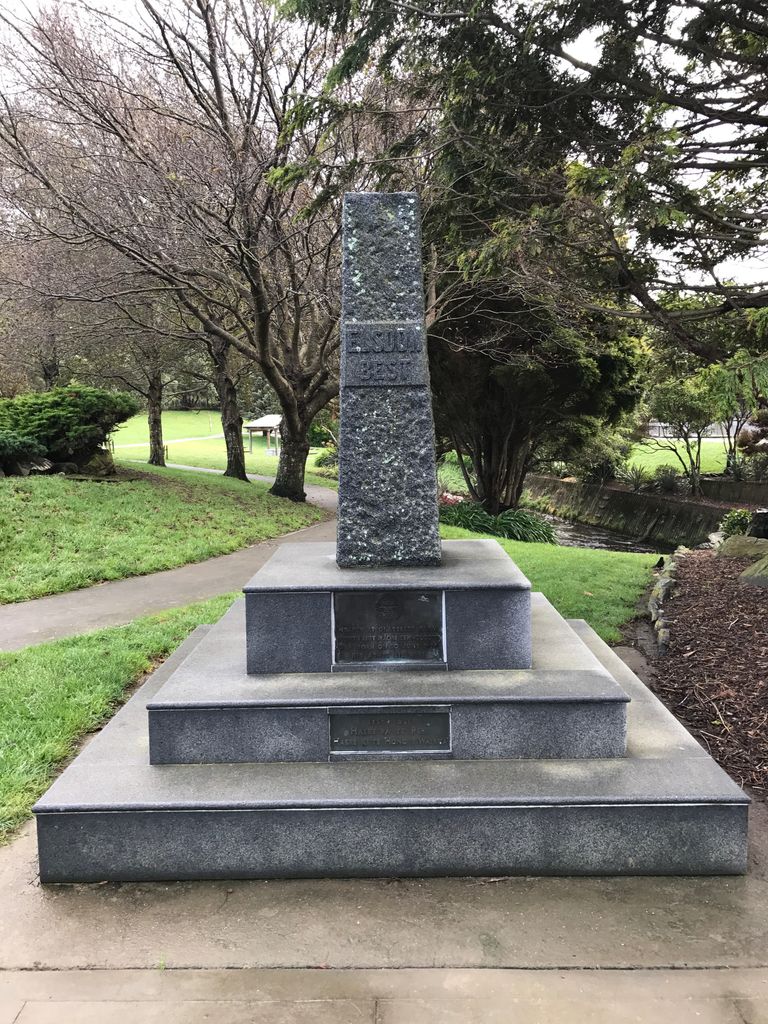
| Description | : | Grasslees Reserve is named after the former farm of Elsdon Best(1856-1931), farm worker, soldier, sawmiller, health inspector, ethnologist and writer. Elsdon Best spent his first nine years in Tawa and his ashes are interred in the memorial, which was dedicated in 1960. |
frequently asked questions (FAQ):
-
Where is Grasslees Reserve?
Grasslees Reserve is located at Tawa, Wellington City ,Wellington ,New Zealand.
-
Grasslees Reserve cemetery's updated grave count on graveviews.com?
0 memorials
-
Where are the coordinates of the Grasslees Reserve?
Latitude: -41.1647415
Longitude: 174.8284302
Nearby Cemetories:
1. Tawa Flat Cemetery
Tawa, Wellington City, New Zealand
Coordinate: -41.1580600, 174.8281800
2. Porirua Cemetery
Porirua, Porirua City, New Zealand
Coordinate: -41.1453640, 174.8420300
3. Ngati Toa Street Urupā
Takapuwahia, Porirua City, New Zealand
Coordinate: -41.1264070, 174.8344310
4. Mataiwhetu St Urupā
Takapuwahia, Porirua City, New Zealand
Coordinate: -41.1208070, 174.8364500
5. Takapu Urupā
Takapuwahia, Porirua City, New Zealand
Coordinate: -41.1203960, 174.8330360
6. Holy Trinity Cemetery
Ohariu, Wellington City, New Zealand
Coordinate: -41.2000860, 174.7793400
7. St. John's Anglican Churchyard Cemetery
Johnsonville, Wellington City, New Zealand
Coordinate: -41.2201300, 174.8076800
8. Johnsonville Methodist Cemetery
Wellington, Wellington City, New Zealand
Coordinate: -41.2229000, 174.8083500
9. Korokoro Catholic Cemetery
Lower Hutt, Lower Hutt City, New Zealand
Coordinate: -41.2210110, 174.8702590
10. Te Puni Urupā
Petone, Lower Hutt City, New Zealand
Coordinate: -41.2254898, 174.8686975
11. Bridge Street Cemetery
Lower Hutt, Lower Hutt City, New Zealand
Coordinate: -41.2117740, 174.8969660
12. St. James Churchyard
Lower Hutt, Lower Hutt City, New Zealand
Coordinate: -41.2128840, 174.9003910
13. Bradey Grave
Whitby, Porirua City, New Zealand
Coordinate: -41.1173161, 174.9056161
14. Boulcott Farm Cemetery
Lower Hutt, Lower Hutt City, New Zealand
Coordinate: -41.2030590, 174.9272750
15. St Josephs Catholic Cemetery
Pauatahanui, Porirua City, New Zealand
Coordinate: -41.1135060, 174.9196220
16. Plimmerton Urupā
Plimmerton, Porirua City, New Zealand
Coordinate: -41.0822790, 174.8641890
17. Pauatahanui Burial Ground
Pauatahanui, Porirua City, New Zealand
Coordinate: -41.1068190, 174.9173310
18. Saint Albans Burial Ground
Pauatahanui, Porirua City, New Zealand
Coordinate: -41.1067240, 174.9179340
19. Owhiti Urupā
Seaview, Lower Hutt City, New Zealand
Coordinate: -41.2358800, 174.9044500
20. Somes Island
Wellington, Wellington City, New Zealand
Coordinate: -41.2548630, 174.8650830
21. Christ Church Anglican Cemetery
Taita, Lower Hutt City, New Zealand
Coordinate: -41.1820960, 174.9600920
22. Taita Old Cemetery
Naenae, Lower Hutt City, New Zealand
Coordinate: -41.1945700, 174.9564000
23. Hongoeka Urupā
Plimmerton, Porirua City, New Zealand
Coordinate: -41.0651560, 174.8525070
24. Knox Presbyterian Church Cemetery
Lower Hutt, Lower Hutt City, New Zealand
Coordinate: -41.1965430, 174.9579920