
| Memorials | : | 1 |
| Location | : | Wellington, Wellington City, New Zealand |
| Coordinate | : | -41.2548630, 174.8650830 |
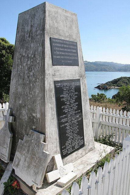
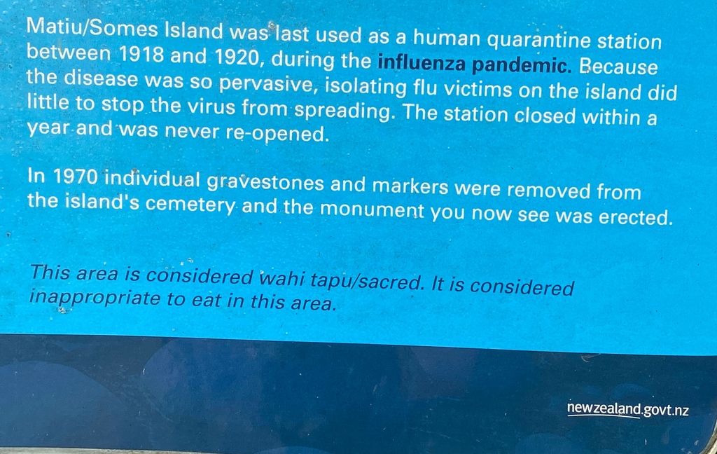
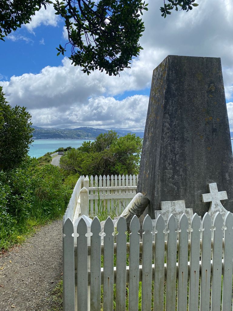
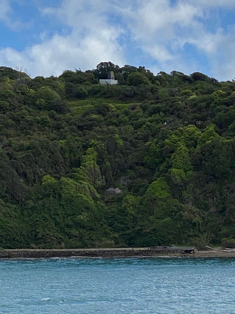
| Description | : | Matiu/Somes Island, at 24.9 ha (62 acres), is the largest of three islands in the northern half of Wellington Harbour, New Zealand. It lies 3 km (1.9 mi) south of the suburb of Petone and the mouth of the Hutt River, and about 5 km (3.1 mi) northwest of the much smaller Makaro/Ward Island. Legend has it that both Matiu and Makaro Islands received their original Mâori names from Kupe, the semi-legendary first navigator to reach New Zealand and get home again with reports of the new land. He named them after his two daughters (or, in some versions of the... Read More |
frequently asked questions (FAQ):
-
Where is Somes Island?
Somes Island is located at Wellington, Wellington City ,Wellington ,New Zealand.
-
Somes Island cemetery's updated grave count on graveviews.com?
0 memorials
-
Where are the coordinates of the Somes Island?
Latitude: -41.2548630
Longitude: 174.8650830
Nearby Cemetories:
1. Te Puni Urupā
Petone, Lower Hutt City, New Zealand
Coordinate: -41.2254898, 174.8686975
2. Korokoro Catholic Cemetery
Lower Hutt, Lower Hutt City, New Zealand
Coordinate: -41.2210110, 174.8702590
3. Owhiti Urupā
Seaview, Lower Hutt City, New Zealand
Coordinate: -41.2358800, 174.9044500
4. Massey Memorial
Wellington, Wellington City, New Zealand
Coordinate: -41.2850700, 174.8259900
5. Bridge Street Cemetery
Lower Hutt, Lower Hutt City, New Zealand
Coordinate: -41.2117740, 174.8969660
6. St. James Churchyard
Lower Hutt, Lower Hutt City, New Zealand
Coordinate: -41.2128840, 174.9003910
7. Johnsonville Methodist Cemetery
Wellington, Wellington City, New Zealand
Coordinate: -41.2229000, 174.8083500
8. St. John's Anglican Churchyard Cemetery
Johnsonville, Wellington City, New Zealand
Coordinate: -41.2201300, 174.8076800
9. Woodlands Farm Cemetery
Wainuiomata, Lower Hutt City, New Zealand
Coordinate: -41.2587540, 174.9549250
10. Boulcott Farm Cemetery
Lower Hutt, Lower Hutt City, New Zealand
Coordinate: -41.2030590, 174.9272750
11. Homedale Methodist Cemetery
Wainuiomata, Lower Hutt City, New Zealand
Coordinate: -41.2780500, 174.9527000
12. Bolton Street Cemetery
Wellington, Wellington City, New Zealand
Coordinate: -41.2786810, 174.7727660
13. Mount Street Cemetery
Wellington, Wellington City, New Zealand
Coordinate: -41.2888040, 174.7713370
14. New Zealand National War Memorial
Wellington, Wellington City, New Zealand
Coordinate: -41.2990000, 174.7771620
15. Wainuiomata Remembrance Garden
Wainuiomata, Lower Hutt City, New Zealand
Coordinate: -41.2762300, 174.9696800
16. Sinclair Cemetery
Wainuiomata, Lower Hutt City, New Zealand
Coordinate: -41.2770470, 174.9697580
17. Holy Trinity Cemetery
Ohariu, Wellington City, New Zealand
Coordinate: -41.2000860, 174.7793400
18. Truby King House and Gardens
Melrose, Wellington City, New Zealand
Coordinate: -41.3201760, 174.7889800
19. Karori Cemetery and Crematorium
Wellington, Wellington City, New Zealand
Coordinate: -41.2804030, 174.7512000
20. Knox Presbyterian Church Cemetery
Lower Hutt, Lower Hutt City, New Zealand
Coordinate: -41.1965430, 174.9579920
21. Taita Old Cemetery
Naenae, Lower Hutt City, New Zealand
Coordinate: -41.1945700, 174.9564000
22. Taita Lawn Cemetery
Naenae, Lower Hutt City, New Zealand
Coordinate: -41.1968900, 174.9634900
23. Grasslees Reserve
Tawa, Wellington City, New Zealand
Coordinate: -41.1647415, 174.8284302
24. Saint Mary's Anglican Churchyard
Wellington, Wellington City, New Zealand
Coordinate: -41.2826680, 174.7438880