
| Memorials | : | 0 |
| Location | : | Sour Lake, Hardin County, USA |
| Coordinate | : | 30.1144009, -94.4080963 |
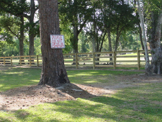
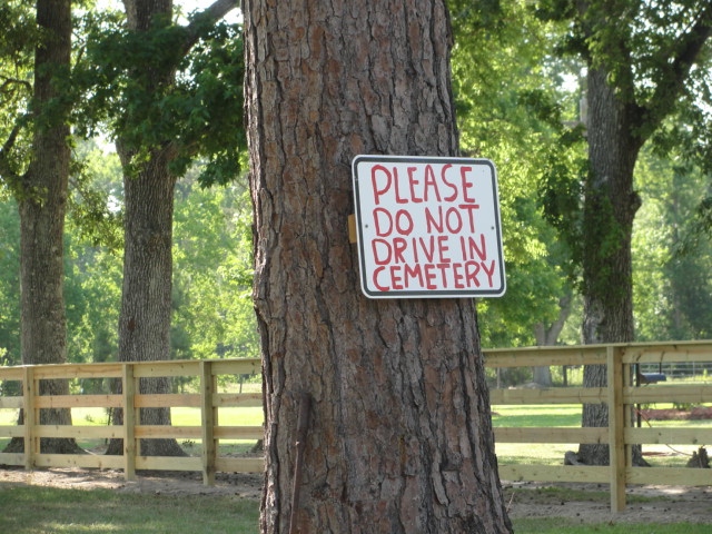
| Description | : | Directions to Grayburg Old Cemetery: Starting in Sour Lake, Texas at the intersection of Hwy 105 and Hwy 326, take Hwy 326 south for 2.0 miles. Turn right onto Old Monument Road. The Grayburg Old Cemetery is at the end of Old Monument Road. |
frequently asked questions (FAQ):
-
Where is Grayburg Old Cemetery?
Grayburg Old Cemetery is located at Sour Lake, Hardin County ,Texas ,USA.
-
Grayburg Old Cemetery cemetery's updated grave count on graveviews.com?
0 memorials
-
Where are the coordinates of the Grayburg Old Cemetery?
Latitude: 30.1144009
Longitude: -94.4080963
Nearby Cemetories:
1. PineGrove Cemetery
Sour Lake, Hardin County, USA
Coordinate: 30.1154900, -94.4037900
2. Grayburg Black Cemetery
Hardin County, USA
Coordinate: 30.1142310, -94.4193190
3. Rosedale Cemetery
Sour Lake, Hardin County, USA
Coordinate: 30.1313992, -94.3981018
4. Millhollon Cemetery
Sour Lake, Hardin County, USA
Coordinate: 30.1179300, -94.4372390
5. Jackson Family Cemetery
Sour Lake, Hardin County, USA
Coordinate: 30.1423710, -94.4084360
6. Pine Ridge Cemetery
Sour Lake, Hardin County, USA
Coordinate: 30.2016900, -94.3554600
7. Breaux Cemetery
Sour Lake, Hardin County, USA
Coordinate: 30.2171610, -94.4227690
8. Pittman Cemetery
Saratoga, Hardin County, USA
Coordinate: 30.2224690, -94.4662520
9. Teel Cemetery
Saratoga, Hardin County, USA
Coordinate: 30.2585280, -94.5122910
10. Oil Town Cemetery
Saratoga, Hardin County, USA
Coordinate: 30.2816570, -94.5125480
11. Roadside Memorial Baptist Church Cemetery
Saratoga, Hardin County, USA
Coordinate: 30.2923200, -94.4906300
12. Guedry Cemetery
Batson, Hardin County, USA
Coordinate: 30.2143993, -94.6033020
13. Crawford Family Cemetery
Saratoga, Hardin County, USA
Coordinate: 30.2868710, -94.5221510
14. Midtown Cemetery
Saratoga, Hardin County, USA
Coordinate: 30.2872009, -94.5227966
15. Leatherwood Cemetery
Loeb, Hardin County, USA
Coordinate: 30.1919003, -94.1856003
16. Jordan Cemetery
Batson, Hardin County, USA
Coordinate: 30.2482970, -94.6085070
17. West Cemetery
Batson, Hardin County, USA
Coordinate: 30.2502990, -94.6205230
18. Old Nona Ogden Cemetery
Kountze, Hardin County, USA
Coordinate: 30.3335559, -94.2944586
19. Knight Cemetery
Batson, Hardin County, USA
Coordinate: 30.2536130, -94.6356300
20. Bumstead Cemetery
Lumberton, Hardin County, USA
Coordinate: 30.2698440, -94.1935160
21. Mills Family Cemetery
Lumberton, Hardin County, USA
Coordinate: 30.2673700, -94.1901950
22. Fairchild Cemetery
Lumberton, Hardin County, USA
Coordinate: 30.2675760, -94.1902450
23. Hanging Tree Cemetery
Kountze, Hardin County, USA
Coordinate: 30.3523410, -94.3422600
24. Walton Cemetery
Lumberton, Hardin County, USA
Coordinate: 30.2847004, -94.2035980