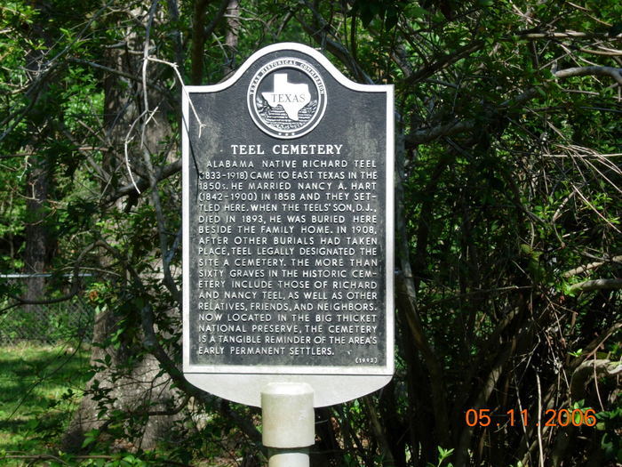
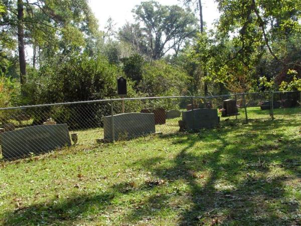
| Memorials | : | 0 |
| Location | : | Saratoga, Hardin County, USA |
| Coordinate | : | 30.2585280, -94.5122910 |
| Description | : | Directions to Cemetery: From the junction of FM 770 and FM 787 in Saratoga, Texas take FM 770 east 1.3 miles to Rosier Park Road. Turn right on Rosier Park Road and go 0.7 miles to Teel Cemetery Road (right fork). Follow Teel Cemetery Road 1.2 miles to cemetery. |
frequently asked questions (FAQ):
-
Where is Teel Cemetery?
Teel Cemetery is located at Saratoga, Hardin County ,Texas ,USA.
-
Teel Cemetery cemetery's updated grave count on graveviews.com?
0 memorials
-
Where are the coordinates of the Teel Cemetery?
Latitude: 30.2585280
Longitude: -94.5122910
Nearby Cemetories:
1. Oil Town Cemetery
Saratoga, Hardin County, USA
Coordinate: 30.2816570, -94.5125480
2. Crawford Family Cemetery
Saratoga, Hardin County, USA
Coordinate: 30.2868710, -94.5221510
3. Midtown Cemetery
Saratoga, Hardin County, USA
Coordinate: 30.2872009, -94.5227966
4. Roadside Memorial Baptist Church Cemetery
Saratoga, Hardin County, USA
Coordinate: 30.2923200, -94.4906300
5. Pittman Cemetery
Saratoga, Hardin County, USA
Coordinate: 30.2224690, -94.4662520
6. Jordan Cemetery
Batson, Hardin County, USA
Coordinate: 30.2482970, -94.6085070
7. Breaux Cemetery
Sour Lake, Hardin County, USA
Coordinate: 30.2171610, -94.4227690
8. Guedry Cemetery
Batson, Hardin County, USA
Coordinate: 30.2143993, -94.6033020
9. Jackson Settlement Cemetery
Saratoga, Hardin County, USA
Coordinate: 30.3351364, -94.5728972
10. West Cemetery
Batson, Hardin County, USA
Coordinate: 30.2502990, -94.6205230
11. Knight Cemetery
Batson, Hardin County, USA
Coordinate: 30.2536130, -94.6356300
12. Felps Cemetery
Thicket, Hardin County, USA
Coordinate: 30.3742008, -94.5975037
13. Jackson Family Cemetery
Sour Lake, Hardin County, USA
Coordinate: 30.1423710, -94.4084360
14. Pine Ridge Cemetery
Sour Lake, Hardin County, USA
Coordinate: 30.2016900, -94.3554600
15. Jordan Cemetery
Honey Island, Hardin County, USA
Coordinate: 30.3917350, -94.4353330
16. Millhollon Cemetery
Sour Lake, Hardin County, USA
Coordinate: 30.1179300, -94.4372390
17. Bracken Cemetery
Honey Island, Hardin County, USA
Coordinate: 30.3931007, -94.4131012
18. Rosedale Cemetery
Sour Lake, Hardin County, USA
Coordinate: 30.1313992, -94.3981018
19. Grayburg Black Cemetery
Hardin County, USA
Coordinate: 30.1142310, -94.4193190
20. Hall Cemetery
Thicket, Hardin County, USA
Coordinate: 30.3999996, -94.6159973
21. Grayburg Old Cemetery
Sour Lake, Hardin County, USA
Coordinate: 30.1144009, -94.4080963
22. PineGrove Cemetery
Sour Lake, Hardin County, USA
Coordinate: 30.1154900, -94.4037900
23. Hanging Tree Cemetery
Kountze, Hardin County, USA
Coordinate: 30.3523410, -94.3422600
24. Wheeler Cemetery
Kountze, Hardin County, USA
Coordinate: 30.3573740, -94.3459300


