
| Memorials | : | 11 |
| Location | : | Country Club Village, Andrew County, USA |
| Coordinate | : | 39.8333015, -94.8632965 |
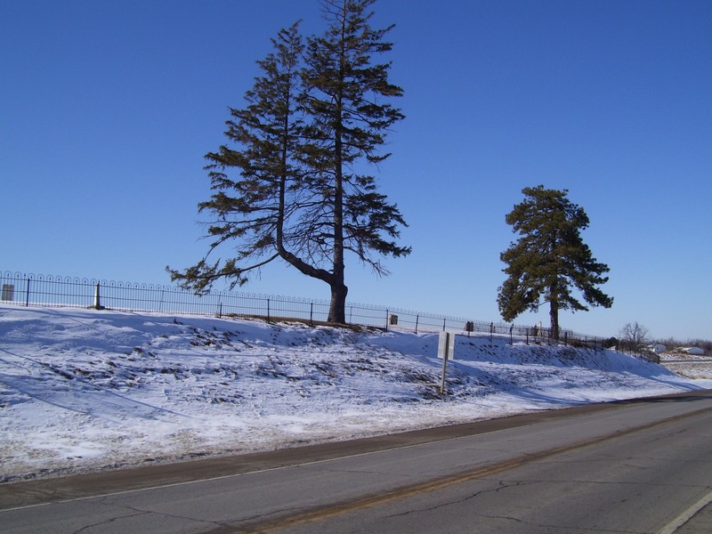
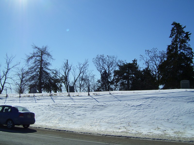
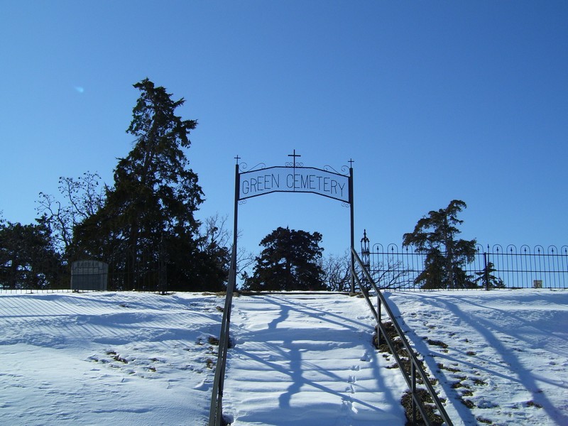
| Description | : | Green Cemetery is located about 5 miles north of downtown St. Joseph, Missouri on "K" highway at the intersection of Interstate 229. Access to the cemetery is via steps leading from "K" highway up to the cemetery; there is no off street parking. This cemetery was established as early as 1850 and has been used by many residents of St. Joseph (Buchanan county). Obituaries and death certificates often do not make clear that the cemetery is in Andrew county, Missouri. |
frequently asked questions (FAQ):
-
Where is Green Cemetery?
Green Cemetery is located at Country Club Village, Andrew County ,Missouri ,USA.
-
Green Cemetery cemetery's updated grave count on graveviews.com?
11 memorials
-
Where are the coordinates of the Green Cemetery?
Latitude: 39.8333015
Longitude: -94.8632965
Nearby Cemetories:
1. Samuel Ball Green Cemetery
Andrew County, USA
Coordinate: 39.8264400, -94.8586500
2. Todd Cemetery
Country Club Village, Andrew County, USA
Coordinate: 39.8342018, -94.8424988
3. Green Valley Cemetery
Andrew County, USA
Coordinate: 39.8211594, -94.8477020
4. Felix Cemetery
Saint Joseph, Buchanan County, USA
Coordinate: 39.8090330, -94.8673600
5. Maxwell Cemetery
Saint Joseph, Buchanan County, USA
Coordinate: 39.8065948, -94.8490295
6. Sunbridge Cemetery
Saint Joseph, Buchanan County, USA
Coordinate: 39.8053818, -94.8513336
7. Buchanan County Poor Farm Cemetery
Saint Joseph, Buchanan County, USA
Coordinate: 39.8170160, -94.8113140
8. Mount Olivet Cemetery
Saint Joseph, Buchanan County, USA
Coordinate: 39.7953262, -94.8294296
9. Jackson Cemetery
Wathena, Doniphan County, USA
Coordinate: 39.8260994, -94.9244003
10. Bnai Sholem Cemetery
Buchanan County, USA
Coordinate: 39.8191986, -94.7988968
11. Vanschoiack West Cemetery
Andrew County, USA
Coordinate: 39.8649935, -94.8091622
12. Greenwick Cemetery
Amazonia, Andrew County, USA
Coordinate: 39.8866997, -94.8653030
13. Shaare Sholem Cemetery
Saint Joseph, Buchanan County, USA
Coordinate: 39.7889404, -94.8234482
14. Vanschoiack Cemetery
Andrew County, USA
Coordinate: 39.8647003, -94.8056030
15. Ashland Cemetery
Saint Joseph, Buchanan County, USA
Coordinate: 39.7881813, -94.8218002
16. Amazonia Cemetery
Amazonia, Andrew County, USA
Coordinate: 39.8884300, -94.8858600
17. Adath Joseph Cemetery
Saint Joseph, Buchanan County, USA
Coordinate: 39.7860718, -94.8164215
18. Fairview Cumberland Presbyterian Cemetery
Country Club Village, Andrew County, USA
Coordinate: 39.8283005, -94.7857971
19. Mount Auburn Cemetery
Saint Joseph, Buchanan County, USA
Coordinate: 39.7859497, -94.8156281
20. Mount Mora Cemetery
Saint Joseph, Buchanan County, USA
Coordinate: 39.7743225, -94.8418808
21. Saint Johns Cemetery
Amazonia, Andrew County, USA
Coordinate: 39.8941800, -94.8908600
22. Moskau Cemetery
Doniphan County, USA
Coordinate: 39.8157997, -94.9443970
23. Smithton Cemetery
Wathena, Doniphan County, USA
Coordinate: 39.8478400, -94.9496900
24. Elwood Cemetery
Elwood, Doniphan County, USA
Coordinate: 39.7652300, -94.8760500