
| Memorials | : | 92 |
| Location | : | Saint Joseph, Buchanan County, USA |
| Phone | : | (816) 385-3361 |
| Coordinate | : | 39.7881813, -94.8218002 |
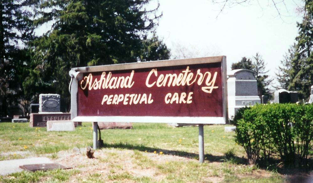
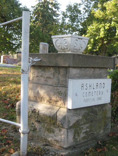
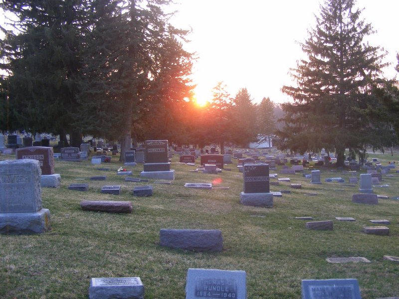
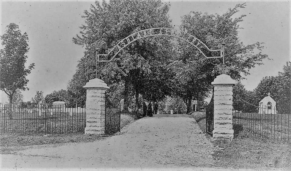
| Description | : | These hallowed grounds were originally two separate cemeteries. One in the northeast was named Ashland and one in the southwest was called Oakland. Both began in 1869 and both were started by local churches. As well, both were public cemeteries. During November 1913, Oakland Cemetery was sold to the Ashland Association to form one cemetery. Each cemetery had maintained their original burial books. All of Oakland records from 1869 to 1913 were "lost." This was a common occurrence back then. Even a large amount of the Ashland records mysteriously disappeared. Yet an older book was referenced when the ledgers were rewritten. Mr.... Read More |
frequently asked questions (FAQ):
-
Where is Ashland Cemetery?
Ashland Cemetery is located at 2324 Ashland Avenue Saint Joseph, Buchanan County ,Missouri , 64506USA.
-
Ashland Cemetery cemetery's updated grave count on graveviews.com?
85 memorials
-
Where are the coordinates of the Ashland Cemetery?
Latitude: 39.7881813
Longitude: -94.8218002
Nearby Cemetories:
1. Shaare Sholem Cemetery
Saint Joseph, Buchanan County, USA
Coordinate: 39.7889404, -94.8234482
2. Adath Joseph Cemetery
Saint Joseph, Buchanan County, USA
Coordinate: 39.7860718, -94.8164215
3. Mount Auburn Cemetery
Saint Joseph, Buchanan County, USA
Coordinate: 39.7859497, -94.8156281
4. Mount Olivet Cemetery
Saint Joseph, Buchanan County, USA
Coordinate: 39.7953262, -94.8294296
5. State Hospital Cemetery
Saint Joseph, Buchanan County, USA
Coordinate: 39.7717209, -94.8067780
6. Mount Mora Cemetery
Saint Joseph, Buchanan County, USA
Coordinate: 39.7743225, -94.8418808
7. Maxwell Cemetery
Saint Joseph, Buchanan County, USA
Coordinate: 39.8065948, -94.8490295
8. Sunbridge Cemetery
Saint Joseph, Buchanan County, USA
Coordinate: 39.8053818, -94.8513336
9. Buchanan County Poor Farm Cemetery
Saint Joseph, Buchanan County, USA
Coordinate: 39.8170160, -94.8113140
10. Saint Joseph Memorial Park
Saint Joseph, Buchanan County, USA
Coordinate: 39.7796249, -94.7824707
11. Bnai Sholem Cemetery
Buchanan County, USA
Coordinate: 39.8191986, -94.7988968
12. Green Valley Cemetery
Andrew County, USA
Coordinate: 39.8211594, -94.8477020
13. Felix Cemetery
Saint Joseph, Buchanan County, USA
Coordinate: 39.8090330, -94.8673600
14. Samuel Ball Green Cemetery
Andrew County, USA
Coordinate: 39.8264400, -94.8586500
15. Elwood Cemetery
Elwood, Doniphan County, USA
Coordinate: 39.7652300, -94.8760500
16. Todd Cemetery
Country Club Village, Andrew County, USA
Coordinate: 39.8342018, -94.8424988
17. Fairview Cumberland Presbyterian Cemetery
Country Club Village, Andrew County, USA
Coordinate: 39.8283005, -94.7857971
18. Leanord Cemetery
Buchanan County, USA
Coordinate: 39.7459989, -94.7832187
19. Green Cemetery
Country Club Village, Andrew County, USA
Coordinate: 39.8333015, -94.8632965
20. Ozenberger Cemetery
Buchanan County, USA
Coordinate: 39.8050003, -94.7461014
21. Nelson Cemetery
Buchanan County, USA
Coordinate: 39.7201614, -94.8059692
22. Vanschoiack West Cemetery
Andrew County, USA
Coordinate: 39.8649935, -94.8091622
23. Vanschoiack Cemetery
Andrew County, USA
Coordinate: 39.8647003, -94.8056030
24. Oak Ridge Cemetery
Andrew County, USA
Coordinate: 39.8394012, -94.7444000