
| Memorials | : | 0 |
| Location | : | Burnt Corn, Conecuh County, USA |
| Coordinate | : | 31.5824990, -87.1306990 |
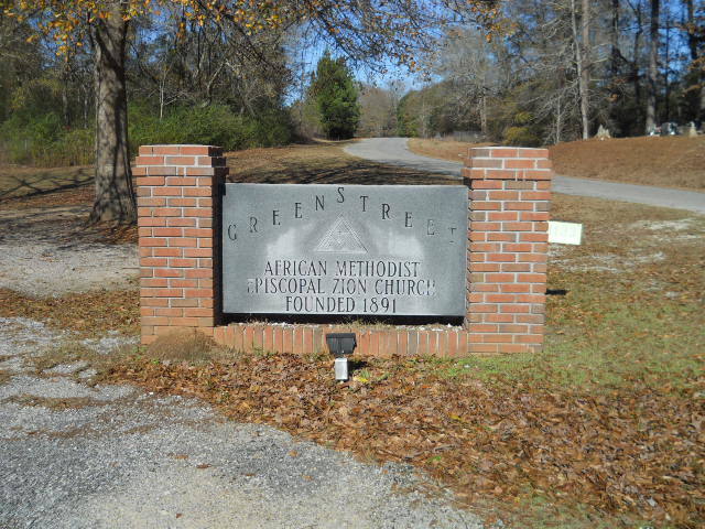
| Description | : | Green Street is a small community northeast of Burnt Corn, located on CR-9. Green Street is where a slave owner by the name of Enoch Salter purchased a slave by the name of Fannie (McCarter) Lee and her son Allen McCarter for $2000.00. Today, Green Street consist primarily of African American citizens. The cemetery is split into three parts -- the two older sections are located directly across CR-9 from the church; one being behind a chain-link fence, consisting of only four headstones; the second is located atop a steep embankment and is the larger of the three sections. The... Read More |
frequently asked questions (FAQ):
-
Where is Green Street AME Church Cemetery?
Green Street AME Church Cemetery is located at CR-9 Burnt Corn, Conecuh County ,Alabama , 36401USA.
-
Green Street AME Church Cemetery cemetery's updated grave count on graveviews.com?
0 memorials
-
Where are the coordinates of the Green Street AME Church Cemetery?
Latitude: 31.5824990
Longitude: -87.1306990

Nearby Cemetories:
1. Purnell Methodist Church Cemetery
Fairnelson, Conecuh County, USA
Coordinate: 31.5688460, -87.1042010
2. Martin Cemetery
Conecuh County, USA
Coordinate: 31.5949993, -87.1014023
3. Ramah Baptist Church Cemetery
Pine Orchard, Monroe County, USA
Coordinate: 31.6119003, -87.1386032
4. Breckenridge Cemetery
Burnt Corn, Conecuh County, USA
Coordinate: 31.5568890, -87.1051450
5. Burnt Corn Methodist Cemetery
Burnt Corn, Conecuh County, USA
Coordinate: 31.5503700, -87.1589290
6. Bethany Baptist Church Cemetery
Monroe County, USA
Coordinate: 31.5498700, -87.1597600
7. John Green Cemetery
Conecuh County, USA
Coordinate: 31.5417004, -87.1382980
8. Lee Cemetery
Conecuh County, USA
Coordinate: 31.5394001, -87.1314011
9. Sardis Cemetery
Lyeffion, Conecuh County, USA
Coordinate: 31.5674180, -87.0810870
10. Ithiel Lee Cemetery
Burnt Corn, Conecuh County, USA
Coordinate: 31.5424800, -87.1064330
11. New Hope AME Church Zion Cemetery
Burnt Corn, Conecuh County, USA
Coordinate: 31.5374760, -87.1349220
12. Old Duke Cemetery
Monroe County, USA
Coordinate: 31.5654000, -87.1807330
13. New Haven Cemetery
Conecuh County, USA
Coordinate: 31.6096992, -87.0742035
14. Bethany Missionary Baptist Church Cemetery
Monroe County, USA
Coordinate: 31.5391300, -87.1752700
15. Pine Orchard Cemetery
Conecuh County, USA
Coordinate: 31.6408005, -87.1355972
16. Pilgrim Rest AME Zion Church Cemetery
Monroe County, USA
Coordinate: 31.5495110, -87.1933000
17. Puryearville Cemetery
Peterman, Monroe County, USA
Coordinate: 31.5452003, -87.1922226
18. Rankin Cemetery
Monroe County, USA
Coordinate: 31.5763300, -87.2087900
19. A. J. Ellis Cemetery
Fairnelson, Conecuh County, USA
Coordinate: 31.5514770, -87.0594410
20. Davis Family Cemetery
Monroe County, USA
Coordinate: 31.5919940, -87.2112360
21. Fairfield Cemetery
Evergreen, Conecuh County, USA
Coordinate: 31.5307020, -87.0742890
22. Antioch Baptist Church Cemetery
Tunnel Springs, Monroe County, USA
Coordinate: 31.6411430, -87.1867490
23. Lone Star Cemetery
Pine Orchard, Monroe County, USA
Coordinate: 31.6594009, -87.1125031
24. Booker Family Cemetery
Monroe County, USA
Coordinate: 31.6613990, -87.1148480