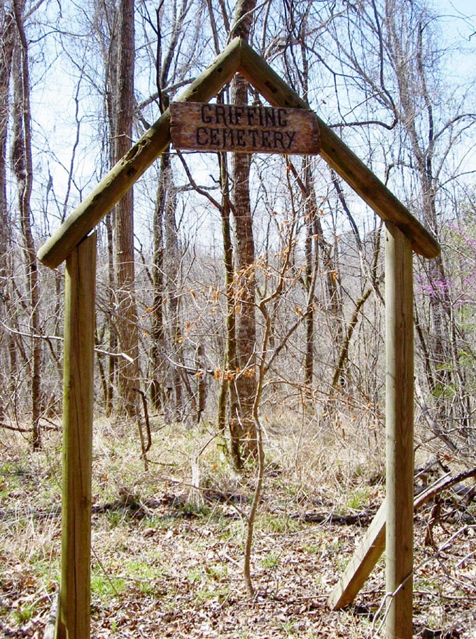
| Memorials | : | 0 |
| Location | : | Jefferson County, USA |
| Coordinate | : | 31.8558693, -91.1307602 |
| Description | : | This cemetery is located in the woods, about .3 mile off Crosby Road. From Alcorn University, drive east on Highway 552 approximately .5 mile. Turn right (south)on Crosby Rd. Driving south on Crosby Rd approximately .5 mile to the small road on the left (east) side. Also, you can see the remains of a sunken road next to the road. Park and walk east following the small road. At the top of the rise, follow the road to the left. This will connect you with the old sunken road. Continue walking east, and off to your right, in March 2005,... Read More |
frequently asked questions (FAQ):
-
Where is Griffing Cemetery?
Griffing Cemetery is located at Jefferson County ,Mississippi ,USA.
-
Griffing Cemetery cemetery's updated grave count on graveviews.com?
0 memorials
-
Where are the coordinates of the Griffing Cemetery?
Latitude: 31.8558693
Longitude: -91.1307602
Nearby Cemetories:
1. Louis Edward Ball Gravesite
Rodney, Jefferson County, USA
Coordinate: 31.8541400, -91.1312400
2. Snodgrass Cemetery
Rodney, Jefferson County, USA
Coordinate: 31.8422400, -91.1202500
3. Matthew Bolls Graveyard
Alcorn, Claiborne County, USA
Coordinate: 31.8721667, -91.1280167
4. Oak Mound Plantation Cemetery
Rodney, Jefferson County, USA
Coordinate: 31.8422100, -91.1429500
5. Coleman-McGill Cemetery
Lorman, Jefferson County, USA
Coordinate: 31.8662500, -91.1509670
6. Scott Family Graveyard
Rodney, Jefferson County, USA
Coordinate: 31.8346700, -91.1250200
7. Snodgrass Cemetery
Alcorn, Claiborne County, USA
Coordinate: 31.8795500, -91.1306670
8. Fellowship Church Cemetery
Rodney, Jefferson County, USA
Coordinate: 31.8370970, -91.1124520
9. Oakland Cemetery
Alcorn, Claiborne County, USA
Coordinate: 31.8789005, -91.1430969
10. Herring Cemetery
Rodney, Jefferson County, USA
Coordinate: 31.8475500, -91.1625670
11. Laurel Hill Missionary Baptist Church Cemetery
Rodney, Jefferson County, USA
Coordinate: 31.8490170, -91.1642660
12. Wheatley Cemetery
Lorman, Jefferson County, USA
Coordinate: 31.8505900, -91.0968500
13. Compton Cemetery
Rodney, Jefferson County, USA
Coordinate: 31.8601000, -91.1659830
14. Laurel Hill Cemetery
Jefferson County, USA
Coordinate: 31.8533001, -91.1735992
15. Mount Olive M.B. Church Cemetery
Lorman, Jefferson County, USA
Coordinate: 31.8986390, -91.1279530
16. King Cemetery
Westside, Claiborne County, USA
Coordinate: 31.8971000, -91.0955500
17. Smith - Dorsey Cemetery
Melton, Jefferson County, USA
Coordinate: 31.8115330, -91.0984830
18. Noland Hill ME Church Cemetery
Melton, Jefferson County, USA
Coordinate: 31.8022800, -91.1331700
19. Watkins Family Cemetery
Westside, Claiborne County, USA
Coordinate: 31.9112670, -91.1154000
20. Logan Cemetery
Jefferson County, USA
Coordinate: 31.8418999, -91.1958008
21. Rodney Cemetery
Rodney, Jefferson County, USA
Coordinate: 31.8624992, -91.1986008
22. Travels Rest Baptist Church Cemetery
Rodney, Jefferson County, USA
Coordinate: 31.8329400, -91.1936400
23. Oak Hill Cemetery
Claiborne County, USA
Coordinate: 31.8752995, -91.1960983
24. Yoe Cemetery
Alcorn, Claiborne County, USA
Coordinate: 31.8695000, -91.1998300

