
| Memorials | : | 0 |
| Location | : | Westside, Claiborne County, USA |
| Coordinate | : | 31.9112670, -91.1154000 |
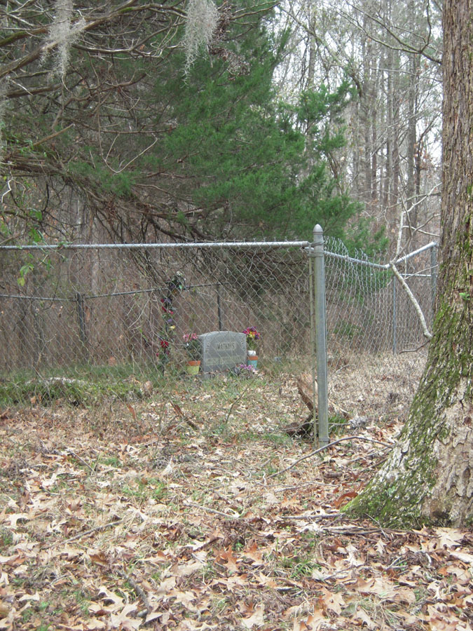
| Description | : | Enclosed by chain-link fence - well kept. Only two stones and two apparent vaults with no names. |
frequently asked questions (FAQ):
-
Where is Watkins Family Cemetery?
Watkins Family Cemetery is located at Westside, Claiborne County ,Mississippi ,USA.
-
Watkins Family Cemetery cemetery's updated grave count on graveviews.com?
0 memorials
-
Where are the coordinates of the Watkins Family Cemetery?
Latitude: 31.9112670
Longitude: -91.1154000
Nearby Cemetories:
1. Rembert Cemetery
Westside, Claiborne County, USA
Coordinate: 31.9114000, -91.0965170
2. Mount Olive M.B. Church Cemetery
Lorman, Jefferson County, USA
Coordinate: 31.8986390, -91.1279530
3. Carbondale Cemetery
Westside, Claiborne County, USA
Coordinate: 31.9169006, -91.1343994
4. King Cemetery
Westside, Claiborne County, USA
Coordinate: 31.8971000, -91.0955500
5. James Crane Cemetery
Bruinsburg, Claiborne County, USA
Coordinate: 31.9277700, -91.0939800
6. Briscoe Cemetery
Claiborne County, USA
Coordinate: 31.9153004, -91.0828018
7. Atlas Cemetery
Westside, Claiborne County, USA
Coordinate: 31.9184830, -91.0812160
8. Daniell Cemetery
Claiborne County, USA
Coordinate: 31.9447002, -91.1231003
9. Snodgrass Cemetery
Alcorn, Claiborne County, USA
Coordinate: 31.8795500, -91.1306670
10. Oakland Cemetery
Alcorn, Claiborne County, USA
Coordinate: 31.8789005, -91.1430969
11. Matthew Bolls Graveyard
Alcorn, Claiborne County, USA
Coordinate: 31.8721667, -91.1280167
12. Thompson Cemetery
Westside, Claiborne County, USA
Coordinate: 31.9355300, -91.0632600
13. Coleman-McGill Cemetery
Lorman, Jefferson County, USA
Coordinate: 31.8662500, -91.1509670
14. Griffing Cemetery
Jefferson County, USA
Coordinate: 31.8558693, -91.1307602
15. Louis Edward Ball Gravesite
Rodney, Jefferson County, USA
Coordinate: 31.8541400, -91.1312400
16. Wheatley Cemetery
Lorman, Jefferson County, USA
Coordinate: 31.8505900, -91.0968500
17. Old Colony Cemetery
Russum, Claiborne County, USA
Coordinate: 31.8882400, -91.0436500
18. Compton Cemetery
Rodney, Jefferson County, USA
Coordinate: 31.8601000, -91.1659830
19. Snodgrass Cemetery
Rodney, Jefferson County, USA
Coordinate: 31.8422400, -91.1202500
20. Oak Mound Plantation Cemetery
Rodney, Jefferson County, USA
Coordinate: 31.8422100, -91.1429500
21. Fellowship Church Cemetery
Rodney, Jefferson County, USA
Coordinate: 31.8370970, -91.1124520
22. Laurel Hill Missionary Baptist Church Cemetery
Rodney, Jefferson County, USA
Coordinate: 31.8490170, -91.1642660
23. Herring Cemetery
Rodney, Jefferson County, USA
Coordinate: 31.8475500, -91.1625670
24. Laurel Hill Cemetery
Jefferson County, USA
Coordinate: 31.8533001, -91.1735992