
| Memorials | : | 1 |
| Location | : | Gibson County, USA |
| Coordinate | : | 36.0793991, -88.8600006 |
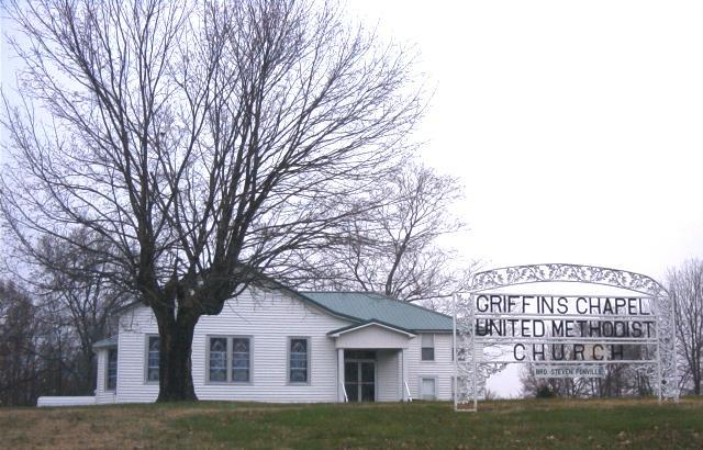
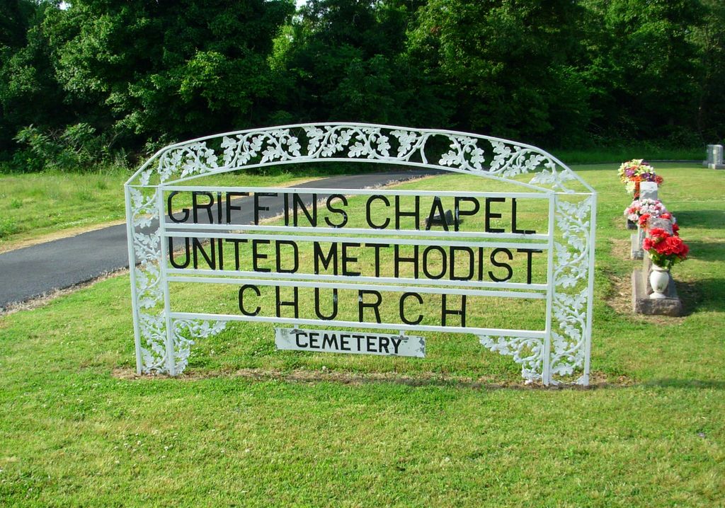
| Description | : | The Griffin's Chapel United Methodist Church and cemetery are located three miles west of Bradford, Gibson County, Tennessee, on the Griffin's Chapel Road. The original church building was erected in 1916, but was destroyed on April 2, 2006 by a tornado. A new church was then built on the original site. The cemetery is situated behind the church. |
frequently asked questions (FAQ):
-
Where is Griffins Chapel United Methodist Church Cemetery?
Griffins Chapel United Methodist Church Cemetery is located at Gibson County ,Tennessee ,USA.
-
Griffins Chapel United Methodist Church Cemetery cemetery's updated grave count on graveviews.com?
1 memorials
-
Where are the coordinates of the Griffins Chapel United Methodist Church Cemetery?
Latitude: 36.0793991
Longitude: -88.8600006
Nearby Cemetories:
1. Mount Zion Cemetery
Dyer, Gibson County, USA
Coordinate: 36.0936775, -88.8878403
2. Antioch Cumberland Presbyterian Cemetery
Bradford, Gibson County, USA
Coordinate: 36.1050010, -88.8742630
3. Antioch Methodist Cemetery
Bradford, Gibson County, USA
Coordinate: 36.1061400, -88.8737340
4. Bradford Cemetery
Bradford, Gibson County, USA
Coordinate: 36.0756030, -88.8239690
5. Church of Jesus Christ Cemetery
Bradford, Gibson County, USA
Coordinate: 36.0511110, -88.8449340
6. Locust Grove Church of Christ Cemetery
Bradford, Gibson County, USA
Coordinate: 36.0936012, -88.8255997
7. Davis Grove Cemetery
Bradford, Gibson County, USA
Coordinate: 36.0451750, -88.8527140
8. Cartwright Family
Dyer, Gibson County, USA
Coordinate: 36.0523510, -88.9001610
9. Oliver's Chapel Cemetery
Idlewild, Gibson County, USA
Coordinate: 36.0374985, -88.8214035
10. Keeley Cemetery
Gibson County, USA
Coordinate: 36.0511017, -88.9175034
11. Shiloh Cemetery
Bradford, Gibson County, USA
Coordinate: 36.0758018, -88.7818985
12. Salem Baptist Church Cemetery
Trenton, Gibson County, USA
Coordinate: 36.0266991, -88.9075012
13. Hillis Cemetery
Greenfield, Weakley County, USA
Coordinate: 36.1448870, -88.8524360
14. Harrison Cemetery
Gibson County, USA
Coordinate: 36.0321300, -88.9191800
15. Poplar Grove Cemetery
Dyer, Gibson County, USA
Coordinate: 36.0574989, -88.9389038
16. Davidson Chapel Cemetery
Gibson County, USA
Coordinate: 36.0116997, -88.8522034
17. Salem Cemetery
Rutherford, Gibson County, USA
Coordinate: 36.1217003, -88.9266968
18. New Bethlehem Baptist Church Cemetery
Dyer, Gibson County, USA
Coordinate: 36.0715180, -88.9448400
19. Pounds & Idlewild Cemetery
Idlewild, Gibson County, USA
Coordinate: 36.0285700, -88.8019300
20. New Bethlehem Memorial Cemetery
Dyer, Gibson County, USA
Coordinate: 36.0689090, -88.9452540
21. Moseley Family Cemetery #3
Greenfield, Weakley County, USA
Coordinate: 36.1241290, -88.7907880
22. China Grove Church Cemetery
Gibson County, USA
Coordinate: 36.1383018, -88.9113998
23. Union United Methodist Cemetery
Gibson County, USA
Coordinate: 36.0203018, -88.9122009
24. Cooper Family Cemetery
Trenton, Gibson County, USA
Coordinate: 36.0418840, -88.9371910