
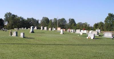
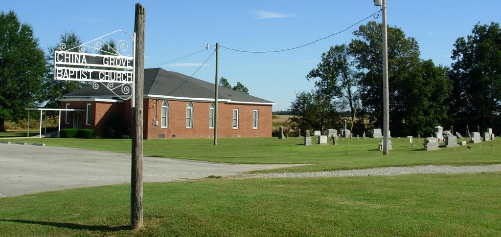
| Memorials | : | 11 |
| Location | : | Gibson County, USA |
| Coordinate | : | 36.1383018, -88.9113998 |
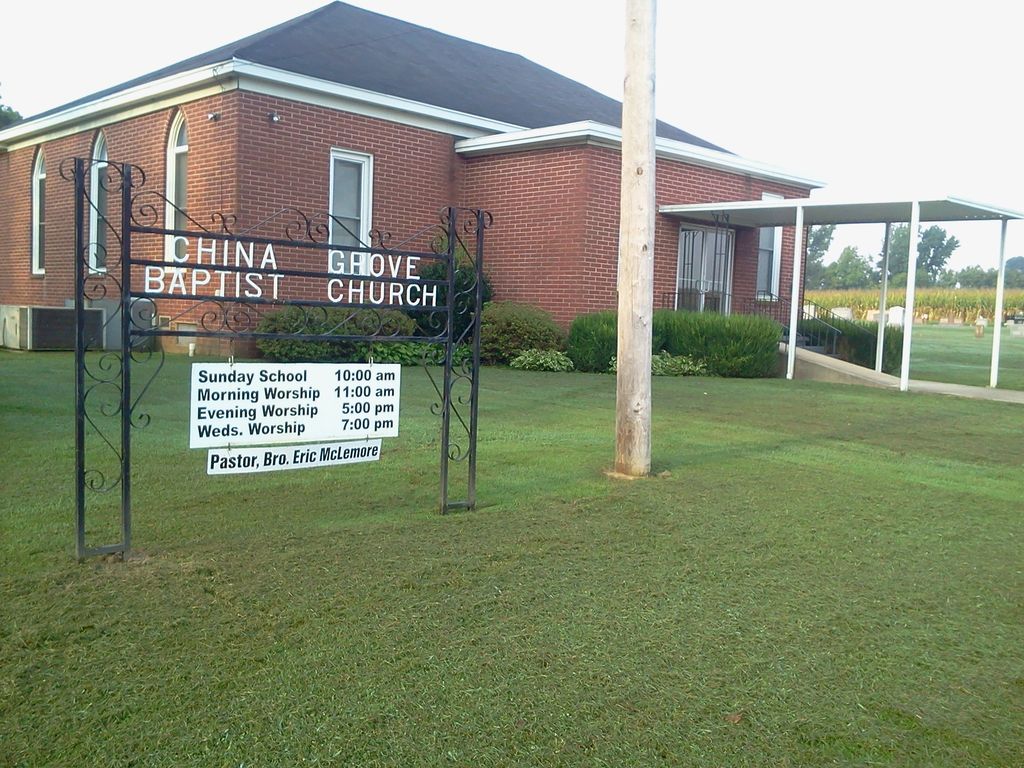
| Description | : | Take Highway 105 (Bradford Highway) approximately 1 mile until the road splits into a 3-way fork. Take middle fork (China Grove Road). Church and cemetery located 5 miles on right. |
frequently asked questions (FAQ):
-
Where is China Grove Church Cemetery?
China Grove Church Cemetery is located at Gibson County ,Tennessee ,USA.
-
China Grove Church Cemetery cemetery's updated grave count on graveviews.com?
11 memorials
-
Where are the coordinates of the China Grove Church Cemetery?
Latitude: 36.1383018
Longitude: -88.9113998
Nearby Cemetories:
1. Salem Cemetery
Rutherford, Gibson County, USA
Coordinate: 36.1217003, -88.9266968
2. Beech Grove Cemetery
Rutherford, Gibson County, USA
Coordinate: 36.1591988, -88.9464035
3. Antioch Methodist Cemetery
Bradford, Gibson County, USA
Coordinate: 36.1061400, -88.8737340
4. Antioch Cumberland Presbyterian Cemetery
Bradford, Gibson County, USA
Coordinate: 36.1050010, -88.8742630
5. Hillis Cemetery
Greenfield, Weakley County, USA
Coordinate: 36.1448870, -88.8524360
6. Mount Zion Cemetery
Dyer, Gibson County, USA
Coordinate: 36.0936775, -88.8878403
7. Old Bluff Cemetery
Rutherford, Gibson County, USA
Coordinate: 36.1417870, -88.9751880
8. Walnut Grove Baptist Church Cemetery
Gibson County, USA
Coordinate: 36.1742000, -88.9606000
9. Crockett Memorial Plot
Rutherford, Gibson County, USA
Coordinate: 36.1299620, -88.9871980
10. Rutherford Cemetery
Rutherford, Gibson County, USA
Coordinate: 36.1258011, -88.9989014
11. New Bethlehem Baptist Church Cemetery
Dyer, Gibson County, USA
Coordinate: 36.0715180, -88.9448400
12. Griffins Chapel United Methodist Church Cemetery
Gibson County, USA
Coordinate: 36.0793991, -88.8600006
13. Keathley & Peel Family Cemetery
Gibson County, USA
Coordinate: 36.1651820, -88.9949470
14. New Victory MB Church Cemetery
Rutherford, Gibson County, USA
Coordinate: 36.1596780, -88.9978150
15. New Bethlehem Memorial Cemetery
Dyer, Gibson County, USA
Coordinate: 36.0689090, -88.9452540
16. Hopper Cemetery
Dyer, Gibson County, USA
Coordinate: 36.0936200, -88.9878680
17. Apostolic Faith Tabernacle Cemetery
Dyer, Gibson County, USA
Coordinate: 36.0732460, -88.9674180
18. Keas Cemetery
Dyer, Gibson County, USA
Coordinate: 36.0769005, -88.9757996
19. Locust Grove Church of Christ Cemetery
Bradford, Gibson County, USA
Coordinate: 36.0936012, -88.8255997
20. Carroll Cemetery
Rutherford, Gibson County, USA
Coordinate: 36.1453900, -89.0140800
21. Poplar Grove Cemetery
Dyer, Gibson County, USA
Coordinate: 36.0574989, -88.9389038
22. Highland Cemetery
Greenfield, Weakley County, USA
Coordinate: 36.1594009, -88.8103027
23. Bobbitt Cemetery
Dyer, Gibson County, USA
Coordinate: 36.0774994, -88.9850006
24. Cartwright Family
Dyer, Gibson County, USA
Coordinate: 36.0523510, -88.9001610