| Memorials | : | 1 |
| Location | : | North Buffalo Township, Armstrong County, USA |
| Coordinate | : | 40.7673000, -79.6116000 |
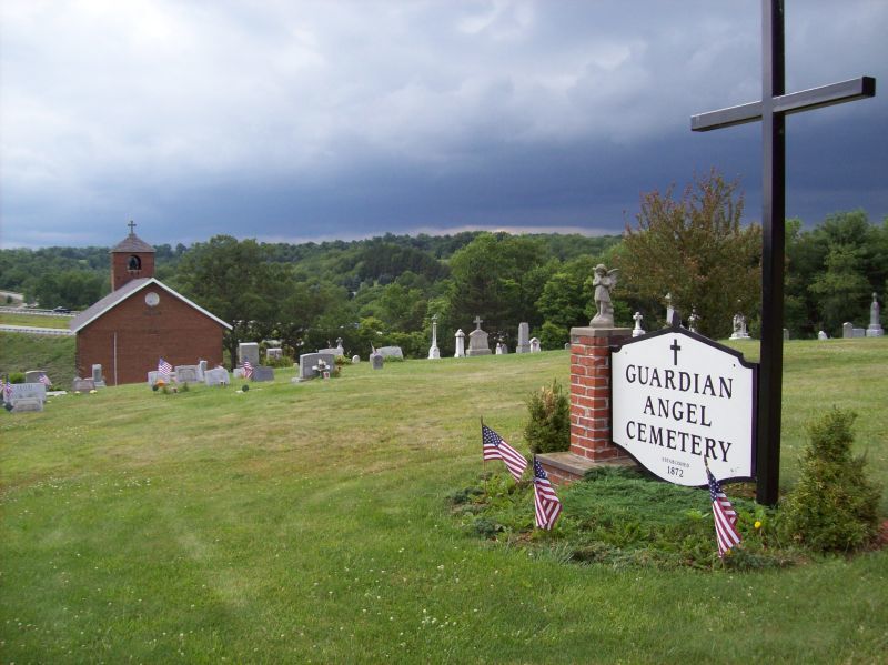
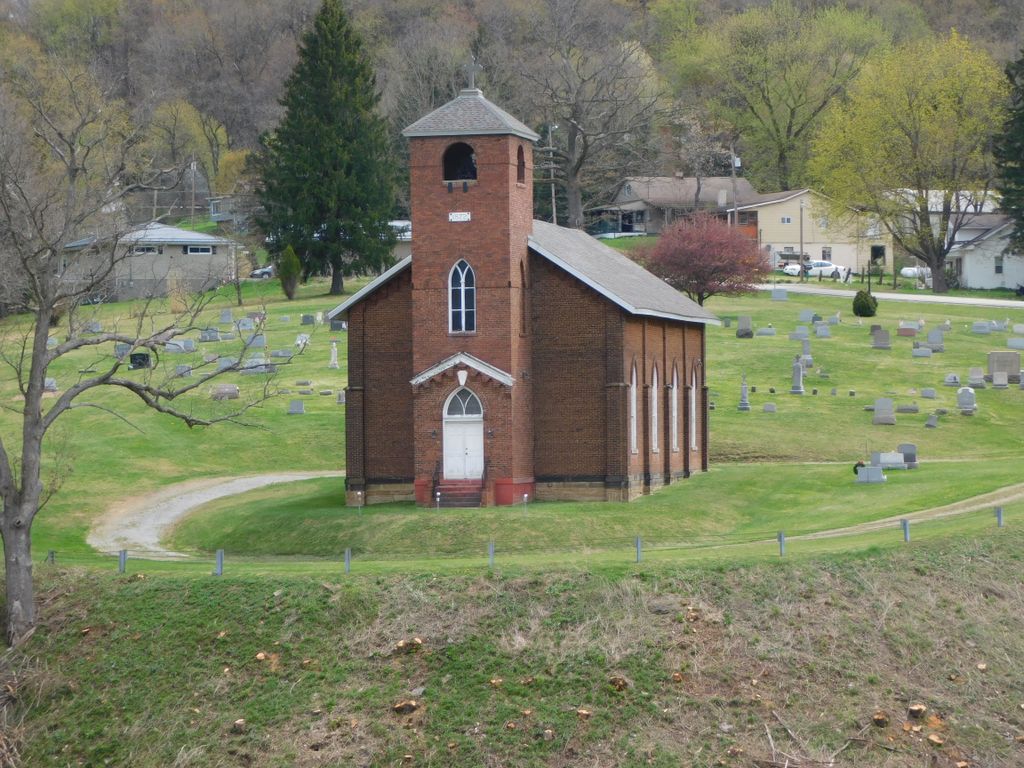
| Description | : | HGA stands for Holy Guardian Angel Church, although it is mostly known just as Guardian Angel Church. It was the first Roman Catholic church in the area. The church is no longer used except on Christmas Eve, but you can peek in the windows if you care to glimpse the interior. The attached old cemetery is still in use for current burials (2016) Up until after the American Revolution in 1776, Pennsylvania law prohibited Catholic churches from being built, although they did allow meeting houses (such as the Quakers had) or Catholic Chapels. About 1800, Casper W. Easley, Sr received this... Read More |
frequently asked questions (FAQ):
-
Where is Guardian Angel Cemetery?
Guardian Angel Cemetery is located at Rt. 28 - Cadogan Slate Lick Road North Buffalo Township, Armstrong County ,Pennsylvania , 16201USA.
-
Guardian Angel Cemetery cemetery's updated grave count on graveviews.com?
0 memorials
-
Where are the coordinates of the Guardian Angel Cemetery?
Latitude: 40.7673000
Longitude: -79.6116000
Nearby Cemetories:
1. Union Baptist Cemetery
North Buffalo, Armstrong County, USA
Coordinate: 40.7663100, -79.5899400
2. Slate Lick United Presbyterian Cemetery
Slate Lick, Armstrong County, USA
Coordinate: 40.7633890, -79.6387230
3. Buffalo United Presbyterian Church Cemetery
Slate Lick, Armstrong County, USA
Coordinate: 40.7706940, -79.6408260
4. Slate Lick Cemetery
Slate Lick, Armstrong County, USA
Coordinate: 40.7680397, -79.6423721
5. Saint Francis DePaul Cemetery
Cadogan, Armstrong County, USA
Coordinate: 40.7432000, -79.5955000
6. Biblical Life Institute Grounds
Freeport, Armstrong County, USA
Coordinate: 40.7473650, -79.6468650
7. Grace Brethren Church Cemetery
Center Hill, Armstrong County, USA
Coordinate: 40.7962720, -79.5785880
8. Blue Slate Cemetery
Slate Lick, Armstrong County, USA
Coordinate: 40.7604600, -79.6629490
9. Bonner Cemetery
Center Hill, Armstrong County, USA
Coordinate: 40.7958130, -79.5754020
10. Center Hill Church of the Brethren Cemetery
Center Hill, Armstrong County, USA
Coordinate: 40.7962350, -79.5759060
11. McVille Union Cemetery
McVille, Armstrong County, USA
Coordinate: 40.7275848, -79.6052933
12. Green Cemetery
Armstrong County, USA
Coordinate: 40.7626839, -79.5522919
13. Cowan Cemetery
North Buffalo, Armstrong County, USA
Coordinate: 40.7877998, -79.5507965
14. Mud Church Cemetery
Freeport, Armstrong County, USA
Coordinate: 40.7260050, -79.6556400
15. Homewood Baptist Church Cemetery
Ford City, Armstrong County, USA
Coordinate: 40.7266000, -79.5616000
16. West Glade Run Presbyterian Cemetery
Armstrong County, USA
Coordinate: 40.8225000, -79.5857000
17. Appleby Manor Presbyterian Church Cemetery
Ford City, Armstrong County, USA
Coordinate: 40.7539300, -79.5269720
18. Ford City Cemetery
Ford City, Armstrong County, USA
Coordinate: 40.7528570, -79.5239460
19. Holy Trinity Cemetery
Ford City, Armstrong County, USA
Coordinate: 40.7571983, -79.5216980
20. Fort Run Cemetery
Manor Township, Armstrong County, USA
Coordinate: 40.7823460, -79.5224960
21. Saint Mary's Roman Catholic Cemetery
Ford City, Armstrong County, USA
Coordinate: 40.7599983, -79.5180969
22. Saint Mary's Ukrainian Catholic Cemetery
Ford City, Armstrong County, USA
Coordinate: 40.7467003, -79.5205994
23. Oakland Methodist Cemetery
Ford City, Armstrong County, USA
Coordinate: 40.7217865, -79.5342789
24. Silvis Cemetery
Forks Church, Armstrong County, USA
Coordinate: 40.6948260, -79.5841460


