
| Memorials | : | 0 |
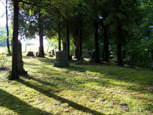
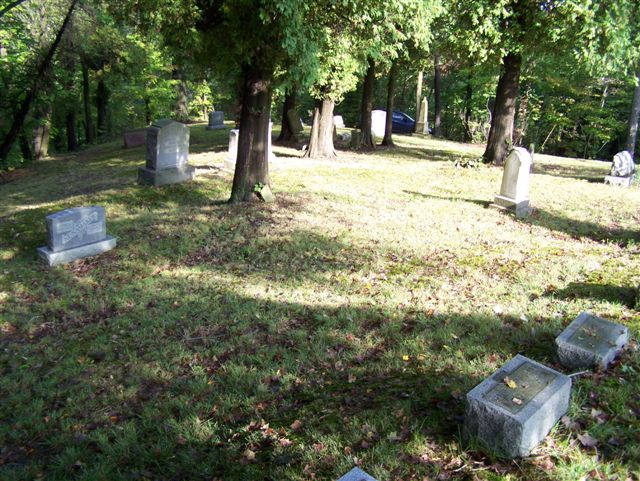
| Location | : | Ford City, Armstrong County, USA |
| Coordinate | : | 40.7217865, -79.5342789 |
| Description | : | From the intersection of the U.S. Route 422 bridge and Pennsylvania Route 66, in Kittanning, PA, take Route 66 South and drive 5.25 miles, to the intersection of Montgomery Flats Road. Turn left onto Montgomery Flats Rd. and drive 100 yards up the hill. The cemetery is on the right, less then 100 yards up Montgomery Flats Road, from Route 66. If you pass Garda's Restaurant or cross the Crooked Creek Bridge, you have gone too far and missed this road. This turn off is on a sharp bend and is somewhat easy to miss. |
frequently asked questions (FAQ):
-
Where is Oakland Methodist Cemetery?
Oakland Methodist Cemetery is located at Ford City, Armstrong County ,Pennsylvania ,USA.
-
Oakland Methodist Cemetery cemetery's updated grave count on graveviews.com?
0 memorials
-
Where are the coordinates of the Oakland Methodist Cemetery?
Latitude: 40.7217865
Longitude: -79.5342789
Nearby Cemetories:
1. Crooked Creek Presbyterian Cemetery
Ford City, Armstrong County, USA
Coordinate: 40.7104000, -79.5197000
2. Homewood Baptist Church Cemetery
Ford City, Armstrong County, USA
Coordinate: 40.7266000, -79.5616000
3. Bethel Lutheran Church Cemetery
Ford City, Armstrong County, USA
Coordinate: 40.6969290, -79.5336720
4. Saint Mary's Ukrainian Catholic Cemetery
Ford City, Armstrong County, USA
Coordinate: 40.7467003, -79.5205994
5. Ford City Cemetery
Ford City, Armstrong County, USA
Coordinate: 40.7528570, -79.5239460
6. Appleby Manor Presbyterian Church Cemetery
Ford City, Armstrong County, USA
Coordinate: 40.7539300, -79.5269720
7. Holy Trinity Cemetery
Ford City, Armstrong County, USA
Coordinate: 40.7571983, -79.5216980
8. Saint Mary's Roman Catholic Cemetery
Ford City, Armstrong County, USA
Coordinate: 40.7599983, -79.5180969
9. Green Cemetery
Armstrong County, USA
Coordinate: 40.7626839, -79.5522919
10. Smail Family Cemetery
North Vandergrift, Armstrong County, USA
Coordinate: 40.6781730, -79.5466050
11. Shotts Cemetery
Armstrong County, USA
Coordinate: 40.7186012, -79.4753036
12. Silvis Cemetery
Forks Church, Armstrong County, USA
Coordinate: 40.6948260, -79.5841460
13. Saint Francis DePaul Cemetery
Cadogan, Armstrong County, USA
Coordinate: 40.7432000, -79.5955000
14. McVille Union Cemetery
McVille, Armstrong County, USA
Coordinate: 40.7275848, -79.6052933
15. Saint John's Lutheran Church Cemetery
Ford City, Armstrong County, USA
Coordinate: 40.7197037, -79.4614410
16. Fort Run Cemetery
Manor Township, Armstrong County, USA
Coordinate: 40.7823460, -79.5224960
17. Union Baptist Cemetery
North Buffalo, Armstrong County, USA
Coordinate: 40.7663100, -79.5899400
18. Porter Cemetery
Armstrong County, USA
Coordinate: 40.6618996, -79.5147018
19. Heilman Emmanuel Evangelical Lutheran Cemetery
Heilman, Armstrong County, USA
Coordinate: 40.7588959, -79.4687347
20. Black Cemetery
Kittanning, Armstrong County, USA
Coordinate: 40.7764060, -79.4860300
21. Cowan Cemetery
North Buffalo, Armstrong County, USA
Coordinate: 40.7877998, -79.5507965
22. Forks-Zion Lutheran Evangelical Church Cemetery
Leechburg, Armstrong County, USA
Coordinate: 40.6746490, -79.5986510
23. Dunkard Baptist Christian Bretheren Cemetery
Cochrans Mills, Armstrong County, USA
Coordinate: 40.6697655, -79.4726105
24. Cochrans Mill United Methodist Church Cemetery
Cochrans Mills, Armstrong County, USA
Coordinate: 40.6706000, -79.4700000