
| Memorials | : | 0 |
| Location | : | Clay County, USA |
| Coordinate | : | 33.1360016, -85.8889999 |
frequently asked questions (FAQ):
-
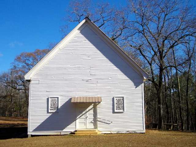
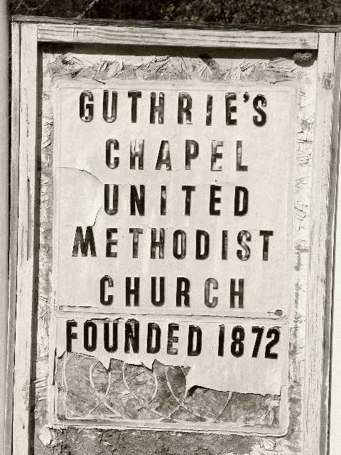
Where is Guthrie Chapel Cemetery?
Guthrie Chapel Cemetery is located at Clay County ,Alabama ,USA.
-
Guthrie Chapel Cemetery cemetery's updated grave count on graveviews.com?
0 memorials
-
Where are the coordinates of the Guthrie Chapel Cemetery?
Latitude: 33.1360016
Longitude: -85.8889999
Nearby Cemetories:
1. Mount Zion Missionary Baptist Cemetery
Ashland, Clay County, USA
Coordinate: 33.1512060, -85.8667370
2. Old Providence Baptist Church Cemetery
Tallapoosa County, USA
Coordinate: 33.0980988, -85.9225006
3. Mount Ararat Cemetery
Gibsonville, Clay County, USA
Coordinate: 33.1594009, -85.8377991
4. Patterson Cemetery
Clay County, USA
Coordinate: 33.1500015, -85.8300018
5. New Hope Cemetery
Tallapoosa County, USA
Coordinate: 33.0894012, -85.8527985
6. Liberty United Methodist Church Cemetery
Tallapoosa County, USA
Coordinate: 33.1041985, -85.9447021
7. Millerville Baptist Church Cemetery
Millerville, Clay County, USA
Coordinate: 33.1892014, -85.9300003
8. New Hope Cemetery
Clay County, USA
Coordinate: 33.1093010, -85.9580610
9. Bethel Christian Church Cemetery
Ashland, Clay County, USA
Coordinate: 33.2020790, -85.8950860
10. Bethel Baptist Church Cemetery
Cragford, Clay County, USA
Coordinate: 33.1156006, -85.8125000
11. Brown Cemetery
Clay County, USA
Coordinate: 33.1741982, -85.8217010
12. Big Springs Baptist Church Cemetery
Clay County, USA
Coordinate: 33.2052994, -85.8783035
13. Dillard Cemetery
Alexander City, Tallapoosa County, USA
Coordinate: 33.0905991, -85.9638977
14. Pleasant Home Missionary Baptist Church Cemetery
Millerville, Clay County, USA
Coordinate: 33.1276100, -85.9843400
15. Mount Carmel Cemetery
Clay County, USA
Coordinate: 33.1669006, -85.7994003
16. Hackneyville Presbyterian Cemetery
Tallapoosa County, USA
Coordinate: 33.0616989, -85.9306030
17. Hackneyville Cemetery
Tallapoosa County, USA
Coordinate: 33.0621986, -85.9344025
18. Rock Springs Baptist Church Cemetery
Clay County, USA
Coordinate: 33.1403008, -85.9891968
19. New Prospect Baptist Church Cemetery
Ashland, Clay County, USA
Coordinate: 33.2038990, -85.8268970
20. Hillabee Campground Cemetery
Tallapoosa City, Tallapoosa County, USA
Coordinate: 33.0485992, -85.9044037
21. Oak Chapel Baptist Church Cemetery
Millerville, Clay County, USA
Coordinate: 33.1314000, -85.9956000
22. New Prospect Primitive Baptist Church Cemetery
Millerville, Clay County, USA
Coordinate: 33.1134515, -85.9924667
23. Old Liberty Hill Cemetery
Clay County, USA
Coordinate: 33.2230988, -85.8632965
24. Wilsons Cemetery
Clay County, USA
Coordinate: 33.2083015, -85.9546967