
| Memorials | : | 0 |
| Location | : | Hardenberg, Hardenberg Municipality, Netherlands |
| Coordinate | : | 52.5756500, 6.6225300 |
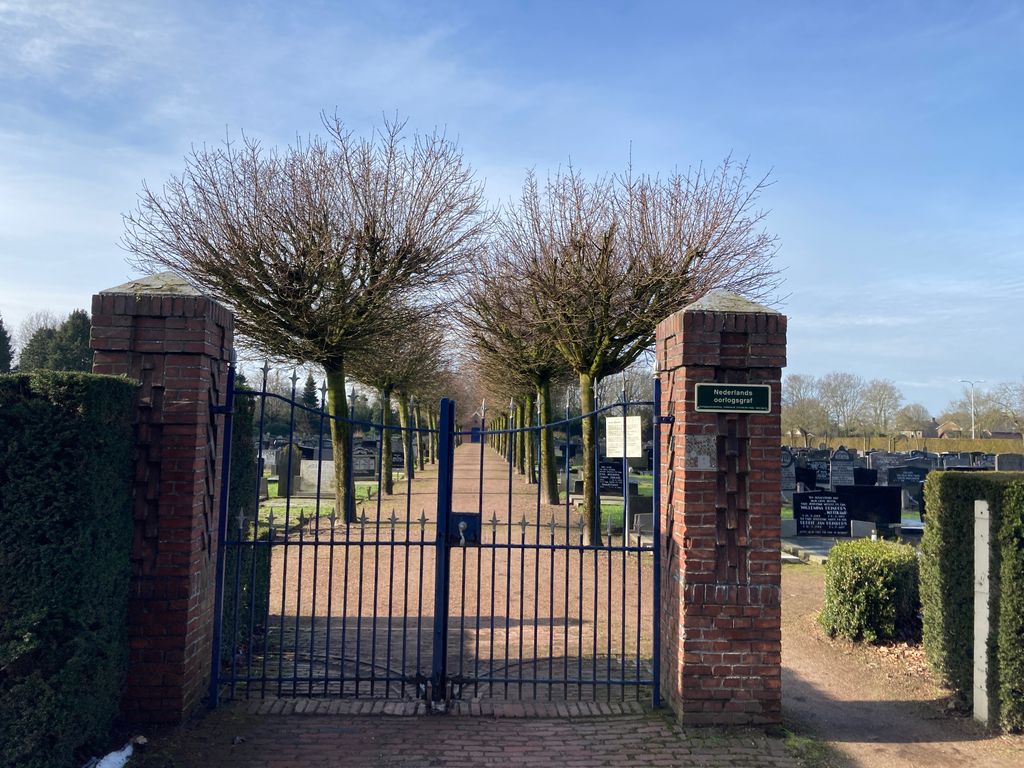
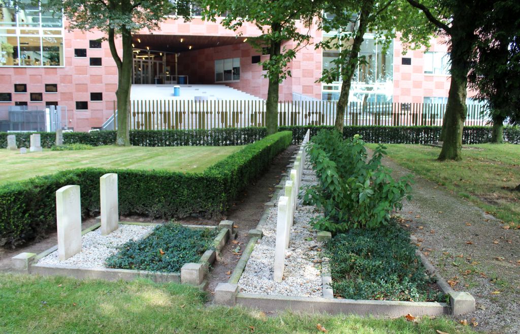
| Description | : | Hardenberg is a small town 38 kilometres north-east of Zwolle, on the road to Coevorden. The cemetery is on the eastern side of the town, about 500 yards north-west of the station. In this cemetery can be found the graves of 22 airmen who crashed or were shot down during the war years. |
frequently asked questions (FAQ):
-
Where is Hardenberg Protestant Cemetery?
Hardenberg Protestant Cemetery is located at Hardenberg, Hardenberg Municipality ,Overijssel ,Netherlands.
-
Hardenberg Protestant Cemetery cemetery's updated grave count on graveviews.com?
0 memorials
-
Where are the coordinates of the Hardenberg Protestant Cemetery?
Latitude: 52.5756500
Longitude: 6.6225300

Nearby Cemetories:
1. Joodse Begraafplaats Mulopad
Hardenberg, Hardenberg Municipality, Netherlands
Coordinate: 52.5757000, 6.6270500
2. Bruchterweg cemetery
Hardenberg, Hardenberg Municipality, Netherlands
Coordinate: 52.5691800, 6.6209900
3. Joodse Begraafplaats 't Holt
Hardenberg, Hardenberg Municipality, Netherlands
Coordinate: 52.5827300, 6.6293800
4. Gramsbergen General Cemetery
Gramsbergen, Hardenberg Municipality, Netherlands
Coordinate: 52.6101600, 6.6607200
5. Lutten General Cemetery
Lutten, Hardenberg Municipality, Netherlands
Coordinate: 52.6113400, 6.5772100
6. Evangelischer Friedhof Laar Möhlenkampstraße
Duisburg, Stadtkreis Duisburg, Germany
Coordinate: 52.6139410, 6.7396830
7. Dedemsvaart Achterveld Cemetery
Dedemsvaart, Hardenberg Municipality, Netherlands
Coordinate: 52.6146500, 6.4740300
8. Dedemsvaart Roman Catholic cemetery
Dedemsvaart, Hardenberg Municipality, Netherlands
Coordinate: 52.6064800, 6.4597800
9. Joodse Begraafplaats
Dedemsvaart, Hardenberg Municipality, Netherlands
Coordinate: 52.6104000, 6.4391940
10. Joodse begraafplaats
Coevorden, Coevorden Municipality, Netherlands
Coordinate: 52.6712850, 6.7349550
11. Coevorden Oude Begraafplaats
Ballast, Coevorden Municipality, Netherlands
Coordinate: 52.6713700, 6.7362900
12. Tubbergen-Langeveen Cemetery
Langeveen, Tubbergen Municipality, Netherlands
Coordinate: 52.4702076, 6.7130924
13. Coevorden Nieuwe Begraafplaats
Ballast, Coevorden Municipality, Netherlands
Coordinate: 52.6729900, 6.7367800
14. Ommen General Cemetery
Ommen, Ommen Municipality, Netherlands
Coordinate: 52.5222700, 6.4291600
15. Den Ham Dennenhof Begraafplaats
Den Ham, Twenterand Municipality, Netherlands
Coordinate: 52.4598900, 6.5267100
16. Joodse Begraafplaats
Ommen Municipality, Netherlands
Coordinate: 52.5206110, 6.4277220
17. Erika Concentration Camp
Ommen, Ommen Municipality, Netherlands
Coordinate: 52.5041670, 6.4422220
18. Nieuwe Joodse begraafplaats
Den Ham, Twenterand Municipality, Netherlands
Coordinate: 52.4612706, 6.5076857
19. Den Ham General Cemetery
Den Ham, Twenterand Municipality, Netherlands
Coordinate: 52.4611700, 6.5034300
20. Hollandscheveld General Cemetery
Hollandscheveld, Hoogeveen Municipality, Netherlands
Coordinate: 52.7080900, 6.5462100
21. Dalen Protestant Churchyard
Dalen, Coevorden Municipality, Netherlands
Coordinate: 52.6970500, 6.7547900
22. Begraafplaats Laarmanshoek
Ommen, Ommen Municipality, Netherlands
Coordinate: 52.5117290, 6.3976338
23. Oud-Avereest General Cemetery
Oud-Avereest, Hardenberg Municipality, Netherlands
Coordinate: 52.6200500, 6.3711200
24. Vriezenveen General Cemetery
Vriezenveen, Twenterand Municipality, Netherlands
Coordinate: 52.4137100, 6.6248400