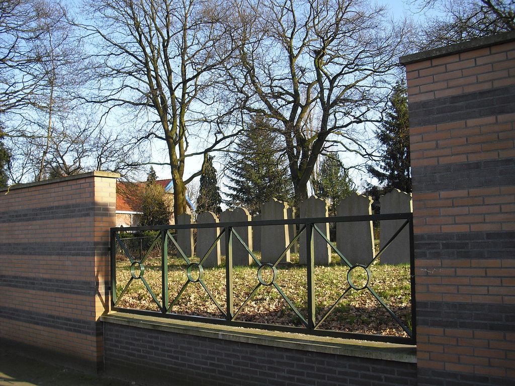
| Memorials | : | 0 |
| Location | : | Hardenberg, Hardenberg Municipality, Netherlands |
| Coordinate | : | 52.5757000, 6.6270500 |
| Description | : | Established in the first decade of the 20th century. The last burial took place in 1941 at the cemetery. During the Second World War, the Germans used various gravestones for target practice, leaving some of them in very poor condition. In 1995, a wall and entrance gate was added. |
frequently asked questions (FAQ):
-
Where is Joodse Begraafplaats Mulopad?
Joodse Begraafplaats Mulopad is located at Mulopad Hardenberg, Hardenberg Municipality ,Overijssel , 7772XPNetherlands.
-
Joodse Begraafplaats Mulopad cemetery's updated grave count on graveviews.com?
0 memorials
-
Where are the coordinates of the Joodse Begraafplaats Mulopad?
Latitude: 52.5757000
Longitude: 6.6270500
Nearby Cemetories:
1. Hardenberg Protestant Cemetery
Hardenberg, Hardenberg Municipality, Netherlands
Coordinate: 52.5756500, 6.6225300
2. Joodse Begraafplaats 't Holt
Hardenberg, Hardenberg Municipality, Netherlands
Coordinate: 52.5827300, 6.6293800
3. Bruchterweg cemetery
Hardenberg, Hardenberg Municipality, Netherlands
Coordinate: 52.5691800, 6.6209900
4. Gramsbergen General Cemetery
Gramsbergen, Hardenberg Municipality, Netherlands
Coordinate: 52.6101600, 6.6607200
5. Lutten General Cemetery
Lutten, Hardenberg Municipality, Netherlands
Coordinate: 52.6113400, 6.5772100
6. Evangelischer Friedhof Laar Möhlenkampstraße
Duisburg, Stadtkreis Duisburg, Germany
Coordinate: 52.6139410, 6.7396830
7. Dedemsvaart Achterveld Cemetery
Dedemsvaart, Hardenberg Municipality, Netherlands
Coordinate: 52.6146500, 6.4740300
8. Dedemsvaart Roman Catholic cemetery
Dedemsvaart, Hardenberg Municipality, Netherlands
Coordinate: 52.6064800, 6.4597800
9. Joodse begraafplaats
Coevorden, Coevorden Municipality, Netherlands
Coordinate: 52.6712850, 6.7349550
10. Coevorden Oude Begraafplaats
Ballast, Coevorden Municipality, Netherlands
Coordinate: 52.6713700, 6.7362900
11. Tubbergen-Langeveen Cemetery
Langeveen, Tubbergen Municipality, Netherlands
Coordinate: 52.4702076, 6.7130924
12. Coevorden Nieuwe Begraafplaats
Ballast, Coevorden Municipality, Netherlands
Coordinate: 52.6729900, 6.7367800
13. Joodse Begraafplaats
Dedemsvaart, Hardenberg Municipality, Netherlands
Coordinate: 52.6104000, 6.4391940
14. Den Ham Dennenhof Begraafplaats
Den Ham, Twenterand Municipality, Netherlands
Coordinate: 52.4598900, 6.5267100
15. Ommen General Cemetery
Ommen, Ommen Municipality, Netherlands
Coordinate: 52.5222700, 6.4291600
16. Joodse Begraafplaats
Ommen Municipality, Netherlands
Coordinate: 52.5206110, 6.4277220
17. Erika Concentration Camp
Ommen, Ommen Municipality, Netherlands
Coordinate: 52.5041670, 6.4422220
18. Nieuwe Joodse begraafplaats
Den Ham, Twenterand Municipality, Netherlands
Coordinate: 52.4612706, 6.5076857
19. Den Ham General Cemetery
Den Ham, Twenterand Municipality, Netherlands
Coordinate: 52.4611700, 6.5034300
20. Hollandscheveld General Cemetery
Hollandscheveld, Hoogeveen Municipality, Netherlands
Coordinate: 52.7080900, 6.5462100
21. Dalen Protestant Churchyard
Dalen, Coevorden Municipality, Netherlands
Coordinate: 52.6970500, 6.7547900
22. Begraafplaats Laarmanshoek
Ommen, Ommen Municipality, Netherlands
Coordinate: 52.5117290, 6.3976338
23. Oud-Avereest General Cemetery
Oud-Avereest, Hardenberg Municipality, Netherlands
Coordinate: 52.6200500, 6.3711200
24. Vriezenveen General Cemetery
Vriezenveen, Twenterand Municipality, Netherlands
Coordinate: 52.4137100, 6.6248400

