
| Memorials | : | 0 |
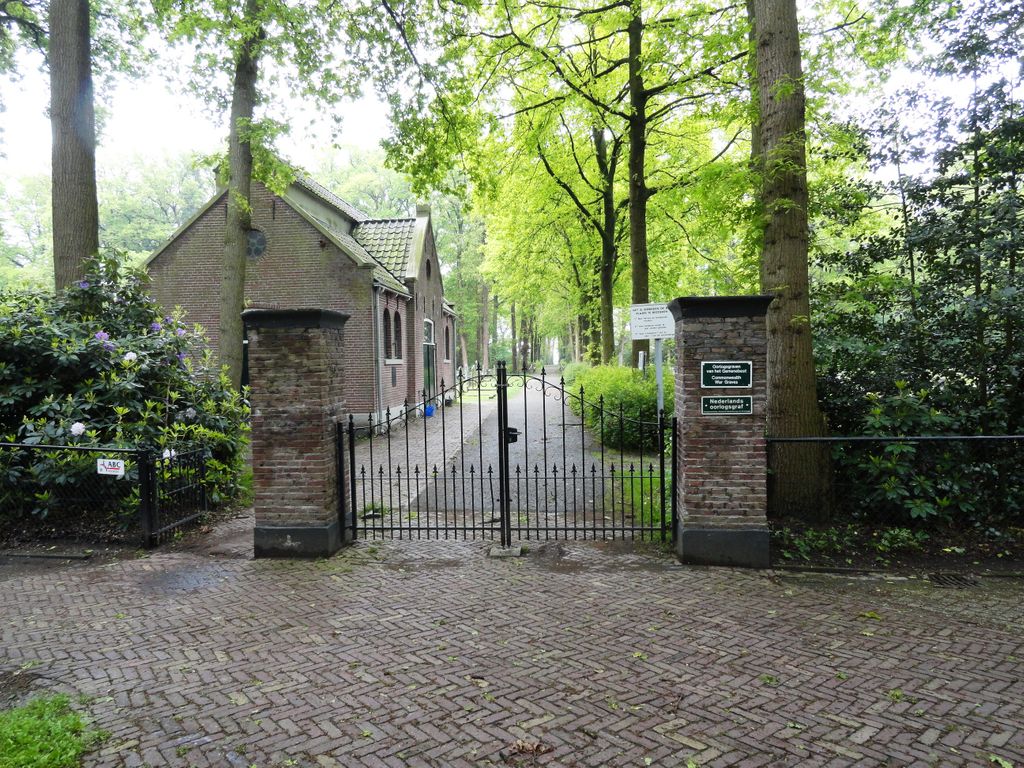
| Location | : | Hollandscheveld, Hoogeveen Municipality, Netherlands |
| Coordinate | : | 52.7080900, 6.5462100 |
frequently asked questions (FAQ):
-
Where is Hollandscheveld General Cemetery?
Hollandscheveld General Cemetery is located at Hollandscheveld, Hoogeveen Municipality ,Drenthe ,Netherlands.
-
Hollandscheveld General Cemetery cemetery's updated grave count on graveviews.com?
0 memorials
-
Where are the coordinates of the Hollandscheveld General Cemetery?
Latitude: 52.7080900
Longitude: 6.5462100
Nearby Cemetories:
1. Oude Joodse Begraafplaats
Hoogeveen Municipality, Netherlands
Coordinate: 52.7254000, 6.4816800
2. Joodse Begraafplaats Zuidweg
Hoogeveen, Hoogeveen Municipality, Netherlands
Coordinate: 52.7171500, 6.4715800
3. Nieuwe begraafplaats
Hoogeveen, Hoogeveen Municipality, Netherlands
Coordinate: 52.7159100, 6.4674200
4. Lutten General Cemetery
Lutten, Hardenberg Municipality, Netherlands
Coordinate: 52.6113400, 6.5772100
5. Dedemsvaart Achterveld Cemetery
Dedemsvaart, Hardenberg Municipality, Netherlands
Coordinate: 52.6146500, 6.4740300
6. Joodse Begraafplaats
Gees, Coevorden Municipality, Netherlands
Coordinate: 52.7492000, 6.7080000
7. Oosterhesselen Geesbrug General Cemetery
Oosterhesselen, Coevorden Municipality, Netherlands
Coordinate: 52.7552100, 6.7119900
8. Dedemsvaart Roman Catholic cemetery
Dedemsvaart, Hardenberg Municipality, Netherlands
Coordinate: 52.6064800, 6.4597800
9. Joodse Begraafplaats
Dedemsvaart, Hardenberg Municipality, Netherlands
Coordinate: 52.6104000, 6.4391940
10. Joodse Begraafplaats
Ruinen, De Wolden Municipality, Netherlands
Coordinate: 52.7654800, 6.3722500
11. Gramsbergen General Cemetery
Gramsbergen, Hardenberg Municipality, Netherlands
Coordinate: 52.6101600, 6.6607200
12. Joodse begraafplaats
Coevorden, Coevorden Municipality, Netherlands
Coordinate: 52.6712850, 6.7349550
13. Coevorden Nieuwe Begraafplaats
Ballast, Coevorden Municipality, Netherlands
Coordinate: 52.6729900, 6.7367800
14. Coevorden Oude Begraafplaats
Ballast, Coevorden Municipality, Netherlands
Coordinate: 52.6713700, 6.7362900
15. Dalen Protestant Churchyard
Dalen, Coevorden Municipality, Netherlands
Coordinate: 52.6970500, 6.7547900
16. Witteveen Communal Cemetery
Witteveen, Midden-Drenthe Municipality, Netherlands
Coordinate: 52.8106200, 6.6705900
17. Joodse Begraafplaats 't Holt
Hardenberg, Hardenberg Municipality, Netherlands
Coordinate: 52.5827300, 6.6293800
18. Oud-Avereest General Cemetery
Oud-Avereest, Hardenberg Municipality, Netherlands
Coordinate: 52.6200500, 6.3711200
19. Hardenberg Protestant Cemetery
Hardenberg, Hardenberg Municipality, Netherlands
Coordinate: 52.5756500, 6.6225300
20. Joodse Begraafplaats Mulopad
Hardenberg, Hardenberg Municipality, Netherlands
Coordinate: 52.5757000, 6.6270500
21. Bruchterweg cemetery
Hardenberg, Hardenberg Municipality, Netherlands
Coordinate: 52.5691800, 6.6209900
22. Westerbork General Cemetery
Westerbork, Midden-Drenthe Municipality, Netherlands
Coordinate: 52.8523100, 6.6100500
23. Evangelischer Friedhof Laar Möhlenkampstraße
Duisburg, Stadtkreis Duisburg, Germany
Coordinate: 52.6139410, 6.7396830
24. Beilen General Cemetery
Beilen, Midden-Drenthe Municipality, Netherlands
Coordinate: 52.8576500, 6.5139600