
| Memorials | : | 0 |
| Location | : | Buckhead, Fulton County, USA |
| Coordinate | : | 33.8440800, -84.3919200 |
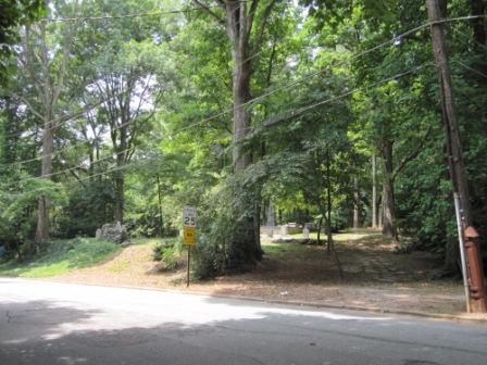
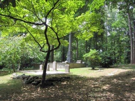
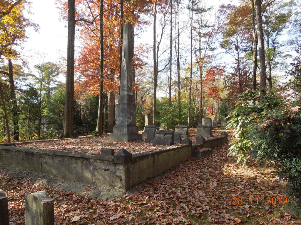
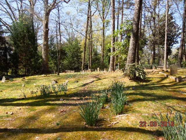
| Description | : | "Located on the southwest intersection of West Paces Ferry and Chatham Roads. Land Lot #114, 17th District, Fulton County, Buckhead Distritc. Prior to about 1925 the lot adjoining the cemetery to the west, and now occupied by a (private) residence, was the site of a frame country church known as Harmony Grove Baptist. (Originally) recorded Nov 5, 1930." Source: Garrett's Necrology, Kenan Research Library, Atlanta History Center. |
frequently asked questions (FAQ):
-
Where is Harmony Grove Cemetery?
Harmony Grove Cemetery is located at Buckhead, Fulton County ,Georgia ,USA.
-
Harmony Grove Cemetery cemetery's updated grave count on graveviews.com?
0 memorials
-
Where are the coordinates of the Harmony Grove Cemetery?
Latitude: 33.8440800
Longitude: -84.3919200
Nearby Cemetories:
1. Peachtree Presbyterian Church Columbarium
Atlanta, Fulton County, USA
Coordinate: 33.8473360, -84.3826100
2. New Hope African Methodist Episcopal Cemetery
Atlanta, Fulton County, USA
Coordinate: 33.8376200, -84.4042500
3. Peachtree Road United Methodist Church Columbarium
Atlanta, Fulton County, USA
Coordinate: 33.8418770, -84.3756460
4. Cathedral of Saint Philip Memorial Garden
Atlanta, Fulton County, USA
Coordinate: 33.8301000, -84.3874300
5. Sardis United Methodist Church Cemetery
Atlanta, Fulton County, USA
Coordinate: 33.8577900, -84.3840400
6. Northside United Methodist Church Memorial Garden
Atlanta, Fulton County, USA
Coordinate: 33.8313500, -84.4060600
7. Mount Olive Cemetery
Buckhead, Fulton County, USA
Coordinate: 33.8368300, -84.3725900
8. Winecoff Hotel Historical Marker
Atlanta, Fulton County, USA
Coordinate: 33.8248610, -84.3877780
9. Trinity Presbyterian Church Memorial Gardens
Atlanta, Fulton County, USA
Coordinate: 33.8374180, -84.4173650
10. Saint Anne's Episcopal Church Memorial Garden
Atlanta, Fulton County, USA
Coordinate: 33.8395200, -84.4184900
11. Fulton County Almshouse Cemetery
Buckhead, Fulton County, USA
Coordinate: 33.8694740, -84.3905110
12. Piney Grove Cemetery
Atlanta, Fulton County, USA
Coordinate: 33.8297500, -84.3591900
13. Holy Spirit Catholic Church Memorial Garden
Atlanta, Fulton County, USA
Coordinate: 33.8771400, -84.4113540
14. Pleasant Hill Cemetery
Atlanta, Fulton County, USA
Coordinate: 33.8538670, -84.4381500
15. Saint James United Methodist Memorial Garden
Atlanta, Fulton County, USA
Coordinate: 33.8746740, -84.3590390
16. Smith Family Cemetery
Atlanta, Fulton County, USA
Coordinate: 33.8221100, -84.4344900
17. Northside Park Baptist Church Cemetery
Atlanta, Fulton County, USA
Coordinate: 33.8061870, -84.4127510
18. Old Mount Zion Cemetery
Atlanta, Fulton County, USA
Coordinate: 33.8061800, -84.4128000
19. Mount Paran Baptist Church Cemetery
Atlanta, Fulton County, USA
Coordinate: 33.8866000, -84.3999700
20. Rock Spring Presbyterian Church Cemetery
Atlanta, Fulton County, USA
Coordinate: 33.8050200, -84.3678000
21. Peachtree Christian Church
Atlanta, Fulton County, USA
Coordinate: 33.7969090, -84.3897290
22. Episcopal Church of the Atonement Memorial Gardens
Sandy Springs, Fulton County, USA
Coordinate: 33.8898110, -84.3669870
23. First Presbyterian Church Memorial Garden
Atlanta, Fulton County, USA
Coordinate: 33.7908050, -84.3855460
24. Unitarian Universalist Congregation of Atlanta Mem
Atlanta, Fulton County, USA
Coordinate: 33.8357860, -84.3261390