
| Memorials | : | 0 |
| Location | : | Atlanta, Fulton County, USA |
| Coordinate | : | 33.8577900, -84.3840400 |
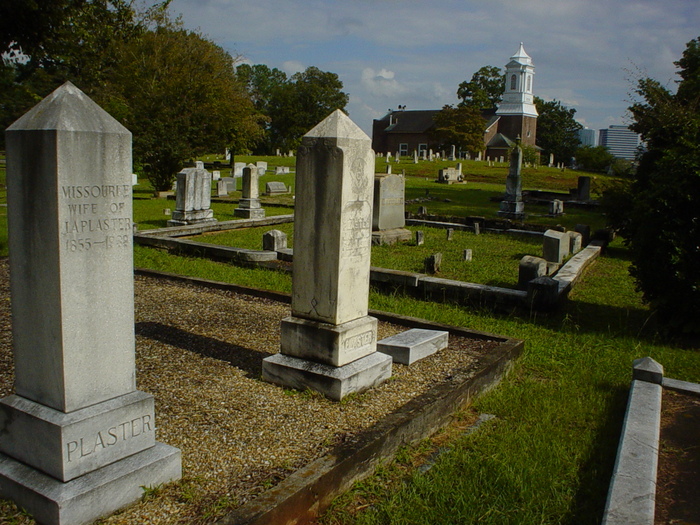
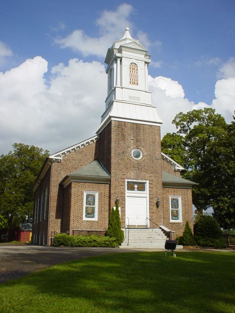
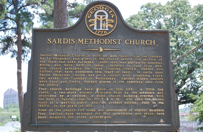
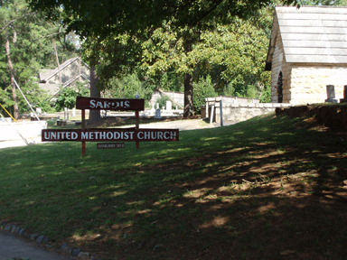
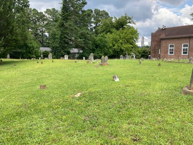
| Description | : | According to church accounts, Sardis Cemetery has over 750 burials. Many of these are unmarked and some are only crudely marked by rocks. The earliest documented burial in the cemetery (John W. Williams) dates to 1869. However, it appears from deed records that most of the current cemetery property was deeded to the Trustees of Sardis Methodist Church by Silas H. Donaldson in 1888 and 1894. In 1975, the members of Sardis UMC organized and incorporated the Sardis Cemetery Association to help preserve the cemetery through a perpetual care arrangement. Sardis Cemetery contains the graves of many of Buckhead's earliest... Read More |
frequently asked questions (FAQ):
-
Where is Sardis United Methodist Church Cemetery?
Sardis United Methodist Church Cemetery is located at Powers Ferry Road at Roswell Road, Buckhead Atlanta, Fulton County ,Georgia ,USA.
-
Sardis United Methodist Church Cemetery cemetery's updated grave count on graveviews.com?
0 memorials
-
Where are the coordinates of the Sardis United Methodist Church Cemetery?
Latitude: 33.8577900
Longitude: -84.3840400
Nearby Cemetories:
1. Peachtree Presbyterian Church Columbarium
Atlanta, Fulton County, USA
Coordinate: 33.8473360, -84.3826100
2. Fulton County Almshouse Cemetery
Buckhead, Fulton County, USA
Coordinate: 33.8694740, -84.3905110
3. Harmony Grove Cemetery
Buckhead, Fulton County, USA
Coordinate: 33.8440800, -84.3919200
4. Peachtree Road United Methodist Church Columbarium
Atlanta, Fulton County, USA
Coordinate: 33.8418770, -84.3756460
5. Mount Olive Cemetery
Buckhead, Fulton County, USA
Coordinate: 33.8368300, -84.3725900
6. New Hope African Methodist Episcopal Cemetery
Atlanta, Fulton County, USA
Coordinate: 33.8376200, -84.4042500
7. Saint James United Methodist Memorial Garden
Atlanta, Fulton County, USA
Coordinate: 33.8746740, -84.3590390
8. Cathedral of Saint Philip Memorial Garden
Atlanta, Fulton County, USA
Coordinate: 33.8301000, -84.3874300
9. Holy Spirit Catholic Church Memorial Garden
Atlanta, Fulton County, USA
Coordinate: 33.8771400, -84.4113540
10. Mount Paran Baptist Church Cemetery
Atlanta, Fulton County, USA
Coordinate: 33.8866000, -84.3999700
11. Northside United Methodist Church Memorial Garden
Atlanta, Fulton County, USA
Coordinate: 33.8313500, -84.4060600
12. Winecoff Hotel Historical Marker
Atlanta, Fulton County, USA
Coordinate: 33.8248610, -84.3877780
13. Saint Anne's Episcopal Church Memorial Garden
Atlanta, Fulton County, USA
Coordinate: 33.8395200, -84.4184900
14. Trinity Presbyterian Church Memorial Gardens
Atlanta, Fulton County, USA
Coordinate: 33.8374180, -84.4173650
15. Piney Grove Cemetery
Atlanta, Fulton County, USA
Coordinate: 33.8297500, -84.3591900
16. Episcopal Church of the Atonement Memorial Gardens
Sandy Springs, Fulton County, USA
Coordinate: 33.8898110, -84.3669870
17. Pleasant Hill Cemetery
Atlanta, Fulton County, USA
Coordinate: 33.8538670, -84.4381500
18. Oglethorpe Presbyterian Church Cemetery
Brookhaven, DeKalb County, USA
Coordinate: 33.8763597, -84.3310164
19. Saint Martin In the Fields Episcopal Columbarium
DeKalb County, USA
Coordinate: 33.8794570, -84.3279650
20. Unitarian Universalist Congregation of Atlanta Mem
Atlanta, Fulton County, USA
Coordinate: 33.8357860, -84.3261390
21. Rock Spring Presbyterian Church Cemetery
Atlanta, Fulton County, USA
Coordinate: 33.8050200, -84.3678000
22. Smith Family Cemetery
Atlanta, Fulton County, USA
Coordinate: 33.8221100, -84.4344900
23. Cross Roads Primitive Baptist Cemetery
Sandy Springs, Fulton County, USA
Coordinate: 33.9056000, -84.4171000
24. Northside Park Baptist Church Cemetery
Atlanta, Fulton County, USA
Coordinate: 33.8061870, -84.4127510